
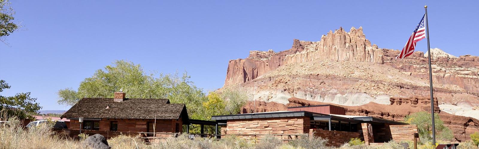
Ready to explore Capitol Reef National Park? Here's everything you need to know before you go!
Discover the trail
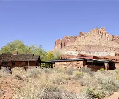
Trail description
Capitol Reef National Park sits in the heart of Utah, centered on one of the most dramatic geological features in the American Southwest — the Waterpocket Fold. This nearly 100-mile-long wrinkle in the Earth's crust was created roughly 65 million years ago when a massive shift in tectonic plates buckled layers of sedimentary rock into a steep, winding monocline. The result is a landscape that feels almost otherworldly: towering sandstone dolds, narrow slot canyons, domed white cliffs, and a riot of color that shifts from deep red to cream to gold depending on the light and the hour.
Despite being one of Utah's five national parks, Capitol Reef consistently draws fewer crowds than Zion or Bryce Canyon, which makes it a genuine gem for hikers who want real solitude alongside serious scenery. The park stretches across a remote stretch of south-central Utah, and its relative isolation is a big part of its appeal.
The Waterpocket Fold
Everything in Capitol Reef revolves around the Waterpocket Fold. This geological backbone runs roughly north to south through the park and creates the defining character of the terrain. On the west side, you get the Capitol Dome area — massive rounded sandstone formations that gave the park its name, their pale surfaces resembling the dome of the U.S. Capitol building. On the east side, the land drops away into a maze of canyons, fins, and eroded basins that reward explorers willing to venture off the main corridor.
The rock layers exposed along the fold tell hundreds of millions of years of geological history. You'll walk past Navajo Sandstone, Wingate Sandstone, Chinle Formation, and Moenkopi Formation — each layer a different color, a different texture, a different era. It's one of the most complete and accessible geological records in the entire Colorado Plateau.
Fruita Historic District
Near the park's main visitor center, the Fruita Historic District adds a human layer to the story. Mormon pioneers settled this narrow valley along the Fremont River in the 1880s, planting orchards that still produce fruit today. The National Park Service maintains these orchards — apple, pear, peach, cherry, and apricot trees — and visitors are welcome to pick and eat fruit in season at no charge. It's one of the more unexpected pleasures in any national park, and the contrast between the lush green valley floor and the towering red cliffs above it is genuinely striking.
The area also preserves evidence of the Fremont people, an Indigenous culture that lived here roughly 1,000 years ago. Petroglyphs carved into the canyon walls near the visitor center are among the most accessible and well-preserved examples of Fremont rock art in the region.
Hiking in Capitol Reef
Capitol Reef offers a wide range of trails, from short walks accessible to almost anyone to full-day backcountry routes that demand navigation skills and solid fitness. The terrain varies dramatically across the park, so the hiking experience can feel completely different depending on which area you're exploring.
In the Fruita area, trails like the Hickman Bridge route take hikers up onto the canyon rim for sweeping views of the Fremont River valley and the surrounding cliffs. The Cohab Canyon Trail cuts through a narrow, winding canyon above the campground and connects to a network of routes that open up the mesa above. These trails are well-marked and manageable for most hikers.
Further south along Scenic Drive, the Capitol Gorge area offers a different kind of experience. The canyon narrows dramatically, and the walls close in around you as you walk along the sandy wash floor. Pioneer inscriptions carved into the rock date back to the late 1800s, and natural water pockets — the "waterpockets" that give the fold its name — collect rainwater in the slickrock above. The Grand Wash route cuts straight through the reef, offering one of the most dramatic canyon walks in the park.
For those willing to venture into the backcountry, the Cathedral Valley in the park's northern section is a world apart. Massive sandstone monoliths rise from the desert floor, and the roads require a high-clearance vehicle to access. The solitude out there is complete.
Terrain and Conditions
The terrain in Capitol Reef is diverse and can be demanding. Much of the hiking involves slickrock — smooth, rounded sandstone that requires careful foot placement, especially when wet. Canyon floors are often sandy and can be soft underfoot. Some routes involve scrambling over boulders or navigating narrow ledges. Flash flood risk is real in the slot canyons and washes; always check weather conditions before heading into any enclosed canyon.
Water is scarce throughout most of the park. The Fremont River runs through the Fruita valley, but water sources in the backcountry are unreliable. Carry more than you think you'll need.
Wildlife and Landscape
Capitol Reef sits at the intersection of several distinct ecosystems, which creates a surprisingly rich wildlife environment. Mule deer are common throughout the park, particularly in the Fruita area. Pronghorn range across the open desert sections. Peregrine falcons nest on the cliff faces. Ringtail cats, canyon wrens, and collared lizards are regular sightings for observant visitors.
The plant life shifts noticeably as you move through the park. Riparian vegetation — cottonwoods, willows, and tamarisk — lines the Fremont River corridor. Higher on the canyon rims, pinyon pine and juniper dominate. In the open desert sections, blackbrush, Mormon tea, and various cacti take over. The diversity of habitats packed into a relatively compact area makes Capitol Reef genuinely interesting from an ecological standpoint.
Practical Information
- Entrance fee: Capitol Reef National Park charges an entrance fee; an America the Beautiful annual pass is accepted and covers entry.
- Visitor center: Located in the Fruita area, the visitor center offers maps, ranger programs, and current trail conditions.
- Scenic Drive: A paved road extends south from the visitor center into the heart of the reef; a fee is required beyond a certain point for non-pass holders.
- Camping: The Fruita Campground is the main developed campground, located near the visitor center. Backcountry camping is available with a free permit.
- Dogs: Pets are allowed in the campground and on paved roads but are not permitted on most trails or in the backcountry.
- Cell service: Extremely limited throughout the park. Download maps and trail information before you arrive.
In winter
Capitol Reef National Park and its campgrounds are open year round, but some roads may be closed because of snow or other inclement weather. From November to February, according to the NPS, daytime highs range from 30 to 45°F (-1.1 to 7.2°C) and nights fall below freezing. Snowfall is infrequent: it often melts the same day but can stay on the ground for days or even weeks. Snow can hide tripping hazards and even the edges of steep drop-offs. In Cathedral Valley, the mountain road (Polk Creek Road) is closed in winter and spring. Elsewhere in the park, the NPS says the access to the South Draw Road from Boulder Mountain (8,500 feet, 2,591 m) can be closed in winter due to snow.
Everything you need for your next hike. Bilingual, printable, 1 page.
Get your free hiking checklistRecommended gear for this trail
As an Amazon Associate I earn from qualifying purchases.


Ready to go?
Everything you need to know before you goWhen?
As an Amazon Associate I earn from qualifying purchases.
Affiliate links — LGPO may earn a commission at no extra cost to you.
- Hiking shoes Essential
- → Salomon Elixir Tour Mid WP · 203.38 $
- Layered clothing Essential
- Rain jacket Essential
- Trekking poles
- → Black Diamond Trail Ergo Cork · 69.99 $
- Headlamp
- → Petzl Actik Core 625 · 103.95 $
FAQ - Frequently asked questions
Everything you need to knowOutings near Capitol Reef National Park
Discover other trails you might enjoy
Reds Canyon Trail
Central Utah · 57.4 km away

Harris Wash
Southern Utah · 72.0 km away
Escalante River
Southern Utah · 76.9 km away
White Rim Road
Southern Utah · 104.1 km away
Crystal Geyser
Southern Utah · 114.2 km away
Price River
Central Utah · 114.4 km away
Hiking near Calgary
128 trails to explore ~1436 km away
We work hard to provide the most up-to-date and error-free data possible. If something seems incorrect, let us know! Your contribution helps the whole community.
Hikers' opinions
Be the first to review!
No hiker has shared their experience yet. Share your impressions and help other hikers!