


Ready to explore Tryon Peak? Here's everything you need to know before you go!
Discover the trail
Oh no! We don't have any photos 😢
This trail hasn't been captured yet. Be the first to share your adventure!Trail description
Tryon Peak sits in the Blue Ridge Mountains of North Carolina, tucked into a corner of the state that doesn't always get the same attention as the more heavily trafficked areas to the north. That relative quiet is part of what makes it worth the trip. The summit offers a genuine sense of arrival — the kind you earn on foot, not from a parking lot overlook.
The Terrain
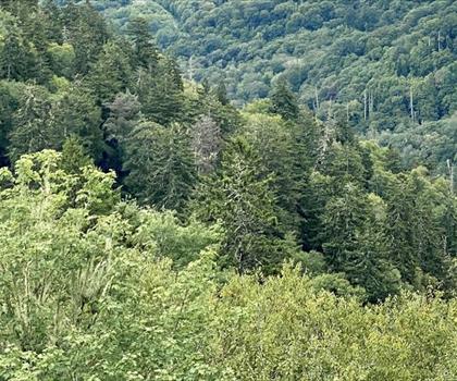
The approach to Tryon Peak moves through classic southern Appalachian forest. You'll walk under a mixed canopy of hardwoods and conifers, with the trail gaining elevation steadily as it climbs toward the ridgeline. The forest floor shifts as you move up — denser understory near the base, opening up as the trail pushes higher and the trees thin out. Rocky outcrops appear along the upper sections, giving the hike a more rugged feel as you near the top.
The footing is generally good on the lower portions, but expect roots and loose rock as the grade increases. Trekking poles are a smart call, especially on the descent when your legs are already worked.
What You'll Find at the Top
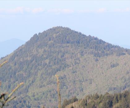
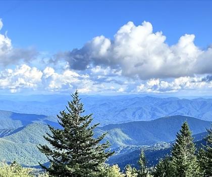
The summit of Tryon Peak rewards the climb with views that stretch out over the surrounding ridges and valleys. On a clear day, the layered blue silhouettes of the Appalachians stack up in every direction — the kind of panorama that reminds you why people have been hiking these mountains for generations. The peak itself has a raw, unmanicured quality that feels honest. There's no observation deck, no interpretive sign explaining what you're looking at. Just the view and the wind.
It's a good spot to sit, eat something, and take your time before heading back down.
Wildlife and Natural Character
The southern Appalachians are one of the most biodiverse temperate forest regions in the world, and the area around Tryon Peak reflects that. The forest holds a wide variety of bird species, and the understory is rich with native wildflowers during the warmer months. White-tailed deer are common, and if you're moving quietly, you stand a reasonable chance of spotting one on the trail. Black bears are present in the region — standard awareness and food storage practices apply.
The mix of elevation zones along the climb means you're moving through noticeably different plant communities as you ascend, which keeps the hike visually interesting from start to finish.
Getting There
Tryon Peak is located in the mountains of western North Carolina, in the area around the town of Tryon. The region sits near the South Carolina border, in the foothills and lower Blue Ridge — a zone that tends to be slightly warmer and more accessible year-round than the higher elevations further north in the range.
Access details and current trailhead conditions are worth confirming before you go, as mountain roads in this part of North Carolina can be affected by weather and seasonal maintenance schedules.
Practical Notes
- Footwear: Trail runners work on the lower sections, but a hiking boot with ankle support is the better call for the rockier upper terrain.
- Water: Carry everything you need from the trailhead. There are no reliable water sources along the route that should be counted on without a filter.
- Weather: Mountain weather in western North Carolina can shift quickly. Check the forecast before heading out, and be prepared for afternoon thunderstorms during summer months.
- Leave No Trace: Pack out everything you bring in. The area's natural character depends on hikers treating it with care.
Who This Hike Is For
Tryon Peak suits hikers who are comfortable with sustained elevation gain and uneven terrain. It's not a casual stroll, but it's also not a technical climb — anyone with a reasonable base of hiking fitness and the right footwear can make it to the top. The payoff at the summit is real, and the relative lack of crowds compared to more famous peaks in the region means you're more likely to have the view to yourself.
If you're based in the Tryon or Saluda area and looking for a hike that actually feels like a mountain experience without driving hours into the high country, this is a strong local option that delivers on its promise.
The Essential Hiking Checklist
Everything you need for your next hike. Bilingual, printable, 1 page.
Get your free hiking checklistRecommended gear for this trail
As an Amazon Associate I earn from qualifying purchases.


Ready to go?
Everything you need to know before you goWhen?
How much?
As an Amazon Associate I earn from qualifying purchases.
Affiliate links — LGPO may earn a commission at no extra cost to you.
- Hiking shoes Essential
- → Salomon Elixir Tour Mid WP · 203.38 $
- Layered clothing Essential
- Rain jacket Essential
- Trekking poles
- → Black Diamond Trail Ergo Cork · 69.99 $
- Headlamp
- → Petzl Actik Core 625 · 103.95 $
FAQ - Frequently asked questions
Everything you need to knowSimilar hikes nearby
Discover other trails you might enjoy

Hiking near Pittsburgh
0 trails to explore ~613 km away
We work hard to provide the most up-to-date and error-free data possible. If something seems incorrect, let us know! Your contribution helps the whole community.
Hikers' opinions
Be the first to review!
No hiker has shared their experience yet. Share your impressions and help other hikers!