
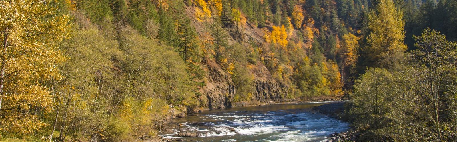

Ready to explore Clackamas River? Here's everything you need to know before you go!
Discover the trail
Oh no! We don't have any photos 😢
This trail hasn't been captured yet. Be the first to share your adventure!Trail description
The Clackamas River is an approximately 83-mile (134 km) tributary of the Willamette River in northwestern Oregon, in the United States. Draining an area of about 940 square miles (2,435 km2), the Clackamas flows through mostly forested and rugged mountainous terrain in its upper reaches, and passes agricultural and urban areas in its lower third. The river rises in eastern Marion County, about 55 miles (89 km) east-southeast of Salem. The headwaters are on the slopes of Olallie Butte in the Mount Hood National Forest, about 10 miles (16 km) north of Mount Jefferson, at an elevation of 4,909 feet (1,496 m) in the Cascade Range. The Clackamas flows briefly north and then flows northwest through the mountains, passing through North Fork Reservoir and Estacada. It then emerges from the mountains southeast of Portland. It joins the Willamette near Oregon City and forms the boundary between Oregon City and Gladstone.
The Clackamas provides hydroelectric power and drinking water for some of the Portland metropolitan area, and it supports runs of Coho salmon, spring and fall Chinook salmon, and summer and winter steelhead. The river's old-growth forests, its habitat for several species of birds, its healthy fish runs, and the recreational opportunities that it provides—such as fishing and whitewater rafting—led to the designation of more than half of the length of the river into the National Wild and Scenic Rivers System (NWSRS). This environment also allowed Native Americans to settle in the river's basin as early as 10,000 years ago.
Regulation of the river began in 1905 with the Cazadero Dam. In 1912, the River Mill Dam intercepted wood and coarse sediment. Later dams at North Fork, Oak Grove, Stone Creek, and Timothy Lake also intercepted wood sediment on the lower river.
Free
1 pages
The Essential Hiking Checklist
Everything you need for your next hike. Bilingual, printable, 1 page.
Get your free hiking checklistRecommended gear for this trail
As an Amazon Associate I earn from qualifying purchases.
LGPO Pick

Salomon
Elixir Tour Mid WP
Waterproof mid-height boot ideal for rocky terrain
203.38 $


Affiliate links — LGPO may earn a commission at no extra cost to you.
Ready to go?
Everything you need to know before you goWhen?
Opening hours
No information
Varies by season
Best season
Fall
Spectacular colors
Best time
Early morning
Less crowded
Weather (next days)
Loading
How much?
Entry fees
Adult
Not available
Child
—
What to bring?
As an Amazon Associate I earn from qualifying purchases.
Affiliate links — LGPO may earn a commission at no extra cost to you.
Gear
- Hiking shoes Essential
- → Salomon Elixir Tour Mid WP · 203.38 $
- Layered clothing Essential
- Rain jacket Essential
- Trekking poles
- → Black Diamond Trail Ergo Cork · 69.99 $
- Headlamp
- → Petzl Actik Core 625 · 103.95 $
Water & food
2L minimum
No water point on the trail
Bring energy snacks for a 4h+ hike
Good to know
Safety
Download the GPX before you go
Limited cellular coverage on the trail
Slippery after rain
Be careful on rocky sections
In an emergency
Emergency
911
Parking GPS
45.0863, -122.162837
Center
Not available
FAQ - Frequently asked questions
Everything you need to knowClackamas River is rated easy.
The elevation gain of Clackamas River is 1 m.
The summit of Clackamas River is at 383 m.
Allow about 5 minutes for Clackamas River (0.2 km).
No, Clackamas River has no visitor centre on site.
Didn't find your answer?
Similar hikes nearby
Discover other trails you might enjoy

Oregon Butte Trail
Central Oregon
8.5 KM
1558 m
Beginner

Oregon Coast Trail
Central Oregon
159 KM
Beginner

Snake River Road to Oregon
Central Oregon
148 KM
3.5 hours
Beginner

Murray Peak
Central Oregon
8 KM
2h00
2 m
Beginner
Granite & Sumpter Campgrounds
Central Oregon
12.9 KM
5h30
914 m
Advanced
The Hook
Central Oregon
10h00
1218 m
Expert
Top 10 best hiking in Central Oregon
Our ranking based on hiker reviews
Hiking near Victoria
93 trails to explore ~383 km away
Did you spot an error?
We work hard to provide the most up-to-date and error-free data possible. If something seems incorrect, let us know! Your contribution helps the whole community.
Hikers' opinions
Be the first to review!
No hiker has shared their experience yet. Share your impressions and help other hikers!