
Ready to explore Estuary Trails? Here's everything you need to know before you go!
Discover the trail
Trail description
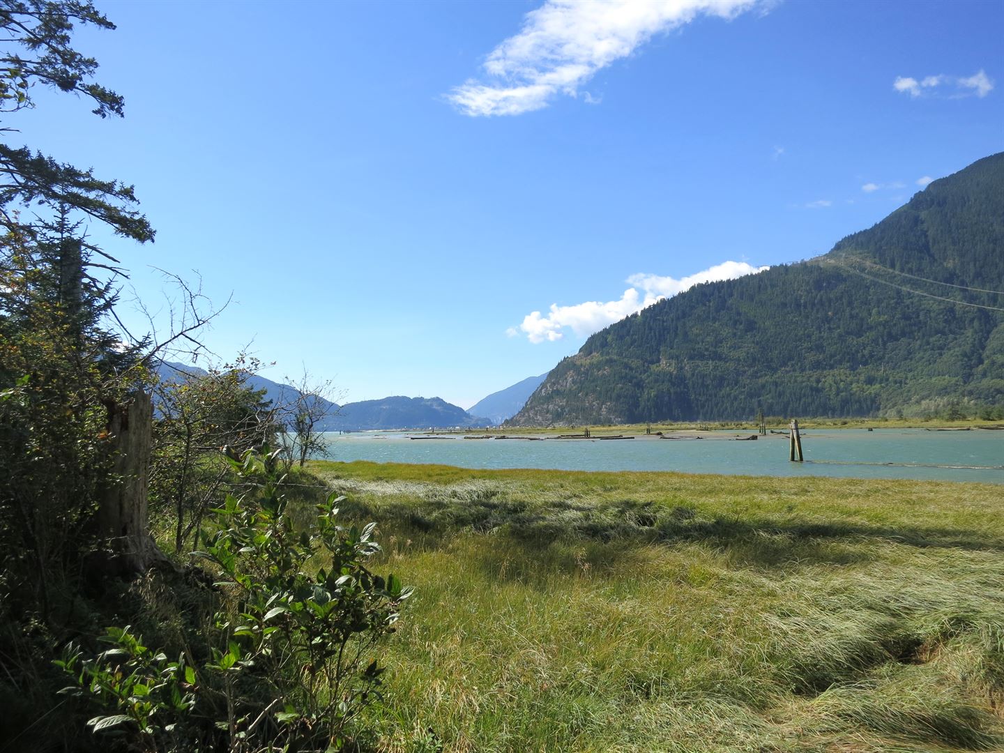
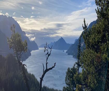
Estuary Trails lies in Squamish and follows the historic tidal estuary of the river, a flat area rich in wildlife. The trails run through the tidal estuary inside the Wildlife Management Area (WMA). From the site, visitors get fine views of the surrounding snow-capped mountains, Stawamus Chief, Shannon Falls and Howe Sound.
The area has a rich, fascinating history in Squamish. Squamish people depended on the abundant fish and game of the estuary and had a village, Skwelwil’em, west of the present site of Castle Rock housing. The first farmer, George Magee, built levees with Chinese labour and drained the wetlands to provide hay for the oxen and horses used in early logging from 1890 to 1910. Forestry later moved inland with logging railroads, but it still needed the estuary for booming and shipping.
In 1982, all stakeholders agreed that the land and waters west of the railway tracks would become a restricted conservation area. The Squamish Estuary Management Plan has been in force since 1999 and is monitored by the Squamish River Watershed Society. Site A, about 30 hectares of cultural significance, was transferred to the Squamish Nation in 2001 with a restricted covenant. The TLC site, about seven hectares acquired in 2008, is an ecologically significant area around Cattermole Creek.
Marsh meadows, spruce and alders provide sanctuary to species at risk such as the Pacific water shrew, red leg frog and trumpeter swan. The estuary is also recognized as an Important Birding Area (IBA) and draws avid birders who come to see and hear birds, including the belted kingfisher, geese and crows. The estuary trails explore the tidal mudflats, marshes and wetlands. Freshwater from the river mixes twice daily with tidal salt water, which creates a bountiful ecosystem.
Several trails are listed. Cattermole Creek Trail runs 1.2 km south from Bailey Street along the southbound tidal stream. Chelem Trail is a 1.1 km loop off Spit Road, also called the Marsh Trail; Chelem is the Squamish word for eel grass. Old South Dike Trail covers 1.2 km, interrupted by washed-out bridges along the top of an old sewer line. Swan Trail South runs 1.8 km north from the old log sort to the Mamquam River, along the River Dike. Woodpecker Trail is a 1.4 km loop off Spit Road, west of Dentville.
Spit Road was built in 1972 in preparation for a planned coal shipping facility. That facility was cancelled due to public pressure, and the road has since become a boon for windsports. The Squamish Windsports Society regulates the safe use of the southern end of the spit, which vies with the Columbia River as the best windsports site in North America.
Trailheads are at the west end of Bailey Street and off Spit Road, and the trails are also accessible from the Mamquam Dike. The etiquette guidance is to stay on the trail and not damage sensitive terrain. Several issues still need to be resolved: trail crossings on railway property, off-leash pets, trail maintenance within WMA and the looming Seventh Avenue Connector road planned for the area.
Everything you need for your next hike. Bilingual, printable, 1 page.
Get your free hiking checklistRecommended gear for this trail
As an Amazon Associate I earn from qualifying purchases.


Ready to go?
Everything you need to know before you goStarting Point
Trailheads are at the west end of Bailey Street and off Spit Road; the trails are also accessible from the Mamquam Dike.
When?
As an Amazon Associate I earn from qualifying purchases.
Affiliate links — LGPO may earn a commission at no extra cost to you.
- Hiking shoes Essential
- → Salomon Elixir Tour Mid WP · 203.38 $
- Layered clothing Essential
- Rain jacket Essential
- Trekking poles
- → Black Diamond Trail Ergo Cork · 69.99 $
- Headlamp
- → Petzl Actik Core 625 · 103.95 $
FAQ - Frequently asked questions
Everything you need to knowOutings near Estuary Trails
Discover other trails you might enjoy

Squamish Chief
Vancouver Coast Mountains · 3.2 km away
Stawamus Chief Trail
Vancouver Coast Mountains · 3.4 km away

Stawamus Chief, British Columbia
Vancouver Coast Mountains · 3.5 km away

Shannon Falls Provincial Park
Vancouver Coast Mountains · 4.0 km away
Petgill Lake
Vancouver Coast Mountains · 6.0 km away
Murrin Provincial Park
Vancouver Coast Mountains · 6.3 km away
Hiking near Squamish
219 trails to explore ~2 km away
We work hard to provide the most up-to-date and error-free data possible. If something seems incorrect, let us know! Your contribution helps the whole community.
Hikers' opinions
Be the first to review!
No hiker has shared their experience yet. Share your impressions and help other hikers!