

Ready to explore Tobique River? Here's everything you need to know before you go!
Discover the trail
Trail description
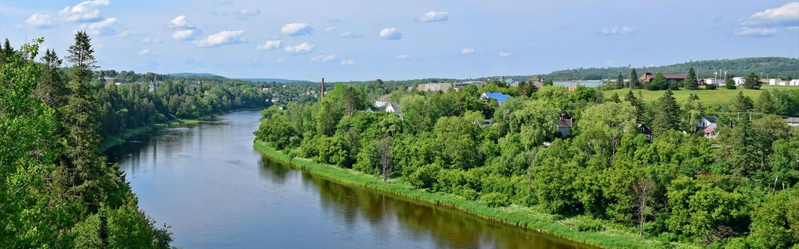
The Tobique River is one of New Brunswick's most celebrated waterways, winding through the western interior of the province before joining the Saint John River near Perth-Andover. For paddlers, anglers, and anyone who simply wants to be near moving water surrounded by forest, the Tobique is the kind of place that earns a permanent spot on your list.
The River and Its Setting
The Tobique cuts through a landscape of rolling hills, dense mixed forest, and rocky outcrops that define this part of New Brunswick's Fundy Coast hinterland. The river corridor feels genuinely remote in stretches — the kind of quiet where you notice the sound of current over rocks and not much else. The surrounding terrain is rugged and forested, with the river itself serving as the main artery through the region.
The water runs clear and cold, fed by tributaries and springs throughout its length. Depending on the season and recent rainfall, the character of the river shifts — from fast-moving and technical in spring to slower and more reflective by late summer. This variability is part of what makes the Tobique worth returning to.
What to Expect on the Water
The Tobique is best known as a paddling and fishing destination. Canoeists and kayakers have been running this river for generations, and it's considered one of the premier canoe routes in New Brunswick. The river offers a mix of flatwater sections and moving water, with some rapids that require attention and skill depending on water levels. It's not a beginner river in all conditions, but experienced paddlers will find it deeply rewarding.
Atlantic salmon fishing on the Tobique has a long and storied history. The river is a designated salmon river, and fly fishing here carries a tradition that goes back well over a century. If you're coming to fish, make sure you're up to date on New Brunswick's licensing requirements and any current regulations specific to the Tobique — rules around salmon fishing can change from season to season.
Shoreline Access and Hiking
While the Tobique is primarily experienced from the water, the river corridor also offers opportunities to explore on foot. The forested banks and surrounding hills provide natural walking terrain, and the views down to the river from higher ground are worth the effort. The landscape here rewards those who slow down — there's wildlife, birdlife, and the kind of stillness that's harder to find closer to populated areas.
Access points along the river allow visitors to reach the water at various points, whether you're launching a canoe, casting a line, or just looking for a place to sit near the current. The surrounding Crown land and forest roads open up additional exploration options for those willing to do a bit of route-finding.
Wildlife and Natural Environment
The Tobique River valley supports a healthy mix of wildlife typical of New Brunswick's forested interior. White-tailed deer, moose, black bear, and beaver are all present in the region. The river itself is important habitat for Atlantic salmon and brook trout, and the riparian zone — the strip of vegetation along the banks — supports a wide variety of bird species throughout the year.
The forest along the Tobique is predominantly mixed, with softwoods like balsam fir and black spruce alongside hardwoods including sugar maple and yellow birch. In fall, the colour along the river corridor is exceptional — the combination of water, hills, and turning leaves makes this one of the more visually striking areas in western New Brunswick during that season.
Practical Information
Getting to the Tobique River requires some planning. The river runs through a largely rural part of New Brunswick, and services are limited once you're away from the main towns. Come prepared with everything you need — food, water, navigation tools, and appropriate gear for the conditions.
- Paddling: Canoe and kayak access is available at multiple points along the river. Water levels vary significantly by season — spring runoff can make sections fast and demanding, while late summer may require lining or portaging in shallower areas.
- Fishing: A valid New Brunswick fishing licence is required. Atlantic salmon fishing is subject to specific regulations — check the current provincial guidelines before your trip.
- Cell service: Coverage is limited to nonexistent in many parts of the river corridor. Let someone know your plans before heading out.
- Leave No Trace: The Tobique's remote character depends on visitors treating it with care. Pack out everything you bring in.
Best Times to Visit
Spring brings high water and fast current — ideal for experienced paddlers looking for a more technical experience, but not the time for casual exploration. Early summer is when the river settles into a more accessible rhythm, and the salmon fishing season draws anglers from across the region. Fall is arguably the most beautiful time to be on or near the Tobique, with foliage colour peaking across the surrounding hills. Winter access is limited and conditions are serious — this is not a year-round destination for most visitors.
Getting There
The Tobique River is accessible from several communities in western New Brunswick, with Perth-Andover serving as a practical base for many visitors. From there, river access points can be reached via local and forest roads. A reliable vehicle is an asset, particularly if you're planning to reach more remote sections of the river. Check road conditions before heading out, especially in spring when forest roads can be soft or washed out.
The Essential Hiking Checklist
Everything you need for your next hike. Bilingual, printable, 1 page.
Get your free hiking checklistRecommended gear for this trail
As an Amazon Associate I earn from qualifying purchases.


Ready to go?
Everything you need to know before you goWhen?
How much?
As an Amazon Associate I earn from qualifying purchases.
Affiliate links — LGPO may earn a commission at no extra cost to you.
- Hiking shoes Essential
- → Salomon Elixir Tour Mid WP · 203.38 $
- Layered clothing Essential
- Rain jacket Essential
- Trekking poles
- → Black Diamond Trail Ergo Cork · 69.99 $
- Headlamp
- → Petzl Actik Core 625 · 103.95 $
FAQ - Frequently asked questions
Everything you need to knowSimilar hikes nearby
Discover other trails you might enjoy

Hiking near Fredericton
11 trails to explore ~139 km away
We work hard to provide the most up-to-date and error-free data possible. If something seems incorrect, let us know! Your contribution helps the whole community.
Hikers' opinions
Be the first to review!
No hiker has shared their experience yet. Share your impressions and help other hikers!