

Ready to explore Cheltenham Badlands? Here's everything you need to know before you go!
Discover the trail
Available trails
| TrailTrails | Dist.Distance | GainElevation | TimeDuration | Difficulty | GPX |
|---|---|---|---|---|---|
|
|
0.32 km | — | 15min | ||
|
|
1.33 km | — | 18min |
Trail description
What you see
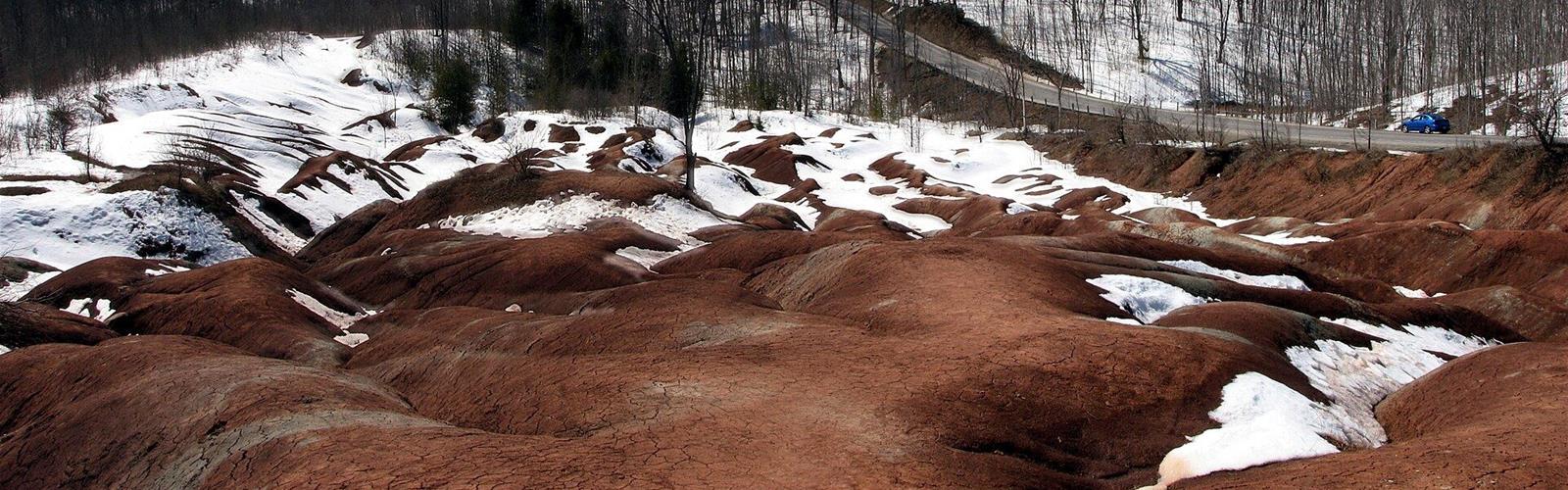
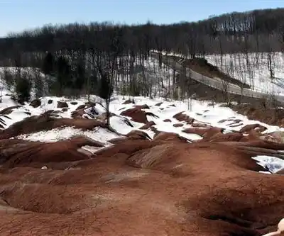
The Cheltenham Badlands are hills of Queenston shale, laid down about 450 million years ago at the base of an ancient sea. Erosion exposed the rock after the trees were cleared and the land was farmed. About 20 per cent of the site's 36 hectares is badlands; the rest is mature forest, wetland and regenerating woodland. It is a provincially significant Earth Science Area of Natural and Scientific Interest.
Where you stand
The formations are viewed from an accessible, 60 m viewing platform. Walking on the badlands themselves is strictly prohibited: stay on the platform, trails and sidewalks. The site closed to the public in June 2015, partly because of erosion from high visitor numbers, and reopened in 2018. The Ontario Heritage Trust has operated it since 2024.
From the parking lot to the platform
There are two ways to get there: the sidewalk along Olde Base Line Road (about 250 m), or the Badlands Trail (0.32 km) through young forest, which links the Bruce Trail to the viewing platform. That trail can be muddy because of the clay soil, and the Trust does not recommend it for people with mobility issues. Accessible parking exists: bookable on weekends (a valid permit is required), first come, first served on weekdays.
The Bruce Trail
A 1.33 km section of the Bruce Trail runs through the site and crosses a tributary of the Credit River. The Caledon Hills Bruce Trail Club maintains the trails. If your goal is to walk rather than look, aim for this section, keeping in mind that the parking slot is time-limited (see below).
Reservations and rules
Access is by reservation only, through the ParkPass system. Fees are per vehicle and admission covers one parking space. Most slots last 90 minutes; a limited number of three-hour slots are offered. No cash or cards are accepted at the lot: everything is paid online, and a cellular connection is needed if you book on arrival. Date or time changes and refunds are not allowed within 48 hours of your slot. Only regular-sized vehicles are allowed: no RVs, buses or trailers. Bike racks are available at the lot.
Credit Valley Conservation and Toronto and Region Conservation Authority passes are not accepted, and the reservation does not include entry to Island Lake or Terra Cotta Conservation Areas. Drones are not permitted. Portable washrooms are on site. Photography is allowed, but the Trust is not currently issuing special use permits (groups, events, photography).
When to go
The 2025 season ran from May 9 to November 17, dawn to dusk. 2026 dates to be confirmed at heritagetrust.on.ca. Weekend slots cost about double the weekday price.
Services and amenities
Portable washrooms on site, bike racks at the lot, accessible 60 m viewing platform.
This information may vary by season.
The Essential Hiking Checklist
Everything you need for your next hike. Bilingual, printable, 1 page.
Get your free hiking checklistRecommended gear for this trail
As an Amazon Associate I earn from qualifying purchases.


Ready to go?
Everything you need to know before you goStarting Point
1739 Olde Base Line Road, Caledon. The site's parking lot is at the entrance on this road; the sidewalk leads to the viewing platform in about 250 m.
When?
2025 season: May 9 to November 17, dawn to dusk, by reservation only. 2026 dates to be confirmed at heritagetrust.on.ca.
How much?
As an Amazon Associate I earn from qualifying purchases.
Affiliate links — LGPO may earn a commission at no extra cost to you.
- Hiking shoes Essential
- → Salomon Elixir Tour Mid WP · 203.38 $
- Layered clothing Essential
- Rain jacket Essential
- Trekking poles
- → Black Diamond Trail Ergo Cork · 69.99 $
- Headlamp
- → Petzl Actik Core 625 · 103.95 $
FAQ - Frequently asked questions
Everything you need to knowSimilar hikes nearby
Discover other trails you might enjoy

Scarborough Bluffs Trail
Greater Toronto Area
Trillium Park
Greater Toronto Area
Balmy Beach Park
Greater Toronto Area
High Park
Greater Toronto Area
Colonel Samuel Smith Park
Greater Toronto Area
Mimico Waterfront Park
Greater Toronto Area
Hiking near Mississauga
171 trails to explore ~32 km away
We work hard to provide the most up-to-date and error-free data possible. If something seems incorrect, let us know! Your contribution helps the whole community.
Hikers' opinions
Be the first to review!
No hiker has shared their experience yet. Share your impressions and help other hikers!