

Ready to explore Sentier De La Mine Cap Feldspath? Here's everything you need to know before you go!
Discover the trail
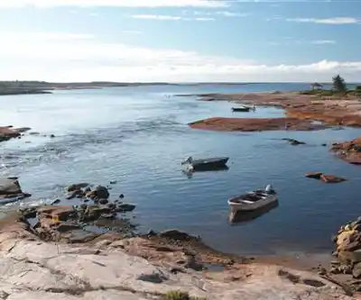

Trail description
Distance and effort
The trail is approximately 3 km linear (or roughly 6 km round trip depending on route chosen), which makes it a comfortable option for a half-day outing. The challenge is rated as easy—suitable for hikers of all skill levels, from beginners to experienced outdoor enthusiasts. The actual hiking time averages around 1 hour.
Recommended gear for this trail


Ready to go?
Everything you need to know before you goStarting Point
To access the hiking trails, head towards the designated parking area located near the trailheads. The main trailhead can be reached by driving to Chemin de la Mine, where you will find a parking lot available for visitors. Ensure to follow local signage for any additional directions or alternative trailheads that may be present in the vicinity.
When?
How much?
- Hiking shoes Essential
- → Salomon Elixir Tour Mid WP · 203.38 $
- Layered clothing Essential
- Rain jacket Essential
- Trekking poles
- → Black Diamond Trail Ergo Cork · 69.99 $
- Headlamp
- → Petzl Actik Core 625 · 103.95 $
FAQ - Frequently asked questions
Everything you need to knowThe Essential Hiking Checklist
Everything you need for your next hike. Bilingual, printable, 1 page.
Download the free checklistSimilar hikes nearby
Discover other trails you might enjoy

Parc National D'anticosti
North Shore

Sentier Pédestre De Portneuf-sur-mer
North Shore

Réserve de parc national de l'Archipel-de-Mingan
North Shore

Mont Groulx
North Shore

Cascades De Rivière-au-tonnerre
North Shore

Chutes Manitou
North Shore
Hiking near Charlottetown
11 trails to explore ~454 km away
We work hard to provide the most up-to-date and error-free data possible. If something seems incorrect, let us know! Your contribution helps the whole community.
Hikers' opinions