

Ready to explore Mont Vallieres-de-Saint-Real? Here's everything you need to know before you go!
Discover the trail
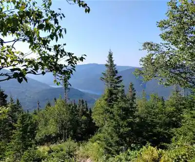
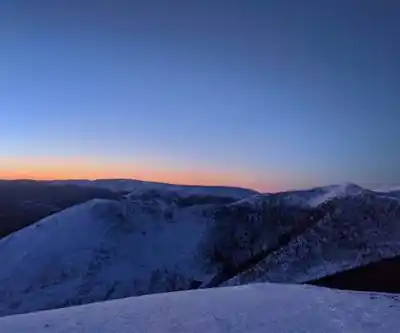
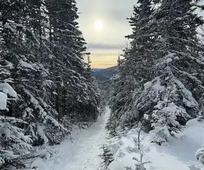
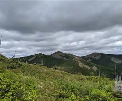
4
community photos
Trail description
Désolé, nous n'avons pas de description pour cet endroit.
Soyez le premier à partager plus d'informations sur cet endroit.
Soyez le premier à partager plus d'informations sur cet endroit.
Recommended gear for this trail
LGPO Pick

Salomon
Elixir Tour Mid WP
Waterproof mid-height boot ideal for rocky terrain
203.38 $


Affiliate links — LGPO may earn a commission at no extra cost to you.
Ready to go?
Everything you need to know before you goWhen?
Opening hours
No information
Varies by season
Best season
Fall
Spectacular colors
Best time
Early morning
Less crowded
Weather (next days)
Loading
How much?
Entry fees
Adult
Not available
Child
—
What to bring?
Gear
- Hiking shoes Essential
- → Salomon Elixir Tour Mid WP · 203.38 $
- Layered clothing Essential
- Rain jacket Essential
- Trekking poles
- → Black Diamond Trail Ergo Cork · 69.99 $
- Headlamp
- → Petzl Actik Core 625 · 103.95 $
Water & food
2L minimum
No water point on the trail
Bring energy snacks for a 4h+ hike
Good to know
Park rules
No dogs
Safety
Download the GPX before you go
Limited cellular coverage on the trail
Slippery after rain
Be careful on rocky sections
In an emergency
Emergency
911
Parking GPS
48.83839709999999, -66.0235958
Center
Not available
FAQ - Frequently asked questions
Everything you need to knowHard
940.00 m
1181.00 m
4h30
No
No
The Mont Vallieres-de-Saint-Real trail is 8.5 km long and typically takes about 4h30 to complete. The duration can vary depending on your fitness level and weather conditions.
The Mont Vallieres-de-Saint-Real trail is rated as hard difficulty. This challenging hike requires good physical conditioning and hiking experience due to the significant elevation gain and technical terrain.
No, the Mont Vallieres-de-Saint-Real trail is not recommended for beginners as it is rated as hard difficulty. The 940-meter elevation gain and challenging terrain make it better suited for experienced hikers with good physical fitness.
Didn't find your answer?
Free
1 pages
The Essential Hiking Checklist
Everything you need for your next hike. Bilingual, printable, 1 page.
Download the free checklistSimilar hikes nearby
Discover other trails you might enjoy

Favorite
🐕
Dog allowed
Parc National De La Gaspésie
Gaspésie - Îles-de-la-Madeleine
3.5 KM
1h30
200 m
Intermediate
4.8
(18)

Favorite
Plage Haldimand
Gaspésie - Îles-de-la-Madeleine
2 KM
30min
Beginner
4.8
(12)

Favorite
Réserve Faunique De Matane
Gaspésie - Îles-de-la-Madeleine
117 KM
30h15
1341 m
Beginner
4.5
(13)

Favorite
🐕
Dog allowed
Mont Saint-Pierre
Gaspésie - Îles-de-la-Madeleine
110.2 KM
28h30
430 M
Beginner
4.0
(15)

🐕
Dog allowed
Parc National Du Canada Forillon
Gaspésie - Îles-de-la-Madeleine
67.7 KM
17h
150 M
Beginner
4.8
(15)

Parc National De L'île-bonaventure-et-du-rocher-percé
Gaspésie - Îles-de-la-Madeleine
14.7 KM
4h30
300 M
Beginner
4.8
(14)
Top 10 best hiking in Gaspésie - Îles-de-la-Madeleine
Our ranking based on hiker reviews
Hiking near Moncton
14 trails to explore ~320 km away
Did you spot an error?
We work hard to provide the most up-to-date and error-free data possible. If something seems incorrect, let us know! Your contribution helps the whole community.
Hikers' opinions