

Ready to explore Parc national de la Gaspésie? Here's everything you need to know before you go!
Discover the trail
Available trails
| Trails | Distance | Elevation | Duration | Difficulty | GPX |
|---|---|---|---|---|---|
| 2.5 km | 33min | Beginner | |||
| 7.5 km | 2h | Beginner | |||
| 0.9 km | 15min | Beginner | |||
| 4 km | 250 m | 1h30 | Intermediate | ||
| 4.5 km | 120 m | 1h30 | Intermediate | ||
| 1.5 km | 150 m | 34min | Intermediate | ||
| 2.6 km | 330 m | 1h | Intermediate | ||
| 4.9 km | 365 m | 1h30 | Intermediate | ||
| 6.3 km | 360 m | 2h | Advanced | ||
| 6.4 km | 220 m | 2h | Advanced | ||
| 9.1 km | 350 m | 2h30 | Advanced | ||
| 6.4 km | 650 m | 2h30 | Advanced | ||
| 6 km | 450 m | 2h | Advanced | ||
| 4.3 km | 360 m | 1h30 | Advanced | ||
| 5.4 km | 350 m | 2h | Advanced |
Trail description
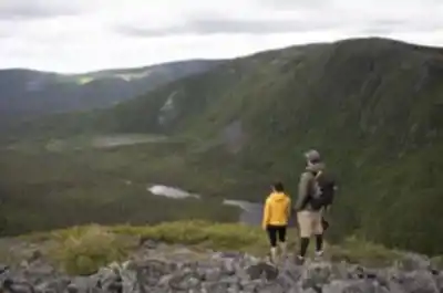
Welcome to parc national de la gaspésie, a hiker's paradise nestled in the breathtaking region of Gaspésie - Îles-de-la-Madeleine. If you're an outdoor enthusiast or someone yearning to reconnect with nature, this is your ultimate destination.
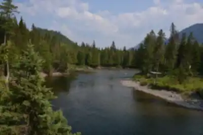
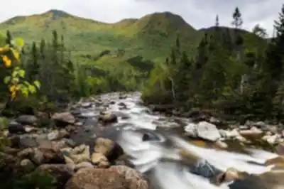
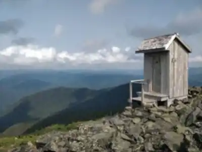
parc national de la gaspésie is renowned for its stunning landscapes and diverse ecosystems. Spanning over 800 square kilometers, the park offers a variety of trails that cater to all levels of hikers. Whether you're a seasoned trekker or just starting out, you'll find paths that suit your pace and skill level.
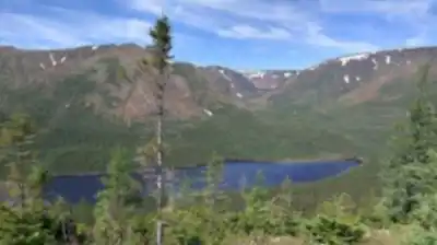
One of the park's highlights is the Mont Jacques-Cartier trail, which leads you to the second-highest peak in Quebec. Standing at 1,268 meters, it offers panoramic views that are nothing short of spectacular. On your way up, keep an eye out for caribou herds that roam freely in their natural habitat—a truly unique sight!
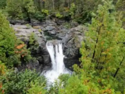
For those who prefer a more leisurely hike, the Lac aux Américains trail provides a serene experience with its crystal-clear waters and lush surroundings. It's perfect for a peaceful day immersed in nature's tranquility.
The park is also home to an impressive array of wildlife and plant species. From moose and black bears to rare alpine flora, every step you take is an opportunity to discover something new.
Beyond hiking, parc national de la gaspésie offers activities like camping, fishing, and birdwatching. The park's visitor center provides detailed maps and information to help you plan your adventure.
Whether you're here for a day trip or an extended stay, parc national de la gaspésie promises an unforgettable experience filled with awe-inspiring beauty and endless exploration opportunities. So lace up your boots and get ready to embark on an adventure that will leave you refreshed and inspired!
Services and amenities
This information may vary by season.
Recommended gear for this trail


Ready to go?
Everything you need to know before you goStarting Point
To access the hiking trails, you can start at the Discovery and Visitors Centre located at 1981 Route du Parc, Sainte-Anne-des-Monts, QC G4V 2E4. This is a common starting point for many of the trails in the area. Additionally, there are other trailheads accessible from various points along Route 299, which runs through the park. Make sure to check specific trail maps for exact locations and parking availability.
When?
How much?
- Hiking shoes Essential
- → Salomon Elixir Tour Mid WP · 203.38 $
- Layered clothing Essential
- Rain jacket Essential
- Trekking poles
- → Black Diamond Trail Ergo Cork · 69.99 $
- Headlamp
- → Petzl Actik Core 625 · 103.95 $
FAQ - Frequently asked questions
Everything you need to knowThe Essential Hiking Checklist
Everything you need for your next hike. Bilingual, printable, 1 page.
Download the free checklistSimilar hikes nearby
Discover other trails you might enjoy

Plage Haldimand
Gaspésie - Îles-de-la-Madeleine

Réserve Faunique De Matane
Gaspésie - Îles-de-la-Madeleine

Mont Saint-Pierre
Gaspésie - Îles-de-la-Madeleine
Mont Vallieres-de-Saint-Real
Gaspésie - Îles-de-la-Madeleine

Parc National Du Canada Forillon
Gaspésie - Îles-de-la-Madeleine

Parc National De L'île-bonaventure-et-du-rocher-percé
Gaspésie - Îles-de-la-Madeleine
Hiking near Moncton
14 trails to explore ~334 km away
We work hard to provide the most up-to-date and error-free data possible. If something seems incorrect, let us know! Your contribution helps the whole community.
Hikers' opinions