

Ready to explore Mont Edouard? Here's everything you need to know before you go!
Discover the trail


Available trails
| TrailTrails | Dist.Distance | GainElevation | Est. timeEstimated time | Difficulty | GPX |
|---|---|---|---|---|---|
|
Beginner
|
2.7 km | 40 m | ≈ 40min | Beginner | |
|
Intermediate
|
1.1 km | 200 m | ≈ 33min | Intermediate | |
|
Intermediate
|
9 km | 500 m | ≈ 3h | Intermediate | |
|
Intermediate
|
5.4 km | 300 m | ≈ 2h | Intermediate | |
|
Intermediate
|
4 km | 350 m | ≈ 1h30 | Intermediate | |
|
Intermediate
|
2.8 km | 120 m | ≈ 48min | Intermediate | |
|
Advanced
|
2.7 km | 475 m | ≈ 1h30 | Advanced |
Trail description
Three sectors, depending on the effort you want
The hiking network at Station Mont-Édouard is split into three sectors: the plains, the mountain and the Haute-Route. According to the resort, it has about 25 km of marked trails: 6 km of forest paths "ideal for a small family walk", 7 km of trails at the foot of the mountain for a short outing, 9 km of mountain trails with viewpoints, and 4 km of adventure trails in the Haute-Route sector.
Plains sector
- Evelyne: low difficulty. A 2.7 km loop with 40 m of climbing, through coniferous forest that sometimes follows a stream.
- Sérénité: moderate. 2.8 km round trip, 120 m of climbing. It starts from the Evelyne trail, crosses a summit and drops to the foot of a rock wall. It is a dead end that finishes with a small loop. Combined with the Evelyne, the round trip from the station is 5.9 km.
- La Croix: moderate. A 1.1 km trail that starts from the Angeline Gagné trail and climbs to a summit with viewpoints, 200 m of climbing. It is a dead end, so you come back the same way, with a short hard stretch near the top. The round trip from the station is 3.2 km.
Mountain sector
- S21: moderate. 5.4 km round trip, about 2 hours, 300 m of climbing. The trail climbs through forest and shares the enduro bike ascent path. The resort presents it as a good first outing on the mountain. It can be combined with the upper section of La Launa to reach the Cap des Bouleaux lookout, a rock wall with a view of the mountain and of the backcountry behind L'Anse-Saint-Jean.
- Pierre Lavoie (West) and Cascadeuse (West): moderate. 9 km round trip, 3 to 4 hours, 500 m of climbing. The trail starts behind the ice rink, near the main parking lot, and the resort calls it the best route to the top. Halfway up is the start of the Haute-Route adventure trail.
- Cascadeuse: high difficulty. 2.7 km round trip, 475 m of climbing. It is steep near each summit, and the section east of the summit is steep for 0.9 km: the resort recommends it to experienced hikers only. The full loop from the station (Pierre Lavoie West, Cascadeuse, Pierre Lavoie East, S21) is 9.3 km with 820 m of climbing.
The resort also announces the Des Vertiges trail, a future ascent route on the east side, continuing the S21 to the top.
Haute-Route sector
This is adventure hiking, less structured, and it calls for good fitness. The Sacré-Cœur trail leads to the Giants' Refuge: moderate, 4 km round trip from the junction with Pierre Lavoie West, 350 m of climbing. The refuge can be rented for the night.
Access, ticket and dogs
The resort asks you to get an access ticket from its online ticket office and to carry it with you. It says access is paid, and free for anyone under 18 and for holders of a ski and bike season pass; another page of its site says access to the trails is free. The hiking pages give no price, so check the ticket online before you go. The resort points to its conditions page for the status of each sector: check it before every outing.
Dogs are allowed on all of the resort's hiking trails except in the Haute-Route sector. They must be on a leash and under their owner's watch at all times.
Before you go
Trails start at the arch of the resort's main entrance, with signs and markers. Each trail has a coloured pictogram; the resort suggests photographing the map before you leave. It asks hikers to stay on the trails and not to use the bike downhill trails. Bring water, a snack, a whistle and extra clothing, tell someone your plans and start with a charged phone: cell coverage is available almost everywhere. In an emergency, call 911.
The resort also offers camping at the summit and at the base.
Services and amenities
Camping at the summit and at the base of the resort; the Giants' Refuge on the Haute-Route can be rented for the night.
Everything you need for your next hike. Bilingual, printable, 1 page.
Get your free hiking checklistRecommended gear for this trail
Affiliate links — LGPO may earn a commission at no extra cost to you. Disclosure
As an Amazon Associate I earn from qualifying purchases.


Ready to go?
Everything you need to know before you goStarting Point
Station Mont-Édouard, 67 Rue Dallaire, L'Anse-Saint-Jean, Quebec G0V 1J0. Trails start at the arch of the resort's main entrance, with signs and markers. The Pierre Lavoie trail starts behind the ice rink, near the main parking lot.
When?
Affiliate links — LGPO may earn a commission at no extra cost to you. Disclosure
As an Amazon Associate I earn from qualifying purchases.
- Hiking shoes Essential
- → Salomon Elixir Tour Mid WP
- Layered clothing Essential
- Rain jacket Essential
- Trekking poles
- → Black Diamond Trail Ergo Cork
- Headlamp
- → Petzl Actik Core 625
FAQ - Frequently asked questions
Everything you need to knowOutings near Mont Edouard
Discover other trails you might enjoy

Montagne Blanche
Saguenay - Lac-Saint-Jean · 9.3 km away
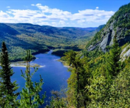
Parc national du Fjord-du-Saguenay
Saguenay - Lac-Saint-Jean · 15.2 km away
La Romane
Charlevoix · 24.7 km away
Mont Elie
Charlevoix · 28.4 km away

Centre De Vacances Ferme 5 Étoiles
North Shore · 32.4 km away

Parc national des Hautes-Gorges-de-la-Rivière-Malbaie
Charlevoix · 36.4 km away
Hiking near Quebec City
47 trails to explore ~166 km away
We work hard to provide the most up-to-date and error-free data possible. If something seems incorrect, let us know! Your contribution helps the whole community.
Hikers' opinions
Be the first to review!
No hiker has shared their experience yet. Share your impressions and help other hikers!