

Ready to explore Cascade d'Ars? Here's everything you need to know before you go!
Discover the trail
Trail description
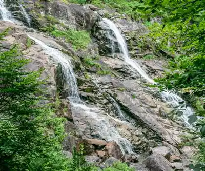
The Cascade d'Ars is one of the most rewarding waterfall hikes in the Ariège, and it earns that reputation honestly. At 6 km round trip with 630 meters of elevation gain, this moderate trail delivers a genuine mountain experience — varied terrain, a stream-fed approach, and a finale that genuinely stops you in your tracks. Plan for about 2.5 hours of hiking, though most people linger longer once they reach the falls.
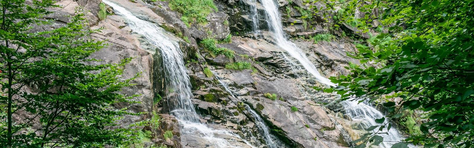
The waterfall itself is a multi-tiered cascade that drops down steep granite cliffs in a series of falls, carving out natural pools and filling the air with mist. The surrounding granite walls channel and amplify the sound, so you hear it well before you see it. During peak snowmelt — typically late spring through early summer — the volume of water is extraordinary, and the spray reaches far enough that you'll feel it on your face from a good distance away.
The Trail
The hike starts in mixed forest, moving through beech and oak before the vegetation gradually shifts to hardier mountain species as you gain elevation. The lower section of the trail is well-maintained with a solid dirt surface, making for comfortable walking. As you climb, the path gets rockier and more technical, and the final approach to the waterfall involves navigating wet granite — some scrambling, some careful footwork over slippery surfaces.
For most of the route, you're following a mountain stream. That's both a navigation aid and one of the more pleasant aspects of the hike — the sound of moving water keeps you company the whole way up. Several smaller cascades appear along the route before you reach the main event, each one a natural excuse to stop, catch your breath, and take in the surroundings. These intermediate falls also offer reliable spots to refill water bottles if needed.
The 630 meters of elevation gain is spread across the 6 km, so the climb is steady rather than brutal. That said, it's a real workout, and the upper section near the waterfall demands your full attention. Wet rocks and mist make the final approach the most technically demanding part of the trail, even on otherwise dry days.
What Makes This Hike Stand Out
A lot of waterfall hikes in the Pyrenees follow a similar formula: forest walk, stream crossing, waterfall, done. The Cascade d'Ars hits those notes but adds something extra in the geology. The granite formations surrounding the falls show clear signs of glacial shaping — polished faces, carved channels, the kind of rock architecture that makes you stop and actually look at the walls around you, not just the water coming down them. The hard granite resists erosion in a way that concentrates the water flow and creates the dramatic, narrow cascade rather than a wide, diffuse one.
The contrast between the rugged granite environment and the alpine wildflowers that bloom in summer is genuinely striking. Delicate species push through rocky crevices and spread across small meadow patches, and the color against the grey stone is worth noticing.
Wildlife Along the Way
The Ariège mountains support a healthy range of mountain wildlife, and this trail passes through enough varied habitat to give you a reasonable chance of seeing some of it. Marmots are common in the higher rocky sections — their sharp whistles carry well in the granite terrain. The forested lower sections provide cover for deer and wild boar, and golden eagles are known to soar above the peaks in this area. Keep your eyes on the ridgelines.
Seasonal Conditions
Spring, roughly April through June, brings the most dramatic water flow as snowmelt feeds the cascade from higher elevations. The falls are at their most powerful and visually impressive during this window, though higher sections of the trail may still carry mud or ice patches. This is the season for the full sensory experience — the roar, the mist, the force of the water.
Summer offers the most stable conditions. The trail is fully accessible, the weather is generally reliable, and the surrounding alpine environment is at its most lush. Water flow is lower than spring but still substantial. Families with children will find summer the most manageable time to attempt the hike.
Fall changes the character of the lower trail significantly, with the beech and oak forest turning before the granite cliffs provide a sharp, unchanging backdrop. Water levels drop further but remain enough to make the cascade worthwhile. Winter access requires proper mountain experience and equipment — snow and ice make the trail genuinely hazardous without the right preparation.
Gear and Practical Notes
Footwear matters on this trail. The combination of wet granite near the falls, loose rock in the upper section, and potentially muddy lower paths calls for hiking boots with solid ankle support and aggressive tread. Waterproof boots are a smart choice, especially in spring or after rain. Trekking poles are worth bringing — they add meaningful stability on the slippery final approach.
Layering is the right approach to clothing regardless of the season. Valley temperatures don't reflect what you'll find near the waterfall, where elevation and constant mist keep things noticeably cooler. A waterproof shell is useful both for weather changes and for staying dry near the cascade itself.
Carry enough water for the climb. The stream provides reliable refill options along the route, but treat or filter before drinking. On warm days, the physical demands of the 630-meter gain increase fluid needs more than people typically expect.
Photography
The Cascade d'Ars is a compelling photography subject, but it comes with technical challenges. The contrast between bright granite and shadowed water can push camera exposure systems to their limits — early morning or late afternoon light tends to produce more balanced results. The mist is constant near the base of the falls, so keeping a lens cloth accessible is essential. That same mist creates rainbow effects when sunlight hits it at the right angle, typically in late morning or early afternoon.
Multiple viewpoints around the base of the falls allow for different angles and compositions. The granite ledges offer stable platforms for tripod work, though wet surfaces require careful footing. The audio environment — the sustained roar of the cascade amplified by the surrounding rock walls — makes this an excellent location for video as well as stills.
The Essential Hiking Checklist
Everything you need for your next hike. Bilingual, printable, 1 page.
Get your free hiking checklistRecommended gear for this trail
As an Amazon Associate I earn from qualifying purchases.


Ready to go?
Everything you need to know before you goWhen?
How much?
As an Amazon Associate I earn from qualifying purchases.
Affiliate links — LGPO may earn a commission at no extra cost to you.
- Hiking shoes Essential
- → Salomon Elixir Tour Mid WP · 203.38 $
- Layered clothing Essential
- Rain jacket Essential
- Trekking poles
- → Black Diamond Trail Ergo Cork · 69.99 $
- Headlamp
- → Petzl Actik Core 625 · 103.95 $
FAQ - Frequently asked questions
Everything you need to knowSimilar hikes nearby
Discover other trails you might enjoy

Hiking near Sydney
22 trails to explore ~4789 km away
We work hard to provide the most up-to-date and error-free data possible. If something seems incorrect, let us know! Your contribution helps the whole community.
Hikers' opinions
Be the first to review!
No hiker has shared their experience yet. Share your impressions and help other hikers!