

Ready to explore Cascades de L'Artigue? Here's everything you need to know before you go!
Discover the trail
Oh no! We don't have any photos 😢
This trail hasn't been captured yet. Be the first to share your adventure!Trail description
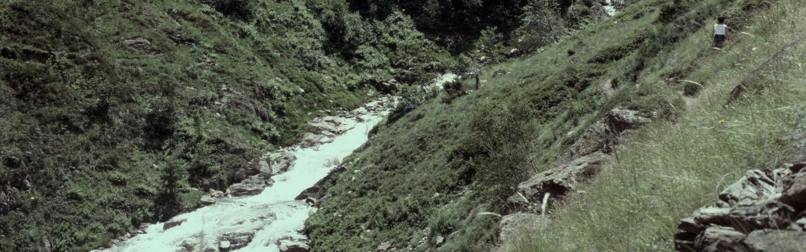
The Cascades de L'Artigue is a mountain waterfall hike in the Ariège department of the French Pyrénées. The route covers approximately 2.9 to 3.1 kilometers round trip with elevation gains ranging from 132 to 163 meters, taking roughly 2 to 2.5 hours to complete. This is a well-rated hike (4.5-4.6 stars) that offers genuine alpine terrain and a rewarding waterfall destination.
What sets this hike apart in the Ariège is the combination of dense forest, dramatic geology, and the cascades themselves — a sequence of waterfalls that have carved their way through the bedrock over thousands of years. The varying water flow throughout the seasons creates different viewing experiences, from powerful spring snowmelt displays to late summer formations that reveal more of the underlying rock structure.
Trail Character and Terrain
The trail starts in thick mountain forest dominated by beech and fir, which provides solid shade in summer and a cushioned, rooted surface underfoot. The path is packed earth and rock for most of its length, with sections where exposed roots and loose stones require you to watch your footing rather than the scenery. This is normal Pyrénéan trail terrain — nothing technical, but not a groomed park path either.
Elevation builds steadily from the start. The 132 to 163-meter gain is distributed in a way that maintains consistent effort without being brutal. As you climb, the forest opens up progressively, and the vegetation shifts toward more alpine character — rocky outcrops, mountain wildflowers in the crevices, and wider views of the surrounding peaks emerging between the trees.
You'll hear the cascades before you see them. The sound of rushing water builds gradually as you approach, which provides motivation on the moderate sections. The final approach involves granite slabs and boulders that require some care, particularly when wet. This is where footwear matters — a boot with solid ankle support and a grippy sole is the right call, not trail runners or approach shoes.
The water volume changes significantly with the season, which means the experience changes too. Spring snowmelt produces the most powerful flows, while late summer reveals more of the underlying rock structure and allows you to get closer to the formations.
Difficulty and Fitness Level
This trail is rated Easy to Moderate, which is accurate for hikers with basic mountain experience. The elevation gain is modest and the rocky terrain near the top requires careful footing but nothing technical or specialized beyond solid footwear. Hikers who are comfortable on uneven mountain terrain and reasonably fit will find this challenging but very manageable.
The return descent on the same terrain deserves attention — loose rock and wet surfaces on the way down are where most trail incidents happen. Take your time on the granite sections heading back.
Seasonal Conditions
Spring brings the highest water volume as the mountain snowpack melts, producing dramatic waterfall displays. Trail conditions are muddier and stream crossings require more caution during this period, but the forest is at its most vivid and the waterfalls are at full power.
Summer offers the most stable conditions overall. Trails are dry, weather is generally reliable, and the forest canopy keeps temperatures manageable even on warm days. Water levels are lower, which changes the character of the cascades but makes the rock formations more accessible and the pools more approachable.
Autumn is a strong season for this hike. The beech trees that dominate the lower elevations turn brilliant yellow and orange, water levels stabilize at moderate flows, and the crowds thin out. Weather becomes less predictable, so carrying rain gear is non-negotiable.
Winter hiking to the cascades requires experience with snow and ice conditions. Ice formations around the waterfalls can be visually striking, but sections of the trail may become impassable without proper equipment, and avalanche awareness is essential. This is not a casual winter outing.
Wildlife and Natural Environment
The ecosystem around Cascades de L'Artigue is typical of the Pyrénéan mountain environment — diverse, active, and best observed quietly. Bird activity is consistent throughout the trail, with woodpeckers audible in the forest sections and birds of prey occasionally visible above the treeline. Signs of wild boar are common on the forest floor, though actual sightings during daylight are uncommon.
The geological story here is worth paying attention to. The granite bedrock shows clear evidence of glacial activity — polished surfaces, striations, and the characteristic shapes left behind by ice age movement. The waterfalls are essentially the current chapter of a much longer geological narrative written into the rock.
The clean mountain water supports native trout and aquatic insects in the stream sections, and the varied flow conditions created by the cascades — from fast rapids to slow pools — sustain different species adapted to each environment.
What to Bring
- Footwear: Hiking boots with ankle support and aggressive tread. The granite slabs near the cascades get slippery, and the descent on loose rock rewards a boot with real grip.
- Layers and rain protection: Pyrénéan weather moves fast. Starting conditions don't predict what you'll encounter near the top.
- Water and food: Enough to spend time at the cascades without rushing the return. There are no services on this trail.
- First aid basics: Standard mountain kit. Cell coverage is limited or absent in this terrain.
- Camera gear: If you're shooting the waterfalls, a polarizing filter manages reflections on wet rock effectively, and a tripod opens up longer exposures that render the moving water well. Keep equipment protected from spray near the falls.
Let someone know your plans and expected return time before you head out — the trail's remote character means self-sufficiency is the baseline expectation, not an optional upgrade.
The Essential Hiking Checklist
Everything you need for your next hike. Bilingual, printable, 1 page.
Get your free hiking checklistRecommended gear for this trail
As an Amazon Associate I earn from qualifying purchases.


Ready to go?
Everything you need to know before you goWhen?
How much?
As an Amazon Associate I earn from qualifying purchases.
Affiliate links — LGPO may earn a commission at no extra cost to you.
- Hiking shoes Essential
- → Salomon Elixir Tour Mid WP · 203.38 $
- Layered clothing Essential
- Rain jacket Essential
- Trekking poles
- → Black Diamond Trail Ergo Cork · 69.99 $
- Headlamp
- → Petzl Actik Core 625 · 103.95 $
FAQ - Frequently asked questions
Everything you need to knowSimilar hikes nearby
Discover other trails you might enjoy

Hiking near Sydney
22 trails to explore ~4795 km away
We work hard to provide the most up-to-date and error-free data possible. If something seems incorrect, let us know! Your contribution helps the whole community.
Hikers' opinions
Be the first to review!
No hiker has shared their experience yet. Share your impressions and help other hikers!