


Ready to explore Parc naturel régional du Queyras - GR58? Here's everything you need to know before you go!
Discover the trail
Trail description
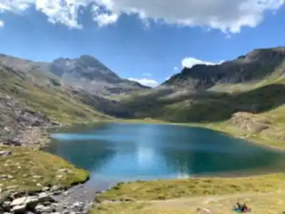
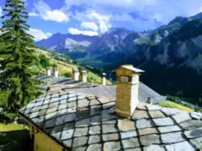
The Queyras Regional Natural Park stands as one of France's most pristine alpine wilderness areas, tucked away in the southeastern corner of the Hautes-Alpes department near the Italian border. This protected landscape encompasses dramatic peaks, traditional mountain villages, and an extensive network of hiking trails that wind through some of the most unspoiled terrain in the French Alps.
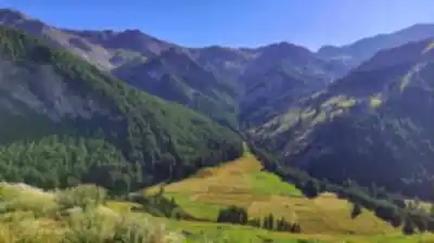
The park's rugged geography centers around the Queyras massif, where ancient schist and limestone formations create a distinctive landscape of sharp ridges, deep valleys, and scattered alpine lakes. Unlike the heavily glaciated peaks found elsewhere in the Alps, the Queyras presents a more austere beauty characterized by rocky summits, expansive meadows, and forests of larch, pine, and fir that change dramatically with the seasons.
Trail Network and Hiking Options
The park offers hiking opportunities for every skill level, from gentle valley walks to challenging high-altitude traverses. The famous GR5 and GR58 long-distance trails pass through the region, but countless shorter day hikes provide access to the park's highlights without requiring multi-day commitments.
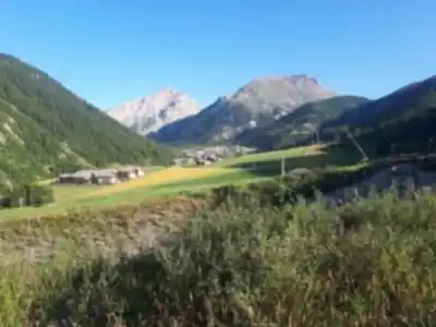
Valley-bottom trails follow ancient mule paths between villages like Ceillac, Molines-en-Queyras, and Saint-Véran, Europe's highest inhabited village at 2,042 meters. These routes typically involve minimal elevation gain while offering stunning views of the surrounding peaks and glimpses into traditional alpine life that has remained largely unchanged for centuries.
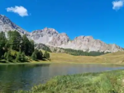
Mid-elevation hikes lead to alpine lakes, mountain passes, and viewpoints that showcase the park's dramatic topography. Popular destinations include Lac Miroir, the Col Agnel pass on the Italian border, and various refuges that serve as both destinations and starting points for higher adventures.
Advanced hikers can tackle the park's numerous summits, including Pic de la Font Sancte and Monte Viso, which dominates the skyline at 3,841 meters just across the Italian border. These routes demand proper mountaineering skills and equipment, particularly early and late in the season when snow and ice conditions can be challenging.
Terrain and What to Expect
The Queyras terrain varies dramatically with elevation and exposure. Lower valleys feature well-maintained paths through mixed forests and pastoral landscapes, where traditional hay meadows and stone farmhouses create a quintessentially alpine atmosphere. The underlying geology creates relatively stable footing, though stream crossings and occasional rockfall areas require attention.
As trails climb toward treeline, hikers encounter increasingly rocky terrain interspersed with alpine meadows that explode with wildflowers during the brief summer growing season. The transition zone between forest and alpine environments often provides the most diverse hiking experiences, with constantly changing views and terrain underfoot.
Above treeline, the landscape becomes more austere but no less beautiful. Exposed ridges and high passes offer panoramic views across the Alps, while hidden cirques shelter pristine lakes and remnant snowfields. Weather conditions can change rapidly at these elevations, and proper preparation becomes essential for safe travel.
Wildlife and Natural Features
The park protects significant populations of alpine wildlife, including chamois, ibex, marmots, and golden eagles. Early morning and evening hours provide the best opportunities for wildlife observation, particularly in the quieter valleys and high meadows away from the most popular trails.
The diverse plant communities reflect the park's position at the intersection of Mediterranean and continental alpine influences. Rare endemic species thrive in the unique microclimates created by the complex topography, making the Queyras particularly valuable for botanical enthusiasts.
Villages and Cultural Heritage
The park's traditional villages serve as both gateways to the wilderness and destinations in their own right. Saint-Véran, Ceillac, and other communities maintain their authentic character through careful preservation of traditional architecture and agricultural practices. Many villages offer accommodations, restaurants, and local guides who provide invaluable insight into the region's natural and cultural history.
Ancient sundials, traditional bread ovens, and centuries-old churches reflect the ingenuity required to thrive in this challenging mountain environment. The local Queyrassin dialect and customs add cultural depth to any visit, particularly during summer festivals and markets.
Seasonal Considerations
The hiking season typically runs from June through October, though timing varies significantly with elevation and snow conditions. Lower valley trails may be accessible as early as May, while high passes and summits often remain snow-covered well into July.
Summer brings the most reliable weather and the fullest range of accessible trails, but also the largest crowds, particularly in July and August. September often provides ideal conditions with stable weather, fewer visitors, and spectacular autumn colors in the larch forests.
Winter transforms the park into a cross-country skiing and snowshoeing destination, though many high-elevation areas become inaccessible to all but the most experienced mountaineers.
Access and Practical Information
The park is accessible via several valley roads that branch off from the main Durance Valley route. Guillestre serves as the primary gateway town, with regular bus connections to the various valley communities during summer months. Parking is generally available in village centers, though spaces can be limited during peak season weekends.
Mountain refuges throughout the park provide accommodation and meals for multi-day adventures, though reservations are strongly recommended during summer months. Many villages also offer gîtes, hotels, and camping facilities for those preferring valley-based accommodations.
The park maintains an excellent network of marked trails with regular signage and maintenance, though conditions can change rapidly due to weather or seasonal factors. Local tourist offices provide current trail conditions and weather forecasts essential for planning safe adventures in this magnificent alpine wilderness.
Recommended gear for this trail


Ready to go?
Everything you need to know before you goWhen?
Tuesday: 9:00 AM – 12:00 PM, 2:00 – 5:00 PM
Wednesday: 9:00 AM – 12:00 PM, 2:00 – 5:00 PM
Thursday: 9:00 AM – 12:00 PM, 2:00 – 5:00 PM
Friday: 9:00 AM – 12:00 PM, 2:00 – 5:00 PM
Saturday: Closed
Sunday: Closed
How much?
- Hiking shoes Essential
- → Salomon Elixir Tour Mid WP · 203.38 $
- Layered clothing Essential
- Rain jacket Essential
- Trekking poles
- → Black Diamond Trail Ergo Cork · 69.99 $
- Headlamp
- → Petzl Actik Core 625 · 103.95 $
FAQ - Frequently asked questions
Everything you need to know
25 hikes under 2 hours from Montreal
Distance, elevation, parking and season for each one. The ones we go back to ourselves.
Get the guideSimilar hikes nearby
Discover other trails you might enjoy


Hiking near Sydney
22 trails to explore ~5087 km away
We work hard to provide the most up-to-date and error-free data possible. If something seems incorrect, let us know! Your contribution helps the whole community.
Hikers' opinions
Be the first to review!
No hiker has shared their experience yet. Share your impressions and help other hikers!