Let's Go Play Outside
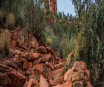
Hiking Dixie Mine - panoramic view  tree outdoor landscape nature mountain sky autumn plant cloud background lake painting forest surrounded distance
--°C
Loading...
See forecast →

Dixie Mine Trail, McDowell Mountain Regional Park

Central Arizona • Arizona

Dixie Mine (Central Arizona, Arizona) : hike, about 3 hours.

3 hours
Duration

Ready to explore Dixie Mine? Here's everything you need to know before you go!

Discover the trail

Oh no! We don't have any photos 😢

This trail hasn't been captured yet. Be the first to share your adventure!

Trail description

The Dixie Mine Trail is in McDowell Mountain Regional Park, near Fountain Hills, Arizona. According to the Fountain Hills Times (2014), the hike to the old mine starts at the Golden Eagle Trailhead and passes through a gated residential neighborhood before entering the park.

The mine and the petroglyphs

The site originally belonged to the Red Mountain Consolidated Copper Mines Company. By 1917, two prospecting tunnels had been dug, one about 240 feet long and one about 100 feet. In 1977, the claims were ruled economically deficient and the land became part of the park. An iron gate was installed at the 240-foot tunnel in the 1980s.

About 100 feet past the tunnels, rock carvings date from three periods: Archaic (over 800 years old), Hohokam and Historic.

Check with Maricopa County Parks before your outing (length, fees, rules).

Free 1 page
The Essential Hiking Checklist

Everything you need for your next hike. Bilingual, printable, 1 page.

Get your free hiking checklist

Recommended gear for this trail

As an Amazon Associate I earn from qualifying purchases.

LGPO Pick
Elixir Tour Mid WP
Salomon
Elixir Tour Mid WP
4.5 (2847 reviews)
Waterproof mid-height boot ideal for rocky terrain
203.38 $
See price
Best Value
Trail Ergo Cork
Black Diamond
Trail Ergo Cork
4.4 (1456 reviews)
Comfortable cork grip for long ascents
69.99 $
See price
Daylite Plus 20L
Osprey
Daylite Plus 20L
4.7 (3215 reviews)
Lightweight and versatile for day hikes
109.99 $
See price
Actik Core 625
Petzl
Actik Core 625
4.6 (1893 reviews)
USB rechargeable with 600 lumens for early starts
103.95 $
See price
Most Popular
Wide Mouth 1L
Nalgene
Wide Mouth 1L
4.8 (12540 reviews)
Unbreakable and BPA-free — a hiking essential
23.11 $
See price
Affiliate links — LGPO may earn a commission at no extra cost to you.

Ready to go?

Everything you need to know before you go

Where?

Address
Not available
GPS coordinates
33.6358, 33.6358
Phone
Not available

Starting Point

According to the Fountain Hills Times (2014), the hike starts at the Golden Eagle Trailhead. Check with Maricopa County Parks for access and parking.

When?

Opening hours
No information
Weather (next days)
Loading
What to bring?

As an Amazon Associate I earn from qualifying purchases.

Affiliate links — LGPO may earn a commission at no extra cost to you.

General hiking tips, to adapt to your outing.
Gear
Download the PDF checklist
Water & food
Tip: bring water
Plan for at least 2 L per person on an outing of 2 hours or more.
Good to know
In an emergency
Emergency
911
GPS coordinates
33.6358, 33.6358

Hikers' opinions

Be the first to review!

No hiker has shared their experience yet. Share your impressions and help other hikers!

FAQ - Frequently asked questions

Everything you need to know
Allow about 3 hours for Dixie Mine.
The Dixie Mine Trail is approximately 9.9 miles round trip, with an elevation gain of about 1,037 feet. This typically takes half a day to a full day depending on your pace and how much time you spend exploring the historic mine structures and petroglyphs.
October through April offers the most comfortable hiking conditions with mild temperatures and better desert visibility. Summer months are dangerously hot, so if visiting June-September, start very early and bring extensive water.
The trail leads to remnants of the historic Dixie Mine established in 1877. You'll find an iron-gated main tunnel, a vertical shaft, and nearby ancient petroglyphs dating back over 800 years, including Archaic and Hohokam carvings etched into a canyon wall.
No, there is no water available on the trail. You must bring all the water you need — carry more than you think you'll need for desert hiking.
Yes, dogs are allowed and the trail is dog-friendly. Leash requirements apply — confirm current dog policies with Maricopa County Parks before your visit.
Yes, the trail is suitable for mountain biking, particularly AM and XC bikes. The terrain is rocky and technical, making it best suited for intermediate riders.
The trailhead is accessible from Golden Eagle Boulevard in Fountain Hills, approximately 13.8 miles east of HWY 101. Parking is available at the trailhead.
The Dixie Mine Trail is part of McDowell Mountain Regional Park's extensive trail network. It intersects with the Prospector Trail and the Pemberton Trail (at 5.6 miles), allowing for loop options and extended day hikes.
Closed-toe hiking boots or trail runners with good grip are essential. The terrain is rocky and sandy with exposed rock — skip sandals and wear shoes with solid traction.
Didn't find your answer?
Top 10 best hiking in Central Arizona
Our ranking based on hiker reviews

Hiking near Sydney

25 trails to explore ~7673 km away

View trails near Sydney
Did you spot an error?

We work hard to provide the most up-to-date and error-free data possible. If something seems incorrect, let us know!

Update : November 2026