
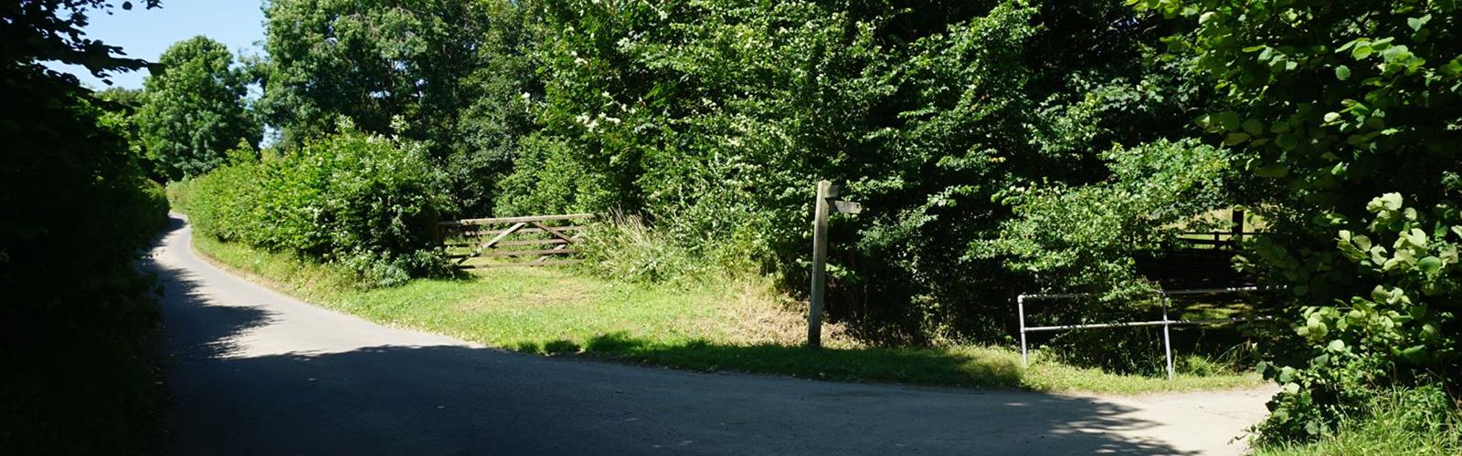

Ready to explore Lane Trail? Here's everything you need to know before you go!
Discover the trail

Trail description
The Lane Trail is a hiking trail located in the Dartmouth-Lake Sunapee region of New Hampshire. Tucked into one of the quieter corners of the state, this trail offers hikers a chance to get out into the New Hampshire woods without the crowds that tend to gather around more well-known destinations in the region.
The Trail Experience
The Lane Trail winds through classic New England forest terrain — the kind of mixed hardwood and softwood landscape that defines hiking in this part of New Hampshire. Expect a natural surface underfoot, with the typical features you'd find on a backcountry trail in this region: roots, rocks, and the occasional muddy stretch depending on recent weather and the time of year.
The trail has a genuine backcountry feel. It's not a heavily developed or heavily trafficked route, which means you're more likely to have a quiet experience out here. That also means you should come prepared — don't count on signage at every junction or a perfectly groomed path throughout.
The Dartmouth-Lake Sunapee Region
The Dartmouth-Lake Sunapee region sits in the west-central part of New Hampshire, a stretch of the state that often gets overlooked in favor of the White Mountains to the north. That's actually part of what makes it worth exploring. The landscape here is gentler in some ways — rolling hills, forested ridges, and a network of lakes and ponds — but it still delivers real hiking with genuine natural character.
Lake Sunapee itself is one of the cleanest and most scenic lakes in New Hampshire, and the surrounding hills and forests provide a solid backdrop for outdoor recreation. The region has a long history of outdoor use, and trails like the Lane Trail are part of that fabric — routes that locals and visitors have been using to access the woods for generations.
What to Expect on the Ground
The Lane Trail passes through forested terrain that's representative of the broader Dartmouth-Lake Sunapee area. You'll move through a mix of tree species typical of New Hampshire's mid-elevation forests — maples, beeches, birches, and conifers depending on the specific section of trail. The forest canopy provides good shade during warmer months, and the understory changes noticeably with the seasons.
The trail surface is natural throughout. Depending on conditions, you may encounter:
- Exposed tree roots across the path, particularly on steeper or more traveled sections
- Rocky footing in certain stretches
- Wet or muddy areas, especially in spring or after significant rainfall
- Leaf litter in fall that can obscure the trail surface and make footing less predictable
Sturdy footwear with good ankle support is a smart choice here. Trail runners or hiking boots will both serve you well; road shoes or casual sneakers are not ideal.
Getting There and Trailhead Access
The Lane Trail is situated in the Dartmouth-Lake Sunapee region of New Hampshire. Before heading out, it's worth confirming current trailhead access, parking availability, and any seasonal closures or conditions through local land management sources. Trailhead access and parking situations can change, and getting up-to-date information before you go will save you headaches on arrival.
If you're coming from outside the immediate area, plan your route in advance. Rural New Hampshire roads can be narrow and navigation apps don't always have the most accurate information for backcountry trailheads. A downloaded offline map or a printed topo is a good backup.
Planning Your Visit
A few practical things worth keeping in mind before you head out to the Lane Trail:
- Trail conditions vary by season. Spring in New Hampshire brings mud season — typically March through May — when trails can be significantly degraded by foot traffic. Many land managers in the state ask hikers to avoid certain trails during this period to prevent lasting damage to the tread.
- Bugs can be a factor. Black flies are a real presence in New Hampshire from late May through June. Bring insect repellent if you're visiting during that window.
- Weather changes quickly. Even on a clear morning, conditions in the New Hampshire hills can shift. Bring an extra layer and rain gear regardless of the forecast.
- Navigation. Download a trail map before you go. Cell service in rural New Hampshire is inconsistent, and having an offline map on your phone — or a paper backup — is a straightforward precaution.
- Leave No Trace. Pack out everything you bring in. The quieter character of a trail like this depends on people treating it well.
Who This Trail Suits
The Lane Trail is a good option for hikers who want to explore the Dartmouth-Lake Sunapee region without committing to a major summit objective. It's the kind of trail that rewards people who enjoy being in the woods for the experience itself — the sounds, the light through the trees, the feel of natural terrain underfoot — rather than those primarily chasing elevation gain or panoramic views.
It's also a reasonable choice for hikers who are familiar with New Hampshire backcountry conditions and comfortable navigating on natural-surface trails without heavy infrastructure. If you're newer to hiking or bringing young kids, make sure you have a solid map and a clear turnaround plan before you set out.
Nearby
The Dartmouth-Lake Sunapee region has more to offer beyond the Lane Trail. The area around Lake Sunapee includes additional hiking opportunities, water access, and the kind of small-town New Hampshire character that makes the region worth spending more than a single afternoon in. If you're making a trip of it, there's enough in the surrounding area to fill a full weekend of outdoor activity.
The Essential Hiking Checklist
Everything you need for your next hike. Bilingual, printable, 1 page.
Get your free hiking checklistRecommended gear for this trail
As an Amazon Associate I earn from qualifying purchases.


Ready to go?
Everything you need to know before you goWhen?
How much?
As an Amazon Associate I earn from qualifying purchases.
Affiliate links — LGPO may earn a commission at no extra cost to you.
- Hiking shoes Essential
- → Salomon Elixir Tour Mid WP · 203.38 $
- Layered clothing Essential
- Rain jacket Essential
- Trekking poles
- → Black Diamond Trail Ergo Cork · 69.99 $
- Headlamp
- → Petzl Actik Core 625 · 103.95 $
FAQ - Frequently asked questions
Everything you need to knowSimilar hikes nearby
Discover other trails you might enjoy
Mt Moosilauke
Dartmouth-Lake Sunapee

AMC Cardigan Lodge
Dartmouth-Lake Sunapee

Cardigan Mountain State Park
Dartmouth-Lake Sunapee

Moose Mountain Shelter
Dartmouth-Lake Sunapee

Welton Falls
Dartmouth-Lake Sunapee
Big Sugarloaf Mountain
Dartmouth-Lake Sunapee
Hiking near Sydney
22 trails to explore ~7670 km away
We work hard to provide the most up-to-date and error-free data possible. If something seems incorrect, let us know! Your contribution helps the whole community.
Hikers' opinions
Be the first to review!
No hiker has shared their experience yet. Share your impressions and help other hikers!