

Ready to explore Shaver Lake? Here's everything you need to know before you go!
Discover the trail
Trail description
Shaver Lake is a scenic mountain reservoir tucked into the Sierra Nevada of central California. Sitting at elevation in the central Sierra, the lake draws visitors looking for a genuine mountain escape — whether that means getting out on the water, exploring the surrounding shoreline, or simply finding a quiet spot away from the valley heat. It's the kind of place that locals have been coming back to for generations, and it's easy to see why.
The Lake and Its Setting
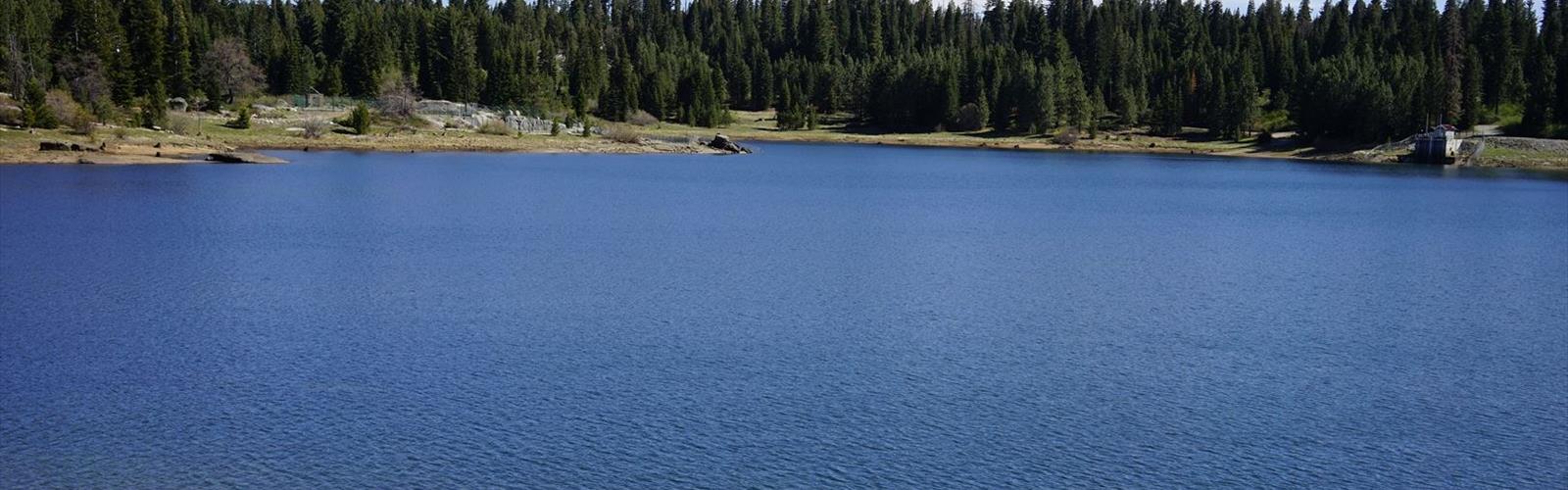
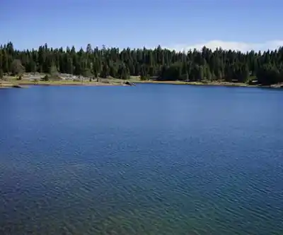
Shaver Lake is a reservoir managed by Southern California Edison, created by a dam on Stevenson Creek. The surrounding landscape is classic Sierra Nevada mixed conifer forest — ponderosa pine, white fir, and incense cedar dominate the slopes, with manzanita and other chaparral species filling in the understory. The water itself is a deep, clear blue-green, and the shoreline alternates between rocky outcroppings, sandy coves, and forested banks that come right down to the water's edge.
The town of Shaver Lake sits right alongside the reservoir, giving the area a relaxed, small-community feel. There are marinas, campgrounds, and a handful of local businesses that cater to outdoor visitors. It's not a wilderness experience in the backcountry sense, but it's a genuinely pleasant mountain destination with solid access and infrastructure.
Hiking Around Shaver Lake
The hiking around Shaver Lake tends to follow the natural contours of the shoreline and the surrounding forested terrain. With approximately 35 miles of multi-purpose hiking trails on Edison land around Shaver Lake, there's plenty of exploration to be done. Trails here offer a mix of lake views and forest immersion, with the kind of terrain that rewards a slower pace. You're not grinding up a relentless climb — the hiking in this area is generally accessible and enjoyable for a wide range of fitness levels, making it a good option for families or anyone looking for a relaxed outing rather than a serious workout.
The forest setting means you're often hiking in shade, which is a real advantage during the warmer months when the Sierra foothills can get hot. The smell of pine and the sound of the lake nearby make for a sensory experience that's hard to replicate at lower elevations. Keep an eye out for wildlife — deer are commonly spotted in the area, and the forest supports a healthy bird population including Steller's jays, woodpeckers, and various raptors.
Getting There and Getting Around
Shaver Lake is accessible via Highway 168 out of Fresno, making it a straightforward drive from the Central Valley. The road is well-maintained and the route is clearly signed. Once you're in the Shaver Lake area, the town serves as a natural hub — you can orient yourself from there and find your way to trailheads, the marina, and the various access points around the lake.
Parking is available at multiple points around the lake and in the town itself. During peak summer weekends, the area gets busy, so arriving earlier in the day gives you a better shot at finding a good spot and having the trails feel less crowded.
On the Water
While hiking is a draw, Shaver Lake is equally well-known as a boating and water recreation destination. The lake allows motorized boats, which means you'll often see everything from fishing boats to water skiers and personal watercraft out on the water during summer. If you're hiking the shoreline, that activity on the lake is part of the backdrop — it adds energy to the scene rather than detracting from it.
Fishing is popular here, with the lake stocked regularly. Anglers target rainbow trout, brown trout, and kokanee salmon, among other species. If you're combining a hike with a fishing outing, Shaver Lake is a natural fit.
Camping and Staying Overnight
There are campgrounds in the Shaver Lake area that make it easy to extend your visit into a multi-day trip. Camping here puts you right in the middle of the Sierra Nevada experience — cool nights, star-filled skies, and mornings that make you want to get outside early. The combination of lakeside access and forest camping is one of the genuine strengths of this destination.
Best Times to Visit
Summer is the peak season at Shaver Lake, and for good reason — the weather is warm, the lake is at its most inviting, and all facilities are fully operational. That said, summer weekends bring crowds, particularly around the Fourth of July and Labor Day. If you can visit on a weekday or during the shoulder season in late spring or early fall, you'll find a noticeably quieter experience.
Spring brings snowmelt and green-up to the surrounding forest, and the lake levels are typically high. Fall offers cooler temperatures and the beginning of color change in the deciduous trees mixed through the conifers. Winter access depends on snowfall — Highway 168 can be affected by winter storms, so checking road conditions before heading up is always a good idea if you're visiting outside of summer.
What to Know Before You Go
- Elevation: Shaver Lake sits at a meaningful Sierra Nevada elevation, so visitors coming from sea level or the Central Valley may notice the altitude, especially during physical activity.
- Sun exposure: Even with forest cover on the trails, the Sierra sun is strong. Sunscreen and a hat are worth bringing regardless of the season.
- Wildlife awareness: Black bears are present in the Sierra Nevada. Store food properly, especially if camping, and be aware of your surroundings on the trail.
- Water: Bring enough water for your outing. While the lake is visually inviting, treat or filter any water before drinking it.
- Cell service: Coverage can be limited in mountain areas. Download offline maps before you leave and let someone know your plans.
- Fees and permits: Check current requirements before your visit, as access fees and camping reservations may apply depending on where you're going and what you're doing.
Shaver Lake is a well-rounded Sierra Nevada destination that delivers on multiple fronts — solid hiking, beautiful lake scenery, good camping, and easy access from the Central Valley make it a reliable choice for a California mountain getaway.
The Essential Hiking Checklist
Everything you need for your next hike. Bilingual, printable, 1 page.
Get your free hiking checklistRecommended gear for this trail
As an Amazon Associate I earn from qualifying purchases.


Ready to go?
Everything you need to know before you goWhen?
How much?
As an Amazon Associate I earn from qualifying purchases.
Affiliate links — LGPO may earn a commission at no extra cost to you.
- Hiking shoes Essential
- → Salomon Elixir Tour Mid WP · 203.38 $
- Layered clothing Essential
- Rain jacket Essential
- Trekking poles
- → Black Diamond Trail Ergo Cork · 69.99 $
- Headlamp
- → Petzl Actik Core 625 · 103.95 $
FAQ - Frequently asked questions
Everything you need to knowSimilar hikes nearby
Discover other trails you might enjoy

California Street
Gold Country
California National Historic Trail
Gold Country
Stony Hill, California
Gold Country
Stony Point, California
Gold Country
Sunset Point, California
Gold Country
Union Hill, California
Gold Country
Hiking near Victoria
93 trails to explore ~1300 km away
We work hard to provide the most up-to-date and error-free data possible. If something seems incorrect, let us know! Your contribution helps the whole community.
Hikers' opinions
Be the first to review!
No hiker has shared their experience yet. Share your impressions and help other hikers!