

Ready to explore Belknap Range? Here's everything you need to know before you go!
Discover the trail
Trail description
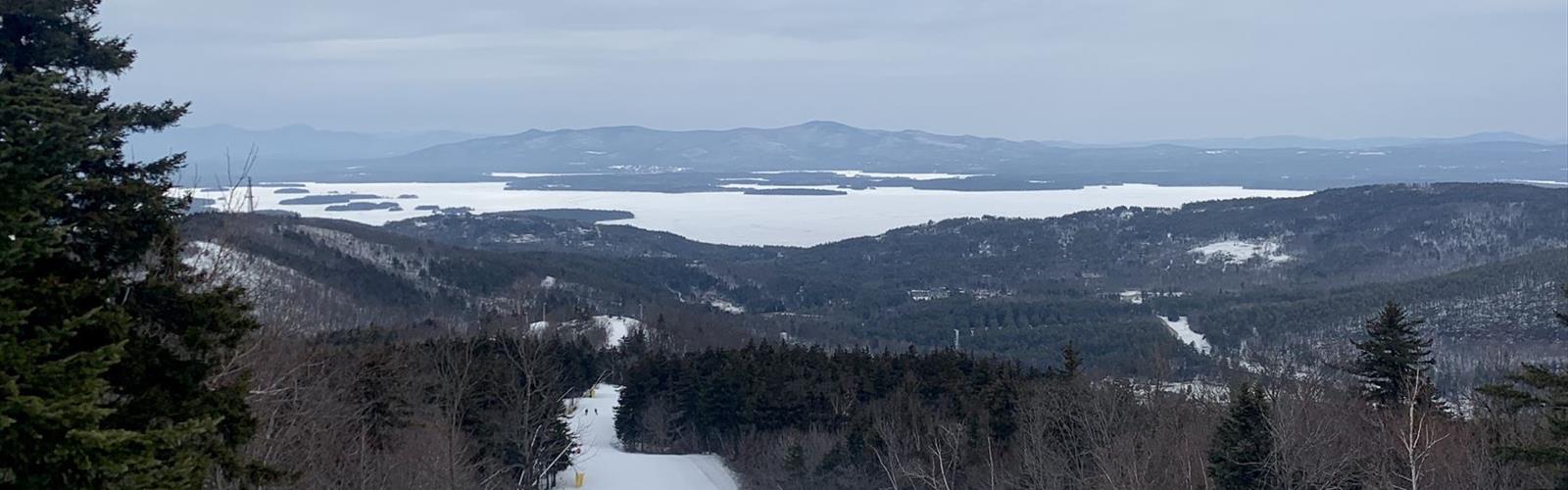
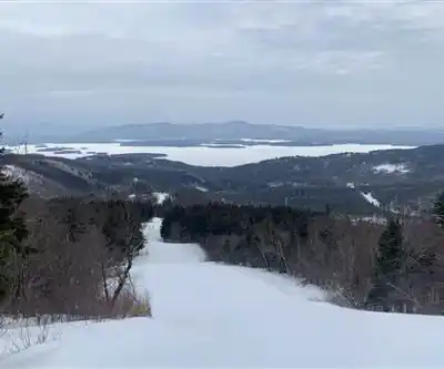
The Belknap Mountains are a small mountain range in the Lakes Region of New Hampshire in the United States. The range lies in the towns of Gilford, Gilmanton, and Alton in Belknap County. The highest peak, Belknap Mountain, with an elevation of 2,382 feet (726 m) above sea level, is the highest point in Belknap County.
The range extends for approximately 8 miles (13 km) in an arc that begins at New Hampshire Route 11A in Gilford and runs south, then curves east through the northern end of Gilmanton, before ending in the town of Alton, where it overlooks Alton Bay of Lake Winnipesaukee.
The named summits in the range, from northwest to southeast, are Mount Rowe (1,690 ft or 520 m), Gunstock Mountain (2,240 ft or 680 m), Belknap Mountain, Straightback Mountain (1,890 ft or 580 m), and Mount Major (1,786 ft or 544 m). A cluster of several unnamed summits with elevations ranging from 1,806 to 2,001 feet (550 to 610 m) are on the main crest of the range between Belknap Mountain and Straightback Mountain, surrounding Round Pond, itself located near the crest of the range at 1,652 feet (504 m) above sea level. A secondary ridge extends southwest from Belknap Mountain to the Gilford/Gilmanton line, containing, from north to south, the summits of Piper Mountain (2,044 ft or 623 m) and Whiteface Mountain (1,670 ft or 510 m).
The range is entirely in the Merrimack River watershed. The northeast side of the range drains via several small brooks to Lake Winnipesaukee, the outlet of which is the Winnipesaukee River, which drains westward to form the Merrimack. The west side of the range drains via the Gunstock River into Lake Winnipesaukee, and the extreme southwest end of the range, near Whiteface Mountain, drains west via the Tioga River to the Winnipesaukee River. The south side of the range, including Round Pond, drains south via the Suncook River to the Merrimack.
Mount Rowe and Gunstock Mountain form the slopes of Gunstock Mountain Resort, a major ski area for central New Hampshire.
Free
1 pages
The Essential Hiking Checklist
Everything you need for your next hike. Bilingual, printable, 1 page.
Get your free hiking checklistRecommended gear for this trail
As an Amazon Associate I earn from qualifying purchases.
LGPO Pick

Salomon
Elixir Tour Mid WP
Waterproof mid-height boot ideal for rocky terrain
203.38 $


Affiliate links — LGPO may earn a commission at no extra cost to you.
Ready to go?
Everything you need to know before you goWhen?
Opening hours
No information
Varies by season
Best season
Fall
Spectacular colors
Best time
Early morning
Less crowded
Weather (next days)
Loading
How much?
Entry fees
Adult
Not available
Child
—
What to bring?
As an Amazon Associate I earn from qualifying purchases.
Affiliate links — LGPO may earn a commission at no extra cost to you.
Gear
- Hiking shoes Essential
- → Salomon Elixir Tour Mid WP · 203.38 $
- Layered clothing Essential
- Rain jacket Essential
- Trekking poles
- → Black Diamond Trail Ergo Cork · 69.99 $
- Headlamp
- → Petzl Actik Core 625 · 103.95 $
Water & food
2L minimum
No water point on the trail
Bring energy snacks for a 4h+ hike
Good to know
Safety
Download the GPX before you go
Limited cellular coverage on the trail
Slippery after rain
Be careful on rocky sections
In an emergency
Emergency
911
Parking GPS
43.5488, -71.3043252
Center
Not available
FAQ - Frequently asked questions
Everything you need to knowBelknap Range is rated hard.
The elevation gain of Belknap Range is 612 m.
Allow about 3h45 for Belknap Range (10.1 km).
No, Belknap Range has no visitor centre on site.
Didn't find your answer?
Similar hikes nearby
Discover other trails you might enjoy
Mt Moosilauke
Dartmouth-Lake Sunapee
11.3 km
5h30
975 m
Advanced
AMC Cardigan Lodge
Dartmouth-Lake Sunapee
5.6 km
3h15
701 m
Intermediate
🐕
Dog allowed
Cardigan Mountain State Park
Dartmouth-Lake Sunapee
4.8 km
3h30
764 m
Intermediate

Moose Mountain Shelter
Dartmouth-Lake Sunapee
3.2 km
2-4 heures
375 m
Intermediate
Welton Falls
Dartmouth-Lake Sunapee
1.6 km
1h
122 m
Beginner
Big Sugarloaf Mountain
Dartmouth-Lake Sunapee
3.2 km
2h15
366 m
Intermediate
Top 10 best hiking in Dartmouth-Lake Sunapee
Our ranking based on hiker reviews
Hiking near Concord
0 trails to explore ~42 km away
Did you spot an error?
We work hard to provide the most up-to-date and error-free data possible. If something seems incorrect, let us know! Your contribution helps the whole community.
Hikers' opinions
Be the first to review!
No hiker has shared their experience yet. Share your impressions and help other hikers!