

Ready to explore Wire Pass Trailhead? Here's everything you need to know before you go!
Discover the trail
Trail description
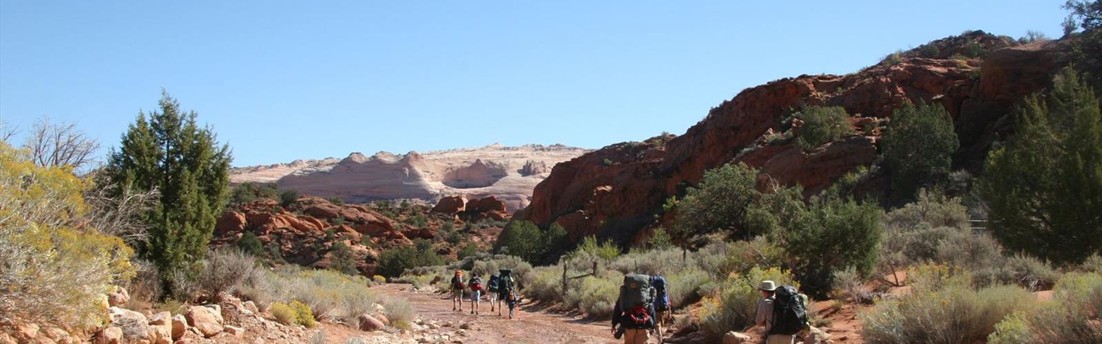
Wire Pass Trailhead is one of those starting points that feels almost too quiet for what it leads to. Tucked into the canyon country of central Utah, this trailhead serves as the gateway to Wire Pass Canyon — a narrow slot canyon experience that draws hikers looking for something genuinely different from a standard trail walk. The moment you step away from the parking area and into the canyon walls, the landscape shifts completely.
The Canyon Itself
Wire Pass Canyon is defined by its slot canyon character. The walls close in tight, sometimes narrow enough that you're turning sideways to squeeze through, with sandstone rising steeply on both sides. The light filters down in ways that change depending on the time of day — midday sun creates sharp contrasts between shadow and illuminated rock, while morning and late afternoon soften everything into warm amber tones. The geology here is Navajo Sandstone, and the erosion patterns are striking up close: smooth curves, cross-bedding layers, and the occasional pothole carved into the canyon floor.
The canyon floor itself is sandy and relatively flat for much of the route, which makes the walking straightforward even as the walls press in around you. There are a few spots where you'll need to navigate over or around small obstacles — nothing technical, but worth wearing sturdy footwear rather than sandals.
What Makes Wire Pass Stand Out
What separates Wire Pass from other slot canyon access points in the region is the combination of accessibility and genuine wildness. You don't need technical gear or a guided tour to experience it. At the same time, it doesn't feel like a theme park version of canyon country. The trailhead is a real trailhead — no paved walkways, no guardrails, no interpretive signs every fifty feet. You're navigating actual terrain.
The canyon also connects to Buckskin Gulch, which is one of the longest slot canyons in the American Southwest. Wire Pass serves as a popular entry point for hikers heading into Buckskin Gulch, making it a significant access hub for longer backcountry routes in addition to being a destination on its own.
Permits and Access
This area falls under Bureau of Land Management (BLM) jurisdiction, specifically the Grand Staircase-Escalante National Monument. A day-use permit is required to hike Wire Pass and enter Buckskin Gulch. Permits can be obtained through the BLM reservation system, and it's worth securing yours in advance, especially during peak season in spring and fall when demand is high.
There is a fee associated with the permit. Dogs are allowed on a leash. The trailhead has a vault toilet and a small parking area. The road leading to the trailhead is unpaved — a high-clearance vehicle is strongly recommended, and after rain the road can become impassable even for 4WD vehicles due to the clay-heavy soil that turns slick when wet.
Flash Flood Awareness
This is not a section to skim. Slot canyons are inherently dangerous in wet weather, and Wire Pass and Buckskin Gulch are no exception. Flash floods can move through these canyons with little to no warning, and the narrow walls leave nowhere to go. Before heading out, check the weather forecast not just for the trailhead location but for the entire watershed upstream — storms many miles away can send water rushing through a canyon under clear skies at your location.
The BLM posts flood risk information, and rangers at the Kanab Field Office can provide current conditions. If there's any uncertainty about weather, reschedule. The canyon will still be there.
Petroglyphs
Near the trailhead and along the early section of the canyon, there are ancestral Puebloan petroglyphs carved into the sandstone walls. These are irreplaceable cultural artifacts. Look, photograph, appreciate — but do not touch. The oils from human hands accelerate deterioration of rock art that has survived for centuries. Stay on the trail and keep a respectful distance from the panels.
Best Times to Visit
Spring and fall are the prime windows for hiking Wire Pass. Temperatures are manageable, the light is excellent for photography, and the canyon feels alive without being overwhelmed with visitors. Summer brings intense heat and a higher risk of afternoon thunderstorms, which is a serious concern in slot canyon terrain. Winter is possible on clear days, but the road conditions and cold temperatures in shaded canyon sections require additional preparation.
Getting There
Wire Pass Trailhead is located off House Rock Valley Road (also known as BLM Road 1065), south of US Highway 89 in Utah. The turnoff is well-signed from the highway. From there, it's a dirt road drive to the trailhead — the distance is manageable but the road quality is the variable. Check conditions before you go, especially if there has been recent precipitation in the area.
What to Bring
- Water: There is no water source at the trailhead or in the canyon. Bring more than you think you need.
- Footwear: Closed-toe shoes with good grip. The canyon floor can be sandy, rocky, and occasionally wet.
- Sun protection: The approach to the canyon is exposed. Hat, sunscreen, and sunglasses matter.
- Your permit: Have it accessible — either printed or on your phone with a screenshot saved offline.
- Weather awareness: Check forecasts the morning of your hike, not the night before.
- Navigation: A downloaded offline map is useful since cell service is unreliable in this area.
Wire Pass Trailhead rewards hikers who come prepared and pay attention to the environment around them — it's the kind of place that stays with you long after you've driven back out on that dusty road.
The Essential Hiking Checklist
Everything you need for your next hike. Bilingual, printable, 1 page.
Get your free hiking checklistRecommended gear for this trail
As an Amazon Associate I earn from qualifying purchases.


Ready to go?
Everything you need to know before you goWhen?
How much?
As an Amazon Associate I earn from qualifying purchases.
Affiliate links — LGPO may earn a commission at no extra cost to you.
- Hiking shoes Essential
- → Salomon Elixir Tour Mid WP · 203.38 $
- Layered clothing Essential
- Rain jacket Essential
- Trekking poles
- → Black Diamond Trail Ergo Cork · 69.99 $
- Headlamp
- → Petzl Actik Core 625 · 103.95 $
FAQ - Frequently asked questions
Everything you need to knowSimilar hikes nearby
Discover other trails you might enjoy
Boulder Top
Southern Utah
Mount Peale
Southern Utah
Lake Powell
Southern Utah
Under the Rim Trail
Southern Utah
Silver Reef
Southern Utah

Harris Wash
Southern Utah
Hiking near Kelowna
45 trails to explore ~1550 km away
We work hard to provide the most up-to-date and error-free data possible. If something seems incorrect, let us know! Your contribution helps the whole community.
Hikers' opinions
Be the first to review!
No hiker has shared their experience yet. Share your impressions and help other hikers!