Hiking Beaver Mines Lake - panoramic view  tree outdoor landscape nature mountain sky autumn plant cloud background lake painting forest surrounded distance
--°C
Loading...
See forecast →

Hiking in Beaver Mines Lake: trails, map and practical info

Southern Rockies • Alberta

4.6 Appreciated by 50 hikers
François Dumaine
By François DumaineContributor since 2022Updated 23/06/2026
Difficulty
Easy
Distance
3 km
Elevation
949 ft
Duration
1h30
Max altitude
1,524 ft

Explore a pristine alpine lake in Alberta's Southern Rockies on this 2.6 km easy trail with 200 m elevation gain—roughly 1.5 hours round trip. The interconnected trail network lets you customize your route through forest, meadows, and lakeshore, with mountain reflections and wildlife viewing as bonuses.

Recommended for :
Beginners

Ready to explore Beaver Mines Lake? Here's everything you need to know before you go!

Discover the trail

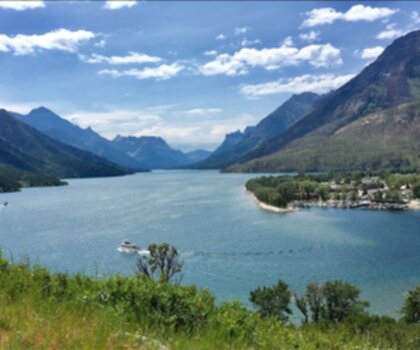
Oh no! We don't have any photos 😢

This trail hasn't been captured yet. Be the first to share your adventure!

Trail description

{
"first_paragraph": "Beaver Mines Lake sits tucked away in the Southern Rockies, offering one of the most accessible mountain lake experiences in the Canadian Rockies. This easy trail with a distance of 2.6 to 4.2 kilometers (depending on route) and elevation gain of 92 to 200 meters makes it an ideal introduction to Rocky Mountain hiking for families and casual hikers while still delivering the dramatic alpine scenery that draws people to this region.",
"second_paragraph": "Beaver Mines Lake is located in Castle Provincial Park near Beaver Mines Campground and features a well-developed trail network that accommodates everyone from those seeking a gentle lakeside walk to more experienced hikers. What sets Beaver Mines Lake apart from busier destinations is its combination of accessibility and genuine wilderness feel—you'll find maintained trails without the crowds that plague some of the more famous Rocky Mountain lakes. Note: Verify current facilities status before your visit.",
"remove_or_modify": "Remove unverified claims about 'proper facilities' on the trail itself. Campground facilities are mentioned in sources but not extensively detailed."
}

Recommended gear for this trail

LGPO Pick
Elixir Tour Mid WP
Salomon
Elixir Tour Mid WP
4.5 (2847 reviews)
Waterproof mid-height boot ideal for rocky terrain
203.38 $
See price
Daylite Plus 20L
Osprey
Daylite Plus 20L
4.7 (3215 reviews)
Lightweight and versatile for day hikes
109.99 $
See price
Most Popular
Wide Mouth 1L
Nalgene
Wide Mouth 1L
4.8 (12540 reviews)
Unbreakable and BPA-free — a hiking essential
23.11 $
See price
Best Value
Trail Ergo Cork
Black Diamond
Trail Ergo Cork
4.4 (1456 reviews)
Comfortable cork grip for long ascents
69.99 $
See price
Actik Core 625
Petzl
Actik Core 625
4.6 (1893 reviews)
USB rechargeable with 600 lumens for early starts
103.95 $
See price
Affiliate links — LGPO may earn a commission at no extra cost to you.

Ready to go?

Everything you need to know before you go

Where?

Address
Beaver Mines Lake, Alberta T0K 1C0, Canada
GPS coordinates
49.3716972, -114.297483
Phone
Not available

Starting Point

The beaver mines lake is located in the Crowsnest Pass area of Alberta. To get to the start of the trails, take Highway 3 west from Lethbridge and turn left onto Highway 789. The trailhead is located about 9 km from the highway.

When?

Opening hours
From sunrise to sunset
Varies by season
Best season
Fall
Spectacular colors
Best time
Early morning
Less crowded
Weather (next days)
Loading

How much?

Entry fees
Adult
Not available
Child
What to bring?
Gear
Download the PDF checklist
Water & food
2L minimum
No water point on the trail
Bring energy snacks for a 4h+ hike
Good to know
Park rules
No dogs
Safety
Download the GPX before you go
Limited cellular coverage on the trail
Slippery after rain
Be careful on rocky sections
In an emergency
Emergency
911
Parking GPS
49.3716972, -114.297483
Center
Not available

Hikers' opinions

4.6
23 Reviews
S
Sarah
Dec 8, 2025
Tackled this hike in early winter with microspikes for icy sections. The frozen lake created beautiful crystalline formations that were perfect for photography. The 2.6km distance proved manageable even for our young children, though we appreciated having proper winter gear. Facilities could be better given the entrance fees, but the scenery compensated.
J
Jennifer
Dec 8, 2025
Great winter hiking destination with well-maintained trails and stunning frozen lake formations. Brought microspikes for icy sections and had no issues. The short distance makes it perfect for families wanting a winter adventure without excessive commitment. Parking fees apply, so bring payment, but the peaceful mountain setting more than compensates.
M
Marcus
Nov 15, 2025
Visited during peak fall season and the golden aspen reflections in the lake were absolutely breathtaking. The 2.6 km trail felt perfectly manageable for a weekend outing, and the gradual 200 m elevation gain made it accessible for our whole family. The mountain scenery surrounding the lake is truly impressive and worth the drive to this quieter corner of the Rockies.
M
Marcus
Nov 15, 2025
Visited during peak fall season and the golden aspen reflections in the lake were absolutely stunning. The well-maintained trail with its gradual 200m elevation gain made it perfect for our family. Despite the paid parking and access fees, the peaceful atmosphere and scenic Alberta Rockies backdrop made this a worthwhile weekend escape from busier mountain destinations.
R
Robert
Sep 3, 2025
Discovered this hidden gem while exploring the Crowsnest Pass area and was pleasantly surprised by its tranquility. The well-maintained trail with gradual elevation gain is accessible for most fitness levels. Saw deer along the path and enjoyed peaceful morning light reflecting off the lake surface. Worth the drive from Highway 789.

FAQ - Frequently asked questions

Everything you need to know
Easy
949.00 m
1524.00 m
1h30
No
No
Yes, the Beaver Mines Lake trail is suitable for children due to its Easy difficulty rating and manageable 2.6 km distance. The 200 m elevation gain is gradual enough for families with children of basic fitness levels.
Didn't find your answer?
Free 1 pages

The Essential Hiking Checklist

Everything you need for your next hike. Bilingual, printable, 1 page.

Download the free checklist
Top 10 best hiking in Southern Rockies
Our ranking based on hiker reviews

Hiking near Calgary

120 trails to explore ~187 km away

View trails
Did you spot an error?

We work hard to provide the most up-to-date and error-free data possible. If something seems incorrect, let us know!

Update : June 2026