

Ready to explore Waterton Lakes National Park of Canada? Here's everything you need to know before you go!
Discover the trail


Trail description
Trail Network
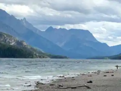
Waterton's trail system covers over 200 kilometers, ranging from flat, wheelchair-accessible lakeside paths to serious backcountry routes that demand full-day commitments and solid fitness. The network is well-maintained and clearly signed, which makes navigation straightforward even on longer routes. With over 200 kilometers of trails spread across the park and varying elevation gains on the more demanding routes, there's genuine variety here for hikers at every level.
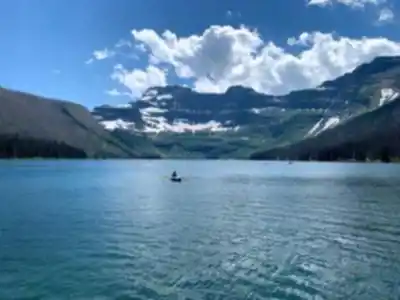
The Crypt Lake Trail is the park's signature hike and consistently ranks among the best day hikes in Canada. The experience starts with a boat ride across Upper Waterton Lake, then climbs steeply through multiple ecosystems before requiring hikers to crawl through a natural rock tunnel and traverse a narrow ledge with a fixed steel cable for support. The destination — Crypt Lake, enclosed by sheer cliffs and fed by waterfalls — justifies every bit of the effort.
The Carthew-Alderson Trail is another standout, a point-to-point route spanning 18 to 20 km that crosses high alpine terrain with sweeping views of multiple mountain ranges. It's one of the best ways to experience the park's upper elevations without committing to technical scrambling. The Lineham Ridge Trail delivers some of the finest wildflower displays in the park during July and August, while Vimy Peak rewards summit-seekers with 360-degree views that extend well into Montana and British Columbia.
For moderate options, the Bertha Lake Trail climbs through montane forest to a beautiful alpine lake with good swimming on warm days. Around Cameron Lake, the lakeshore path offers easy walking with strong mountain reflections, and the Akamina Pass Trail provides a manageable climb through subalpine forest to views of the Continental Divide.
Recommended gear for this trail


Ready to go?
Everything you need to know before you goStarting Point
The easiest way to get to the start of the trails at the waterton lakes national park of canada is to drive there.
When?
How much?
- Hiking shoes Essential
- → Salomon Elixir Tour Mid WP · 203.38 $
- Layered clothing Essential
- Rain jacket Essential
- Trekking poles
- → Black Diamond Trail Ergo Cork · 69.99 $
- Headlamp
- → Petzl Actik Core 625 · 103.95 $
FAQ - Frequently asked questions
Everything you need to knowThe Essential Hiking Checklist
Everything you need for your next hike. Bilingual, printable, 1 page.
Download the free checklistSimilar hikes nearby
Discover other trails you might enjoy

Crypt Lake Trail
Southern Rockies

Lundbreck Falls
Southern Rockies

Castle Mountain Resort
Southern Rockies
Blakiston Falls
Southern Rockies
Lower Bertha Falls
Southern Rockies
Crowsnest Mountain
Southern Rockies
Hiking near Calgary
120 trails to explore ~218 km away
We work hard to provide the most up-to-date and error-free data possible. If something seems incorrect, let us know! Your contribution helps the whole community.
Hikers' opinions