

Ready to explore Lower Bertha Falls? Here's everything you need to know before you go!
Discover the trail
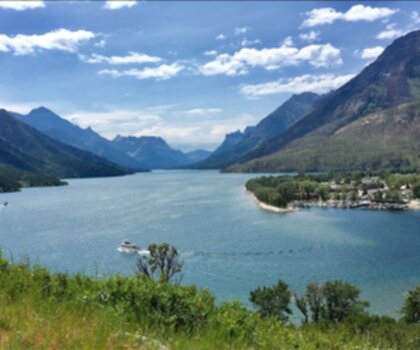
Oh no! We don't have any photos 😢
This trail hasn't been captured yet. Be the first to share your adventure!Trail description
Description
Lower Bertha Falls sits tucked into the heart of Waterton Lakes National Park, offering one of the most rewarding short hikes in the Canadian Rockies. This stunning waterfall is the first major destination along the Bertha Lake Trail system, making it a perfect choice for hikers who want a genuine taste of the Rockies' dramatic scenery without committing to a full-day adventure.
The trailhead starts conveniently near the Waterton townsite, so there's no lengthy drive on mountain roads before you even lace up your boots. From the first steps, you're walking alongside Bertha Creek, and the constant sound of moving water sets the tone for the entire hike.
The Trail
At 1.2 kilometers with 150 meters of elevation gain, this is a short but satisfying out-and-back. The trail earns its easy rating honestly — the incline is steady and gradual rather than steep, and the path stays well-maintained throughout. Most hikers budget around two hours for the round trip, which leaves plenty of time to linger at the falls without feeling rushed.
The route moves through mixed forest right from the start, with aspen and lodgepole pine making up most of the canopy. In late spring and through summer, the understory fills in with wildflowers — Indian paintbrush, beargrass, and mountain asters are common sights along the way. Wooden bridges cross smaller tributaries, and boardwalks protect the softer, wetter sections of trail.
As you follow Bertha Creek upstream, the forest gradually shifts character and the sound of rushing water grows noticeably louder. The trail surface holds up well even after rain, though muddy patches are possible in spring or following a heavy downpour — waterproof footwear is worth it. About halfway along, the trees open up enough to reveal the surrounding peaks, with the layered sedimentary rock faces that define this part of the Canadian Rockies clearly visible. These natural rest stops double as some of the best photography spots on the trail.
The Falls
You'll hear Lower Bertha Falls before you see it. The roar builds steadily through the trees, and when the waterfall finally comes into view, it delivers. Water drops down a series of rocky ledges in multiple tiers before pooling at the base in clear, cold water. The scale is genuinely impressive for such a short approach.
Spring runoff and post-rain conditions bring the falls to their most powerful — the volume of water creates a thunderous, mist-heavy display that you feel as much as hear. Later in summer, the flow settles down, which actually makes it easier to appreciate the rock formations behind the cascade. Either way, the falls hold their appeal across the season.
The viewing area at the base gives you several angles to work with, whether you're shooting photos or just taking it in. Large boulders provide natural seating, and the mist keeps things noticeably cooler — a welcome detail on a warm summer afternoon. It's a natural spot to stop for a snack or a proper lunch before heading back.
Going Further
Lower Bertha Falls works well as a standalone destination, but the trail doesn't end here. The route continues toward Upper Bertha Falls and eventually Bertha Lake, both of which add significant distance and elevation to the day. If you're considering pushing on, use the lower falls as a checkpoint — assess your energy, your remaining daylight, and your group's condition before committing to the extended route. What starts as an easy half-day hike becomes a serious full-day effort once you continue past this point.
Planning Your Visit
The trail typically opens by late May or early June depending on snowpack, and stays accessible through October. Summer is the busiest period, so an early morning start helps you get ahead of the crowds and catch better light for photography. Waterton's weather moves fast — even on a clear morning, conditions can shift by afternoon, so pack a rain jacket and an extra layer regardless of the forecast.
Bring plenty of water, trail snacks, and footwear with solid traction. Wildlife is active throughout the area, including black bears and mountain goats. Make noise on the trail, especially around blind corners, and follow proper food storage protocols. Pack out everything you bring in.
Because the trailhead is right next to the Waterton townsite, this hike fits naturally into a broader day of exploring the park — it's easy to pair with other activities in the area without needing to move your base.
Recommended gear for this trail


Ready to go?
Everything you need to know before you goStarting Point
The lower bertha falls are located in Alberta, Canada. To get to the start of the trails, take Highway 40 east from Calgary to the Kananaskis Village turnoff. Take the exit and drive south for about 5 km until you reach the signed parking area for the falls.
When?
How much?
- Hiking shoes Essential
- → Salomon Elixir Tour Mid WP · 203.38 $
- Layered clothing Essential
- Rain jacket Essential
- Trekking poles
- → Black Diamond Trail Ergo Cork · 69.99 $
- Headlamp
- → Petzl Actik Core 625 · 103.95 $
FAQ - Frequently asked questions
Everything you need to knowThe Essential Hiking Checklist
Everything you need for your next hike. Bilingual, printable, 1 page.
Download the free checklistSimilar hikes nearby
Discover other trails you might enjoy

Crypt Lake Trail
Southern Rockies
Waterton Lakes National Park of Canada
Southern Rockies

Lundbreck Falls
Southern Rockies

Castle Mountain Resort
Southern Rockies
Blakiston Falls
Southern Rockies
Crowsnest Mountain
Southern Rockies
Hiking near Calgary
120 trails to explore ~224 km away
We work hard to provide the most up-to-date and error-free data possible. If something seems incorrect, let us know! Your contribution helps the whole community.
Hikers' opinions