

Ready to explore Les Sentiers De L'estrie? Here's everything you need to know before you go!
Discover the trail

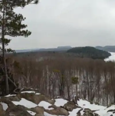
Trail description
Route details (for a challenging outing)
If you're looking for a tough day, one option within Les Sentiers de l'Estrie is a 21 km hike with about 737 m of elevation gain. It's rated very hard, with an estimated duration of 4.5 to 5 hours. This kind of route is best approached as a serious effort: expect sustained movement, sections that demand attention to footing, and a pace that may vary depending on the terrain and how often you stop to take in viewpoints.
Services and amenities
This information may vary by season.
Recommended gear for this trail


Ready to go?
Everything you need to know before you goStarting Point
The trails are divided into 12 distinct areas: maps are available to order and on site to discover the starting points of each trail you are interested in.
When?
How much?
- Hiking shoes Essential
- → Salomon Elixir Tour Mid WP · 203.38 $
- Layered clothing Essential
- Rain jacket Essential
- Trekking poles
- → Black Diamond Trail Ergo Cork · 69.99 $
- Headlamp
- → Petzl Actik Core 625 · 103.95 $
FAQ - Frequently asked questions
Everything you need to knowThe Essential Hiking Checklist
Everything you need for your next hike. Bilingual, printable, 1 page.
Download the free checklistSimilar hikes nearby
Discover other trails you might enjoy

Mount Brome (Bromont)
Eastern Townships

Mont Pinacle
Eastern Townships

Sutton Natural Environment Park
Eastern Townships

Parc De La Gorge De Coaticook
Eastern Townships

Mount Orford National Park
Eastern Townships

Parc national de Frontenac
Eastern Townships
Hiking near Sherbrooke
53 trails to explore ~9 km away
We work hard to provide the most up-to-date and error-free data possible. If something seems incorrect, let us know! Your contribution helps the whole community.
Hikers' opinions
Be the first to review!
No hiker has shared their experience yet. Share your impressions and help other hikers!