

Ready to explore Domaine du Radar? Here's everything you need to know before you go!
Discover the trail


Available trails
| Trails | Distance | Elevation | Duration | Difficulty | GPX |
|---|---|---|---|---|---|
| 5.6 km | 200 m | 1h30 | Intermediate |
Trail description
Description
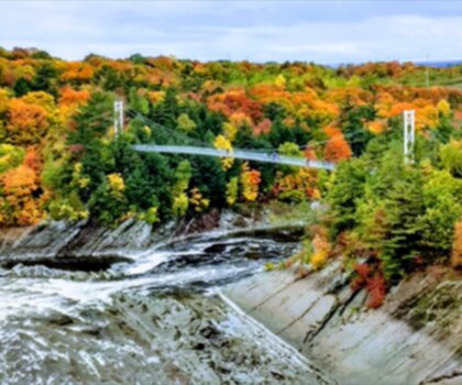
Domaine du Radar is a quieter, lesser-known outdoor spot in the Chaudière-Appalaches region that feels like a true change of scenery without being far from the city. Set on the grounds of a former military radar station, it mixes forest hiking with wide-open viewpoints and a bit of Cold War history, all in one place. It works well for experienced hikers who want a solid outing, and it’s also approachable for anyone looking to spend a few hours outside and get back into the rhythm of being on trail.
Where it is and why people come here
One of the big advantages of Domaine du Radar is how easy it is to reach: it’s located just a short drive from Quebec City, which makes it realistic for a day trip but also tempting for a longer stay if you want to slow down. The setting is classic Chaudière-Appalaches—forested terrain, rolling hills, and a landscape that opens up dramatically as you gain elevation. That contrast between sheltered woods and open panoramas is a big part of what makes the trails here memorable.
The site’s identity is tied to its past: this was once a radar station built for military use during the Cold War era. Today, the same high ground that made it useful for surveillance is what makes it appealing for hikers—elevation, wind, and long sightlines over the surrounding hills and valleys.
Trail network and on-the-ground experience
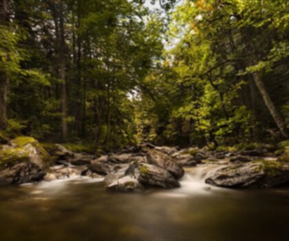
Domaine du Radar has over 15 kilometers of well-maintained hiking trails. “Well-maintained” matters here because it means you can focus on the hike itself: following clear routes through forest, settling into a steady climb, and stopping when the scenery changes rather than constantly worrying about rough footing or confusing junctions. The trails wind through lush forest, so much of your walk is in the trees, with that typical quiet you get when the canopy closes in and the ground is soft underfoot.
As you move along the network, expect a mix of natural highlights and the occasional reminder that this was once a working military site. That variety keeps the hike interesting: you’re not just walking a straight forest path—you’re moving through a place with layers, where nature has reclaimed the area but the story is still visible if you’re paying attention.
The summit viewpoint
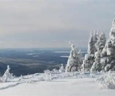
The signature moment at Domaine du Radar is reaching the summit, which sits at 710 meters above sea level. This is where the experience shifts from forest immersion to open views. From the top, the reward is panoramic: the scenery stretches over the rolling hills and valleys of Chaudière-Appalaches, with the kind of long, sweeping sightlines that make you want to pause rather than rush back down.
This summit area is a natural place to take a longer break. It’s a good spot to slow your pace, snack, drink water, and take photos—especially if you’ve been moving through the trees for most of the ascent. The existing landscape lends itself well to a simple picnic with friends or family, with the viewpoint providing the “backdrop” without needing any extra effort beyond getting up there.
Nature, wildlife, and photography
Even though the summit gets most of the attention, the forest sections are a big part of the appeal. Along the trails you’ll encounter diverse flora and fauna native to the region. The wooded terrain and the transition between sheltered forest and more open, elevated areas can create good opportunities for wildlife observation if you keep your pace reasonable and take your time in quieter stretches.
For photographers, Domaine du Radar tends to deliver two very different styles of shots on the same outing: close, textured forest scenes (greens, mossy ground, tree trunks, and filtered light) and then the big, open panoramic frames at the summit. If you’re visiting specifically to take photos, it’s worth budgeting time for both—don’t save all your stops for the top.
History on the trail
The former radar station backstory isn’t just something you read about afterward—it’s part of the visit. Domaine du Radar includes informative panels placed along the trails that explain its historical significance and how the site was repurposed from a Cold War-era radar station into a recreational destination. These small pauses add context without turning the hike into a museum visit, and they give you a better sense of why the area looks the way it does.
If you’re hiking with people who like to know “what this place used to be,” the panels are an easy way to keep everyone engaged, especially on the uphill portions where brief stops can be welcome.
Other activities and seasonal options
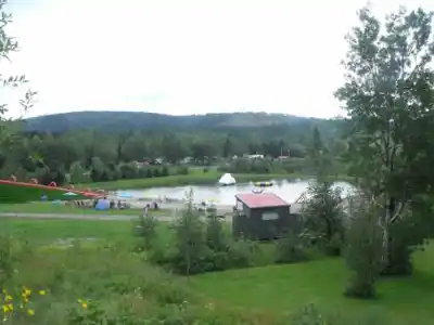
Hiking is the main draw, but the site isn’t limited to summer trails. Domaine du Radar also supports other outdoor activities, including mountain biking. That makes it a good pick for groups where not everyone wants to do the exact same thing, or for visitors who like to return to the same place in different seasons.
In winter, the area shifts into a snow season destination, with snowshoeing as an option. The same forest corridors that feel shaded and cool in warm weather become quieter and more insulated under snow, and the climbs to viewpoints feel like a different kind of effort—slower, steadier, and more about traction and pacing.
Staying longer
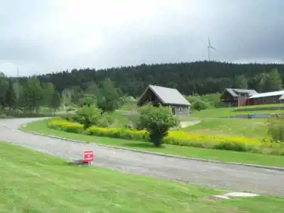
If you don’t want to squeeze everything into a single day, Domaine du Radar offers rustic accommodations. Having a place to stay on-site changes the feel of the visit: you can hike without watching the clock, spend more time at the summit when the views are best, and get out for a shorter walk or a second loop later on. It’s also an easy way to get a bit more quiet time in nature, since you’re not immediately transitioning from trail to highway to city.
The overall vibe here is about slowing down and spending time outside—enough infrastructure to make the visit comfortable, but still focused on the landscape and the trails.
What to expect from the hike
Whether you’re coming for a straightforward hike or to explore the broader trail network, Domaine du Radar is the kind of place where the experience builds as you go: forest first, then bigger terrain, then the summit payoff. The moderate effort of gaining height is balanced by frequent reasons to stop—wildlife and plant life along the way, historical panels that add context, and changing views as you move through the landscape. Plan to bring what you’d normally want for a half-day outdoors: comfortable hiking footwear, water, and layers that let you handle breezier conditions at higher elevation.
With its mix of well-kept trails, native wildlife, summit panoramas, and Cold War-era history, Domaine du Radar stands out in Chaudière-Appalaches as a place where a simple hike turns into a more varied day outside.
Services and amenities
This information may vary by season.
Recommended gear for this trail


Ready to go?
Everything you need to know before you goStarting Point
To access the hiking trails, head to the main parking lot located at 50 Rang Sainte-Catherine, Saint-Sylvestre, QC G0S 3C0. This is the primary starting point for the trails in the area.
When?
Tuesday: 9:00 AM – 7:00 PM
Wednesday: 9:00 AM – 7:00 PM
Thursday: 9:00 AM – 7:00 PM
Friday: 9:00 AM – 7:00 PM
Saturday: 9:00 AM – 7:00 PM
Sunday: 9:00 AM – 5:00 PM
How much?
- Hiking shoes Essential
- → Salomon Elixir Tour Mid WP · 203.38 $
- Layered clothing Essential
- Rain jacket Essential
- Trekking poles
- → Black Diamond Trail Ergo Cork · 69.99 $
- Headlamp
- → Petzl Actik Core 625 · 103.95 $
FAQ - Frequently asked questions
Everything you need to knowTuesday: 9:00 AM – 7:00 PM
Wednesday: 9:00 AM – 7:00 PM
Thursday: 9:00 AM – 7:00 PM
Friday: 9:00 AM – 7:00 PM
Saturday: 9:00 AM – 7:00 PM
Sunday: 9:00 AM – 5:00 PM
The Essential Hiking Checklist
Everything you need for your next hike. Bilingual, printable, 1 page.
Download the free checklistSimilar hikes nearby
Discover other trails you might enjoy

Auberge des Glacis
Chaudière-Appalaches
Parc régional du Massif du Sud
Chaudière-Appalaches
Parc Des Chutes-de-la-chaudière
Chaudière-Appalaches

Domaine Joly-De Lotbinière
Chaudière-Appalaches

Zec JARO
Chaudière-Appalaches

Parc Régional Des Appalaches
Chaudière-Appalaches
Hiking near Quebec City
40 trails to explore ~54 km away
We work hard to provide the most up-to-date and error-free data possible. If something seems incorrect, let us know! Your contribution helps the whole community.
Hikers' opinions