


Ready to explore Parc des Chutes-De-La-Chaudières? Here's everything you need to know before you go!
Discover the trail


Photos: Cephas — CC BY-SA (Wikimedia Commons) Sonia V — Google Maps (Google Maps)
Available trails
| TrailTrails | Dist.Distance | GainElevation | TimeDuration | Difficulty | GPX |
|---|---|---|---|---|---|
|
Beginner
|
0.8 km | — | 15min | Beginner | |
|
Beginner
|
0.4 km | — | 15min | Beginner | |
|
Beginner
|
0.6 km | — | 15min | Beginner | |
|
Intermediate
|
0.4 km | — | 15min | Intermediate | |
|
Intermediate
|
2 km | — | 27min | Intermediate |
Trail description
Parc Des Chutes-de-la-chaudière offers an easy 4.3 km walk in the Chaudière-Appalaches region, perfect for anyone looking for a relaxed outdoor experience without major physical demands. With just 35 m of elevation gain spread across the route, this trail delivers the satisfaction of a proper hike while remaining accessible to most fitness levels and age groups.
The hiking experience
This trail feels more like an extended nature walk than a challenging hike, which is exactly what makes it appealing. The minimal elevation change means you can focus on your surroundings rather than watching your footing on steep sections or managing your breathing on long climbs. The pace naturally stays conversational, making it ideal for catching up with friends or introducing kids to hiking without the pressure of difficult terrain.
The 35 m of elevation gain is so gradual you'll barely notice it. Any small rises feel brief and manageable, never sustained enough to change the overall character of the walk. This predictable effort level makes planning easy—you know what you're getting into, and there won't be any surprise challenges that suddenly make the outing more demanding than expected.
At 4.3 km, the distance gives you enough time to settle into a walking rhythm and feel like you've accomplished something meaningful, but it's not so long that it dominates your entire day. Most people find this length hits a sweet spot where you get the mental benefits of time outdoors without needing to commit to an all-day adventure.
What sets this trail apart in Chaudière-Appalaches
The Chaudière-Appalaches region offers everything from gentle riverside paths to serious mountain climbs, and this trail represents the accessible end of that spectrum perfectly. While the region is known for its more challenging terrain in places, Parc Des Chutes-de-la-chaudière proves that you don't need steep climbs or technical sections to have a rewarding outdoor experience.
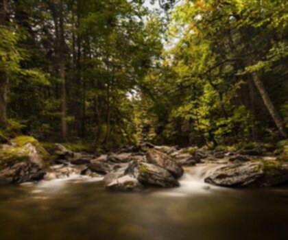
The park's main draw is clearly its waterfalls, which give the location its name and character. Having a specific natural feature as the focal point makes this more than just a generic walk in the woods—there's a clear reason to be here beyond just getting exercise. The falls provide natural stopping points and photo opportunities that break up the walk in a meaningful way.
For visitors exploring the broader region, this trail offers a perfect complement to other activities. You can easily fit it into a day that includes driving between towns, visiting local attractions, or simply taking your time to explore the area without feeling rushed.
Trail conditions and terrain
The easy rating reflects both the gentle elevation profile and the generally well-maintained trail conditions you can expect. The path doesn't require specialized hiking boots or technical gear—comfortable walking shoes that you'd wear for a long walk in town will handle this terrain just fine.
Because the elevation gain is so minimal, you won't encounter the rocky scrambles, root-covered climbs, or loose gravel descents that characterize more challenging trails. The footing stays predictable throughout, which means you can look around and enjoy the scenery rather than constantly watching where you step.
Weather conditions affect this trail less dramatically than they would a more exposed or steep route. While you should always check conditions before heading out, the protected nature of most park trails means you're less likely to encounter the kind of exposure that makes easy trails suddenly difficult.
Planning your visit
The estimated 1 hour and 15 minutes gives you a realistic timeframe that includes a comfortable walking pace and a few stops along the way. This timing assumes you'll pause to look at the waterfalls, take some photos, and generally move at a relaxed pace rather than treating it as a fitness walk.
If you're hiking with children or anyone who likes to take frequent breaks, plan for closer to 1.5 to 2 hours. The beauty of an easy trail like this is that there's no pressure to maintain a specific pace—you can stop whenever something catches your interest without worrying about losing daylight or energy for the return trip.
The short distance and low elevation gain mean you can be flexible with your gear. You'll still want water and weather-appropriate clothing, but you don't need to pack as if you're heading into the backcountry. A small daypack with essentials will cover everything you need for this outing.
Who will enjoy this trail most
This trail works particularly well for people who want the experience of hiking without the physical challenge. If you're new to hiking and want to build confidence on easier terrain before tackling more demanding routes, this provides an excellent introduction to trail hiking basics.
Families with children will find the distance and difficulty level manageable for most ages. The waterfalls provide natural entertainment and rest stops that help break up the walk for shorter attention spans. The predictable terrain means parents can relax a bit rather than constantly worrying about safety on steep or technical sections.
For experienced hikers, this trail offers a nice change of pace when you want to enjoy the outdoors without the physical commitment of a challenging route. It's perfect for recovery days, casual outings with less experienced friends, or times when you want to focus on conversation and scenery rather than the physical effort of hiking.
Making the most of your time here
The waterfalls that give the park its name are obviously the main attraction, so plan to spend some time at the viewpoints rather than just walking past. These natural features provide the best photo opportunities and the most compelling reasons to pause during your hike.
Because the trail doesn't demand constant attention to footing or navigation, you can focus on smaller details that might get overlooked on more challenging hikes. This is a good place to practice identifying plants, listening to bird calls, or simply enjoying the meditative aspects of walking in nature.
The easy nature of this trail makes it ideal for testing new gear, breaking in new hiking shoes, or trying out a new daypack without the consequences that come with equipment failures on more remote or difficult routes.
Services and amenities
This information may vary by season.
The Essential Hiking Checklist
Everything you need for your next hike. Bilingual, printable, 1 page.
Get your free hiking checklistRecommended gear for this trail
As an Amazon Associate I earn from qualifying purchases.


Ready to go?
Everything you need to know before you goWhen?
Tuesday: 5:00 AM – 11:00 PM
Wednesday: 5:00 AM – 11:00 PM
Thursday: 5:00 AM – 11:00 PM
Friday: 5:00 AM – 11:00 PM
Saturday: 5:00 AM – 11:00 PM
Sunday: 5:00 AM – 11:00 PM
How much?
As an Amazon Associate I earn from qualifying purchases.
Affiliate links — LGPO may earn a commission at no extra cost to you.
- Hiking shoes Essential
- → Salomon Elixir Tour Mid WP · 203.38 $
- Layered clothing Essential
- Rain jacket Essential
- Trekking poles
- → Black Diamond Trail Ergo Cork · 69.99 $
- Headlamp
- → Petzl Actik Core 625 · 103.95 $
FAQ - Frequently asked questions
Everything you need to knowSimilar hikes nearby
Discover other trails you might enjoy

Auberge des Glacis
Chaudière-Appalaches
Parc régional du Massif du Sud
Chaudière-Appalaches

Domaine Joly-De Lotbinière
Chaudière-Appalaches

Domaine du Radar
Chaudière-Appalaches

Mont Chocolat
Chaudière-Appalaches

Mont Orignal
Chaudière-Appalaches
Hiking near Quebec City
40 trails to explore ~12 km away
We work hard to provide the most up-to-date and error-free data possible. If something seems incorrect, let us know! Your contribution helps the whole community.
Hikers' opinions
Be the first to review!
No hiker has shared their experience yet. Share your impressions and help other hikers!