
Ready to explore Promenade Samuel-De Champlain? Here's everything you need to know before you go!
Discover the trail
Available trails
| TrailTrails | Dist.Distance | GainElevation | Difficulty | GPX |
|---|---|---|---|---|
|
|
6.8 km | — |
Trail description
The route
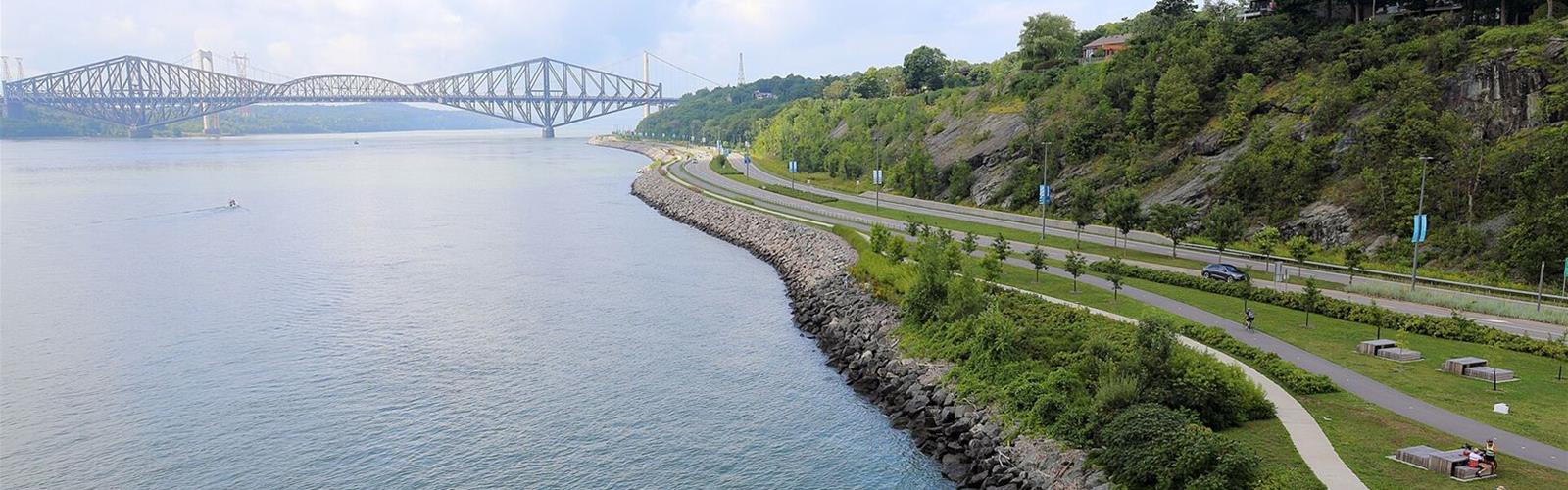
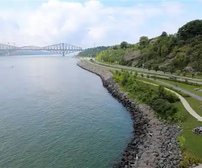
The promenade runs for nearly 6.8 km along the St. Lawrence River, from the bridges to the côte Gilmour area, according to the Commission de la capitale nationale du Québec (CCNQ). The City of Québec places it on boulevard Champlain, between the Pierre-Laporte Bridge and côte Gilmour.
The CCNQ built it in three phases: a 2.5 km linear park from the Quai des Cageux to côte de Sillery, then a link between the Quai des Cageux and the sentier des Grèves, which continues to plage Jacques-Cartier, and finally 2.5 km from côte de Sillery to côte Gilmour. End to end, pedestrian paths, sidewalks and a bike path lead to the six stations.
The six stations
- Cageux (2795 boulevard Champlain): an observation tower more than 20 metres tall, a 280-metre riverside marsh, a services pavilion, a picnic area, a bike repair station (Biciborne) and 112 parking spaces.
- Quais: four themed gardens (Quai-des-Brumes, Quai-des-Flots, Quai-des-Hommes, Quai-des-Vents) and the contemporary art park.
- Sports: two soccer fields, a multi-purpose grassy play area, a services pavilion and limited parking.
- Côte (2200 côte de Sillery): at the foot of côte de Sillery, with the Frontenac wharf, an event area, a services pavilion and 154 parking spaces.
- Plage (1375 boulevard Champlain): an artificial sand beach, a swimming basin (maximum depth 1.2 m), a reflecting pool, a services pavilion with food service and 76 parking spaces.
- Voile (1331 boulevard Champlain): a large lawn with beach volleyball courts and a pétanque court, climbing blocks for children, a picnic area with charcoal barbecues, water access for canoes and kayaks (navigate at your own risk) and 145 parking spaces.
Art and scenery
The contemporary art park, at the Quais station, has 10 monumental sculptures, which the CCNQ says makes the site “the highest concentration of contemporary art in Québec.” Two more works stand at the Cageux and Voile stations.
Dogs, barbecues and alcohol
Dogs on a leash are welcome on the promenade, but only assistance animals are allowed at the Plage station. Barbecues are prohibited everywhere except the fixed barbecues at the Voile station, with no reservations. Alcohol is allowed only with a meal, except at the Plage station, where it is prohibited.
In winter
According to the City of Québec, the promenade is accessible year-round, and a multi-use path running from the Quai des Cageux to côte de Sillery is groomed in winter along the river.
Getting there
According to the CCNQ, bus route 400 of the Réseau de transport de la Capitale runs from May to September, every 30 minutes, between 8 a.m. and 8 p.m., on Saturdays, Sundays and holidays. The Flexibus service also serves the Champlain sector and connects to the bus network at the same fare as a bus trip.
Accessibility
According to the CCNQ, the Côte, Voile and Quais stations are accessible, and the Plage, Sports and Cageux stations are partially accessible.
Services and amenities
Services pavilions with public toilets (Cageux, Côte, Plage, Voile and Sports stations), picnic areas, a Biciborne bike repair station at the Cageux station, an observation tower, food service at the Plage station, and multi-purpose rooms for rent at the Cageux and Plage stations.
Everything you need for your next hike. Bilingual, printable, 1 page.
Get your free hiking checklistRecommended gear for this trail
As an Amazon Associate I earn from qualifying purchases.


Ready to go?
Everything you need to know before you goStarting Point
You can start at the Cageux station, 2795 boulevard Champlain, Québec (G1T 1X9): 112 parking spaces, a services pavilion with public toilets and the observation tower. The Côte (2200 côte de Sillery), Plage (1375 boulevard Champlain) and Voile (1331 boulevard Champlain) stations also have parking.
When?
Daily, 7 a.m. to 11 p.m., year-round (City of Québec). Opening of sports and recreation facilities depends on weather conditions.
How much?
As an Amazon Associate I earn from qualifying purchases.
Affiliate links — LGPO may earn a commission at no extra cost to you.
- Hiking shoes Essential
- → Salomon Elixir Tour Mid WP · 203.38 $
- Layered clothing Essential
- Rain jacket Essential
- Trekking poles
- → Black Diamond Trail Ergo Cork · 69.99 $
- Headlamp
- → Petzl Actik Core 625 · 103.95 $
FAQ - Frequently asked questions
Everything you need to knowOutings near Promenade Samuel-De Champlain
Discover other trails you might enjoy

Parc du Bois-de-Coulonge
Québec City Region · 4.3 km away
Parc des Chutes-De-La-Chaudières
Chaudière-Appalaches · 4.4 km away
Base Plein Air Sainte-Foy
Québec City Region · 5.7 km away

Parc des Champs-de-Bataille
Québec City Region · 6.5 km away
Domaine de Maizerets
Québec City Region · 9.9 km away
Parc Chauveau
Québec City Region · 10.3 km away
Hiking near Quebec City
47 trails to explore ~8 km away
We work hard to provide the most up-to-date and error-free data possible. If something seems incorrect, let us know! Your contribution helps the whole community.
Hikers' opinions
Be the first to review!
No hiker has shared their experience yet. Share your impressions and help other hikers!