

Ready to explore Lac de St Front? Here's everything you need to know before you go!
Discover the trail
Trail description
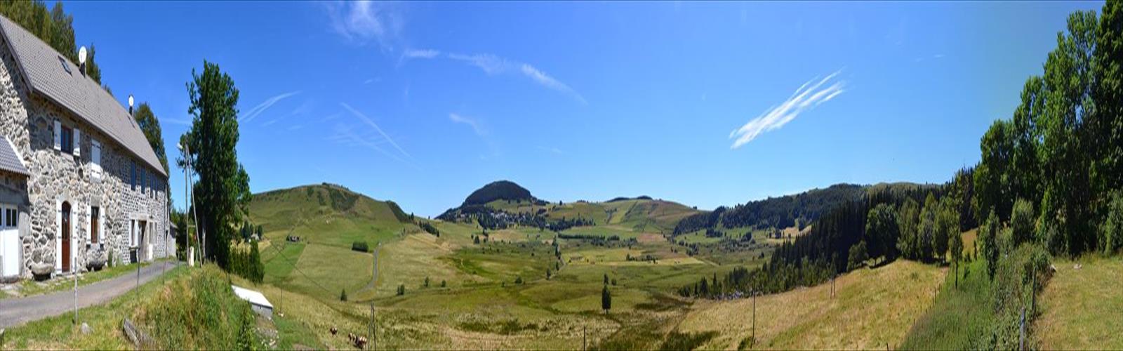
Lac de St Front sits nestled in the volcanic landscape of Haute-Loire, offering hikers a rewarding climb through the distinctive terrain that defines this corner of the Massif Central. The trail winds upward through a mix of forested slopes and open meadows, gaining 300 meters of elevation over an hour and a half of steady hiking as it approaches this serene mountain lake.
The hike begins in typical Haute-Loire fashion, with the path cutting through dense stands of beech and fir that characterize the region's mid-elevation forests. As you climb, the volcanic origins of this landscape become increasingly apparent. Dark basalt outcroppings punctuate the forest floor, and the soil beneath your boots carries that distinctive reddish tint common to volcanic regions. The steady ascent provides glimpses through the canopy of the rolling hills that stretch across this part of the Auvergne.
About halfway up, the forest begins to thin, giving way to the kind of high meadows that make Haute-Loire hiking so distinctive. Here, the trail opens up considerably, offering your first real views of the surrounding countryside. On clear days, you can make out the distant peaks of other volcanic formations that dot this ancient landscape. The contrast between the dark volcanic rock and the bright green of the mountain grasses creates a visual appeal that's uniquely characteristic of this region.
The Lake and Summit Area
Lac de St Front itself rewards the climb with the kind of pristine mountain setting that feels increasingly rare. The lake occupies a natural depression carved by ancient volcanic activity, its dark waters reflecting the surrounding slopes and sky. Unlike some of the more popular lakes in the region, St Front maintains a sense of solitude that appeals to hikers seeking a quieter mountain experience.
The shoreline varies from rocky volcanic outcrops to softer grassy areas where you can comfortably take a break. The water remains quite cold throughout most of the hiking season, fed by mountain springs and snowmelt. Wildlife around the lake includes the typical Haute-Loire mountain fauna – you might spot red deer tracks in the softer soil near the water's edge, and the area supports a healthy population of mountain birds including various raptors that hunt the open meadows.
The terrain around the lake offers several options for extending your visit. Rocky promontories provide elevated viewpoints over the water and back down the valley you've climbed. The volcanic geology creates interesting formations worth exploring, though the rock can be loose in places, so standard mountain caution applies.
Trail Conditions and Terrain
The path to Lac de St Front follows what appears to be an old pastoral route, likely used historically by local farmers moving livestock to high summer pastures. This heritage shows in the trail's generally good condition and logical routing up the mountainside. The surface varies from forest floor covered in leaves and pine needles to rocky sections where the underlying volcanic bedrock breaks through.
The 300-meter elevation gain is distributed fairly evenly throughout the climb, avoiding the steep, punishing sections that characterize some Haute-Loire hikes. This makes it accessible to hikers with moderate fitness levels, though the sustained nature of the climb still provides a solid workout. The trail maintains good definition throughout most of its length, though some sections through the upper meadows require basic route-finding skills when the path becomes less obvious in the grass.
Weather can change quickly at this elevation, particularly during spring and fall. The exposed nature of the upper meadows and lake area means hikers can experience significantly different conditions from what they encountered in the protected forest sections below. Summer thunderstorms are common in the afternoons, making early starts advisable during the warmer months.
What Makes This Hike Special
The beauty of Lac de St Front lies in its perfect representation of Haute-Loire's volcanic heritage. Every step of the climb tells the story of this region's fiery past, from the mineral-rich soil that supports such lush forest growth to the dramatic rock formations that frame the lake itself. The hike offers that rare combination of geological interest and natural beauty that makes the Massif Central such compelling hiking territory.
The relatively easy difficulty rating makes this an ideal introduction to Haute-Loire mountain hiking. You get all the essential elements – volcanic terrain, forest-to-meadow transitions, and a pristine mountain lake – without the technical challenges or extreme distances that can intimidate newer hikers. Yet the 300-meter climb and hour-and-a-half duration provide enough challenge to feel genuinely rewarding.
Seasonal Considerations
Spring brings wildflowers to the meadows and rushing water to the seasonal streams that cross the trail, but also mud and potentially lingering snow patches at the lake level. The volcanic soil holds moisture well, creating muddy conditions that can persist into late spring. Summer offers the most reliable weather and trail conditions, though the lack of shade in the upper sections can make midday hiking uncomfortable during heat waves.
Fall transforms the beech forests into the golden displays that make Haute-Loire autumn hiking so appealing, but shorter days and unpredictable weather require more careful planning. Winter conditions typically make the trail inaccessible to most hikers, with snow persisting at the lake elevation well into spring.
Practical Considerations
The trailhead area provides basic parking, though space can be limited during peak hiking periods in summer and early fall. The volcanic terrain means good hiking boots are essential – the rock can be slippery when wet, and the uneven surfaces require ankle support. Water sources along the trail are seasonal and should not be relied upon, particularly during dry summer periods.
The combination of forest and open terrain means layered clothing works best, allowing you to adjust as conditions change with elevation and exposure. The lake area can be significantly cooler and windier than the protected forest sections, even on warm days. Pack accordingly, and remember that the easy rating refers to technical difficulty rather than the need for proper mountain preparation.
The Essential Hiking Checklist
Everything you need for your next hike. Bilingual, printable, 1 page.
Get your free hiking checklistRecommended gear for this trail
As an Amazon Associate I earn from qualifying purchases.


Ready to go?
Everything you need to know before you goWhen?
How much?
As an Amazon Associate I earn from qualifying purchases.
Affiliate links — LGPO may earn a commission at no extra cost to you.
- Hiking shoes Essential
- → Salomon Elixir Tour Mid WP · 203.38 $
- Layered clothing Essential
- Rain jacket Essential
- Trekking poles
- → Black Diamond Trail Ergo Cork · 69.99 $
- Headlamp
- → Petzl Actik Core 625 · 103.95 $
FAQ - Frequently asked questions
Everything you need to knowHiking near Sydney
22 trails to explore ~4884 km away
We work hard to provide the most up-to-date and error-free data possible. If something seems incorrect, let us know! Your contribution helps the whole community.
Hikers' opinions
Be the first to review!
No hiker has shared their experience yet. Share your impressions and help other hikers!