

Ready to explore Belvedere du Cirque de Bone? Here's everything you need to know before you go!
Discover the trail
Oh no! We don't have any photos 😢
This trail hasn't been captured yet. Be the first to share your adventure!Trail description
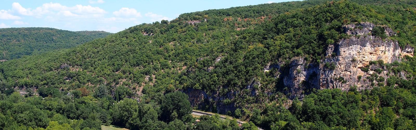
The Belvédère du Cirque de Bone is one of those places in Aveyron that earns its reputation the moment you arrive at the viewpoint. White limestone cliffs rise into a natural amphitheater, two medieval towers stand watch over the plain below, and somewhere in the cirque, circus artists are probably running through a rehearsal. It's an unusual combination — geology, medieval history, and contemporary performance art — and it works surprisingly well together.
The hike itself is approachable: 6 km round trip with 300 meters of elevation gain, rated easy, and typically done in about an hour and a half. That makes it a solid choice for families, casual hikers, or anyone who wants a rewarding viewpoint without committing to a full day on the trail.
The Cirque and Its Limestone Formations
The cirque is the defining feature here. Pale limestone walls curve around in a horseshoe shape, creating the natural amphitheater that gives the site its name. The white stone catches light differently throughout the day — sharp and bright at midday, warmer and more textured in the late afternoon — so the visual character of the place genuinely shifts depending on when you show up.
The rock itself provides decent footing on dry days, but it can get slippery when wet. That's worth keeping in mind if you're planning a visit after rain. The formations along the trail create natural rest spots and good photo angles as you gain elevation, so there's no need to push straight to the top without stopping.
The Medieval Towers
Two 12th-century towers are the most immediately recognizable landmarks at the Cirque de Bone. They were built to defend the nearby town of Bone against Saracen attacks during the medieval period, and their placement on this elevated site wasn't accidental — the position gave defenders a commanding view over the surrounding territory in every direction.
The towers are visible from a distance as you approach, which makes them useful for navigation and also gives you a sense of the site's scale before you arrive. After eight centuries, they've settled into the landscape in a way that feels natural rather than intrusive, their stone walls weathered to roughly the same tones as the surrounding limestone. The strategic logic that drove their construction is easy to appreciate once you're standing at the belvédère and looking out over the plain below.
Views from the Belvédère
The viewpoint delivers what the name promises. From the top, you get a wide panorama over the rolling countryside of Aveyron — villages tucked into valleys, hilltop ruins, agricultural fields spreading out in every direction. The 300-meter elevation gain is enough to give you a genuinely different perspective on the landscape, the kind that makes the geography of the region click into place in a way that ground-level travel doesn't.
The contrast between the white limestone of the cirque and the green fields below is one of the more striking visual elements of the view. On clear days, the horizon extends well beyond the immediate surroundings, and the open sky above the belvédère makes it a good spot for watching weather systems move across the landscape.
The Circus Artists
This is the detail that sets the Cirque de Bone apart from other viewpoints in the region. A community of circus artists has established workshops and dressing rooms within the cirque itself, and their presence adds a layer to the experience that's genuinely unexpected. The natural acoustics of the limestone amphitheater and the dramatic backdrop make it an obvious draw for performers, and the integration feels respectful rather than out of place.
Depending on when you visit, you might walk into an active rehearsal, a workshop in progress, or simply the evidence of recent activity. No two visits are quite the same, which gives the site a living quality that purely natural or historical sites sometimes lack.
The Hiking Experience
The trail winds through terrain that gradually opens up as you gain elevation. The limestone formations become more prominent as you climb, and the views start to expand before you reach the belvédère itself, so the ascent feels rewarding throughout rather than just at the end. The path follows natural contours and has likely been used for centuries by people heading to the same high ground for the same reasons — the view, the defensive advantage, the simple appeal of an elevated vantage point.
At 6 km and 300 meters of gain, the route is well within reach for most hikers. The easy difficulty rating reflects terrain that's manageable without technical skills or specialized gear, though appropriate footwear is always a good idea on limestone. The estimated 1h30 gives you enough time to move at a comfortable pace and stop along the way without feeling rushed.
Location and Access
The Cirque de Bone sits a short distance from the town of Bone in the heart of Aveyron, which makes logistics straightforward. The proximity to town means you can pair the hike with a meal or a look around the local area without much extra planning. The medieval towers are visible from multiple approach directions, so orienting yourself as you arrive is easy.
Aveyron is known for its limestone landscapes, and the Cirque de Bone fits naturally into that broader context — but the combination of geological drama, medieval architecture, and active artistic community gives it a character that's specific to this site rather than generic to the region.
A Few Practical Notes
- Distance: 6 km
- Elevation gain: 300 m
- Difficulty: Easy
- Estimated time: 1h30
- Footing: Limestone can be slippery when wet — check conditions before heading out
- Best light: Early morning or late afternoon for the most interesting angles on the white stone
- Nearby: The town of Bone is close enough to combine with the hike for food or additional exploration
The Belvédère du Cirque de Bone rewards the modest effort it takes to get there with a viewpoint that's genuinely distinctive — not just for the panorama, but for the layered experience of geology, history, and living culture that makes this particular spot in Aveyron worth seeking out.
The Essential Hiking Checklist
Everything you need for your next hike. Bilingual, printable, 1 page.
Get your free hiking checklistRecommended gear for this trail
As an Amazon Associate I earn from qualifying purchases.


Ready to go?
Everything you need to know before you goStarting Point
The Cirque de Bone Belvedere trailhead is located about 2 km from the village of Saint-Martin-de-Fugères, in the Occitanie region. To get there, just follow the D618 towards the village. After crossing this one, you must continue on the D618A and take on the right the small road that leads to the departure of the trails.
When?
How much?
As an Amazon Associate I earn from qualifying purchases.
Affiliate links — LGPO may earn a commission at no extra cost to you.
- Hiking shoes Essential
- → Salomon Elixir Tour Mid WP · 203.38 $
- Layered clothing Essential
- Rain jacket Essential
- Trekking poles
- → Black Diamond Trail Ergo Cork · 69.99 $
- Headlamp
- → Petzl Actik Core 625 · 103.95 $
FAQ - Frequently asked questions
Everything you need to knowHiking near Sydney
22 trails to explore ~4747 km away
We work hard to provide the most up-to-date and error-free data possible. If something seems incorrect, let us know! Your contribution helps the whole community.
Hikers' opinions
Be the first to review!
No hiker has shared their experience yet. Share your impressions and help other hikers!