
Ready to explore Shell Ridge, California? Here's everything you need to know before you go!
Discover the trail
Available trails
| TrailTrails | Dist.Distance | GainElevation | Est. timeEstimated time | Difficulty | GPX |
|---|---|---|---|---|---|
|
|
5.6 km | 93 m | ≈ 1h30 |
Trail description
The place
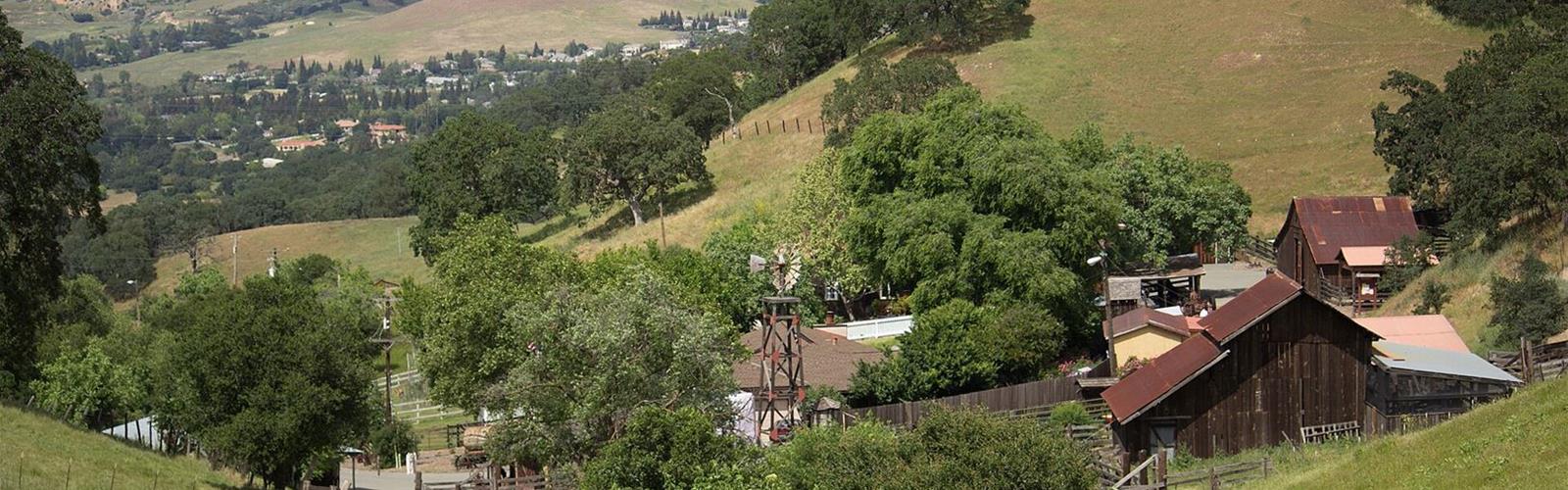
Shell Ridge is one of the four areas of Walnut Creek Open Space, alongside Lime Ridge, Acalanes Ridge and Sugarloaf. It is the largest, at 1,420 acres (about 575 hectares) with 31 miles (about 50 km) of trails, according to Wikipedia. The City of Walnut Creek bought and preserved the site with a bond issue its citizens authorized in 1974, according to the Old-Growth Forest Network.
The landscape
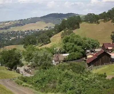
The setting is rolling hills of oak woodland and grassland, with blue oaks, valley oaks and coast live oaks, according to the Old-Growth Forest Network. Wikipedia also describes a ridge, foothills and rock outcroppings, and the site holds two historic sites, Old Borges Ranch and Howe Homestead Park. On the Deer Lake loop, Save Mount Diablo points out views of Mount Diablo and the Castle Rock cliffs, spring wildflowers, grinding holes in large rocks where acorns were ground, and rock formations that might even hold fossilized shells.
A documented loop: Deer Lake and the oak woodland
Save Mount Diablo describes a self-guided hike of 3.5 miles (5.6 km) with 304 feet (93 m) of elevation change. It starts at the Shell Ridge gate at the end of Marshall Drive, next to Indian Valley Elementary School. It passes Deer Lake and uses the Corral Springs, Costanoan, Upper Buck, Lower Buck and Deer Lake Loop trails, then returns to the gate on the Corral Springs Trail. The trails are mostly wide fire roads, with only a small stretch of single-track. Deer Lake was originally built as a fishing pond (a stock impoundment) by a local rancher named Ames. Save Mount Diablo gives no time or difficulty rating for this loop.
Entrances and parking
Several entrances are at the end of residential streets. The Walnut Creek Open Space Foundation asks visitors not to block driveways or crosswalks and never to park in an intersection. Among the entrances it lists for Shell Ridge:
- Marshall Drive: entrance at the end of the street, by Indian Valley School, reached from Homestead Avenue; Save Mount Diablo reports free parking on the side of the street;
- Borges Ranch: paved parking opposite the corral; several Shell Ridge trails start from the ranch;
- Howe Homestead Park: on Walnut Boulevard, drive through the intersection with Homestead Avenue and turn left into the parking lot (the lot's entrance is the second driveway, the exit the first);
- Sutherland Drive: parking lot at the end of the street;
- Bannister Lane: access from Livorna Road, parking at the Diablo Foothills Staging Area;
- Sunburst Court and Benham Court: street parking.
Good to know before you go
Save Mount Diablo warns that the loop's trails are very muddy and somewhat slippery in the wet season, that there are no restrooms on site, and that poison oak grows beside some trails, out of immediate reach. The group writes that spring is when Shell Ridge is at its best.
Other outings
The Walnut Creek Open Space Foundation also recommends the Fossil Hill Nature Trail and the Sugarloaf–Shell Ridge Trail (Young's Valley Road to Borges Ranch) at Shell Ridge. It does not list their length.
Services and amenities
Everything you need for your next hike. Bilingual, printable, 1 page.
Get your free hiking checklistRecommended gear for this trail
As an Amazon Associate I earn from qualifying purchases.


Ready to go?
Everything you need to know before you goStarting Point
Start of the documented loop: the Shell Ridge gate at the end of Marshall Drive, next to Indian Valley Elementary School, in Walnut Creek, California. Other entrances include Borges Ranch, Howe Homestead Park, Sutherland Drive and Bannister Lane.
When?
As an Amazon Associate I earn from qualifying purchases.
Affiliate links — LGPO may earn a commission at no extra cost to you.
- Hiking shoes Essential
- → Salomon Elixir Tour Mid WP · 203.38 $
- Layered clothing Essential
- Rain jacket Essential
- Trekking poles
- → Black Diamond Trail Ergo Cork · 69.99 $
- Headlamp
- → Petzl Actik Core 625 · 103.95 $
FAQ - Frequently asked questions
Everything you need to knowOutings near Shell Ridge, California
Discover other trails you might enjoy
Lafayette Ridge
Bay Area · 7.8 km away
Redwood Regional Park
Bay Area · 16.6 km away
Ring Mountain, California
Bay Area · 39.9 km away

Glen Canyon park
Bay Area · 40.5 km away
Hawk Hill, California
Bay Area · 41.9 km away
San Francisco Bay National Wildlife Refuge
45.2 km away
Hiking near Victoria
105 trails to explore ~1174 km away
We work hard to provide the most up-to-date and error-free data possible. If something seems incorrect, let us know! Your contribution helps the whole community.
Hikers' opinions
Be the first to review!
No hiker has shared their experience yet. Share your impressions and help other hikers!