
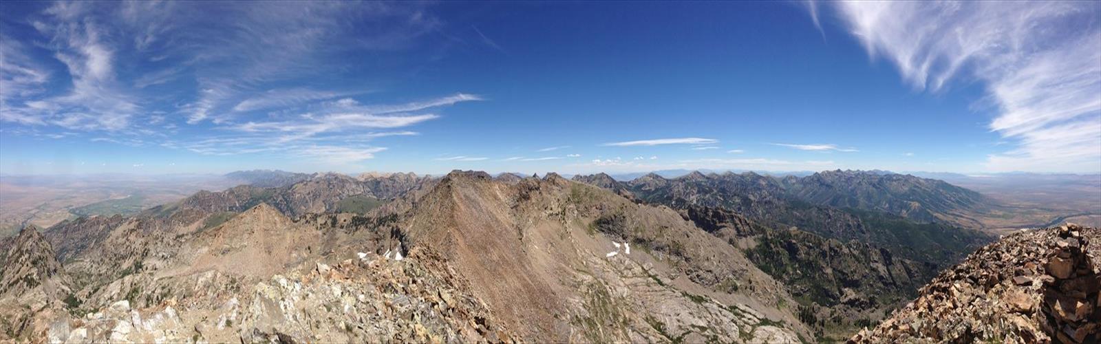

Ready to explore Mount Gilbert, Nevada? Here's everything you need to know before you go!
Discover the trail
Trail description
Mount Gilbert sits in the heart of the Ruby Mountains in northeastern Nevada — one of the most underrated alpine ranges in the entire American West. While most people associate Nevada with desert flats and casino lights, the Ruby Mountains tell a completely different story. Dramatic granite peaks, glacially carved cirques, and high-elevation terrain that genuinely earns the nickname "the Alps of Nevada." Mount Gilbert is one of the range's prominent summits, and climbing it is a serious objective that rewards those willing to put in the effort.
The Ruby Mountains
The Ruby Mountains rise sharply out of the Great Basin in Elko County, Nevada. The range runs roughly north to south and reaches elevations well above timberline, creating a landscape that feels completely out of place with the surrounding desert. Glaciation shaped much of the upper terrain here — you'll find classic alpine features like hanging valleys, tarns, and steep headwalls throughout the range. The Rubies are managed by the Humboldt-Toiyabe National Forest, and the Ruby Mountains Wilderness protects the core of the range.
Access to the range is limited to a handful of trailheads, which keeps the backcountry relatively quiet compared to more famous mountain ranges in the West. If you're looking for a genuine wilderness experience in Nevada, this is it.
Mount Gilbert
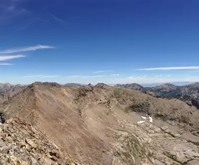
Mount Gilbert is one of the high points in the Ruby Mountains and a legitimate mountaineering objective. The peak demands route-finding ability, comfort on steep and loose terrain, and solid physical fitness. This isn't a maintained hiking trail leading to a summit — it's a climb in the truest sense of the word. Depending on your approach and the conditions you encounter, you may be dealing with talus fields, exposed ridgelines, and sections that require hands-on scrambling.
The terrain in the upper Ruby Mountains is rugged and unforgiving. The rock is primarily granite and quartzite, and while some sections offer solid holds, other areas are characterized by loose, fractured rock that demands careful foot placement. Moving efficiently and reading the terrain ahead of you matters here.
What to Expect on the Approach
Getting to the base of Mount Gilbert involves traveling through some of the most scenic terrain in the Ruby Mountains. The lower elevations feature meadows, willows along creek drainages, and stands of aspen and conifer. As you gain elevation, the vegetation thins out and the landscape opens up into classic alpine terrain — rocky slopes, patches of snow that can persist well into summer, and wide-open views across the Great Basin.
Route-finding is a real consideration. There are no signs pointing you toward the summit, and the terrain can look deceptively similar from multiple angles. A topographic map and the ability to use it confidently are essential. A GPS device is a smart backup, but don't rely on it exclusively in terrain like this.
The Climb
The upper mountain is where things get serious. Expect sustained steep terrain, and be prepared for the possibility of snow and ice depending on the time of year. Early season ascents may require an ice axe and crampons — the Ruby Mountains hold snow at elevation well into summer, and shaded couloirs can stay icy even when the surrounding terrain looks dry. Check conditions carefully before committing to a summit attempt.
The final push to the summit involves navigating exposed ridgeline terrain. The views from the top are expansive — the Ruby Valley stretches out to the east, and the layered ridgelines of the Great Basin extend in every direction. On a clear day, the sense of scale is remarkable. You're standing on one of the highest points in a range that most people driving through Nevada on Interstate 80 never even notice.
Practical Considerations
- Navigation skills are mandatory. This is not a marked trail. Bring a topo map and know how to use it. The Ruby Mountains Wilderness has limited signage, and the terrain can be confusing in poor visibility.
- Weather moves fast. Afternoon thunderstorms are a real hazard in the Ruby Mountains during summer. Start early, and be prepared to turn around if conditions deteriorate. Being on an exposed ridgeline or summit when lightning rolls in is not a situation you want to be in.
- Water sources exist in the lower terrain along creek drainages, but treat all backcountry water before drinking. Higher up, water becomes scarce — carry enough for the upper mountain.
- Leave No Trace principles apply throughout the Ruby Mountains Wilderness. Pack out everything you bring in. The low visitation that makes this range special is partly a result of people treating it with respect.
- Cell service is essentially nonexistent in the Ruby Mountains backcountry. Let someone know your plans and your expected return time before you head out.
- Wildlife is present throughout the range. The Ruby Mountains support populations of mule deer, mountain goats, and various raptors. Bear activity has been documented in the range — store food appropriately.
Getting There
The Ruby Mountains are accessed from the town of Elko, Nevada, which sits along Interstate 80. From Elko, several roads lead into the range, with Lamoille Canyon being the most well-known access point. Lamoille Canyon Road is paved and offers access to multiple trailheads within the Ruby Mountains Wilderness. The road is typically open from late spring through fall, but snow can close it outside of those months — verify current conditions before making the drive.
The trailhead facilities in the Ruby Mountains are basic. Expect vault toilets at the main trailheads and limited parking. Arrive early during peak season to secure a spot.
Who This Climb Is For
Mount Gilbert is best suited for experienced hikers and scramblers who are comfortable in off-trail alpine terrain. If your background is primarily on maintained trails, this is not the place to push your limits for the first time. The combination of route-finding demands, exposed terrain, loose rock, and potential snow and ice conditions means that solid mountain experience is genuinely necessary — not just recommended.
For those with the right background, Mount Gilbert offers a rewarding and relatively uncrowded alpine experience in a range that deserves far more attention than it typically gets.
The Essential Hiking Checklist
Everything you need for your next hike. Bilingual, printable, 1 page.
Get your free hiking checklistRecommended gear for this trail
As an Amazon Associate I earn from qualifying purchases.


Ready to go?
Everything you need to know before you goWhen?
How much?
As an Amazon Associate I earn from qualifying purchases.
Affiliate links — LGPO may earn a commission at no extra cost to you.
- Hiking shoes Essential
- → Salomon Elixir Tour Mid WP · 203.38 $
- Layered clothing Essential
- Rain jacket Essential
- Trekking poles
- → Black Diamond Trail Ergo Cork · 69.99 $
- Headlamp
- → Petzl Actik Core 625 · 103.95 $
FAQ - Frequently asked questions
Everything you need to knowSimilar hikes nearby
Discover other trails you might enjoy
Hiking near Victoria
93 trails to explore ~1070 km away
We work hard to provide the most up-to-date and error-free data possible. If something seems incorrect, let us know! Your contribution helps the whole community.
Hikers' opinions
Be the first to review!
No hiker has shared their experience yet. Share your impressions and help other hikers!