
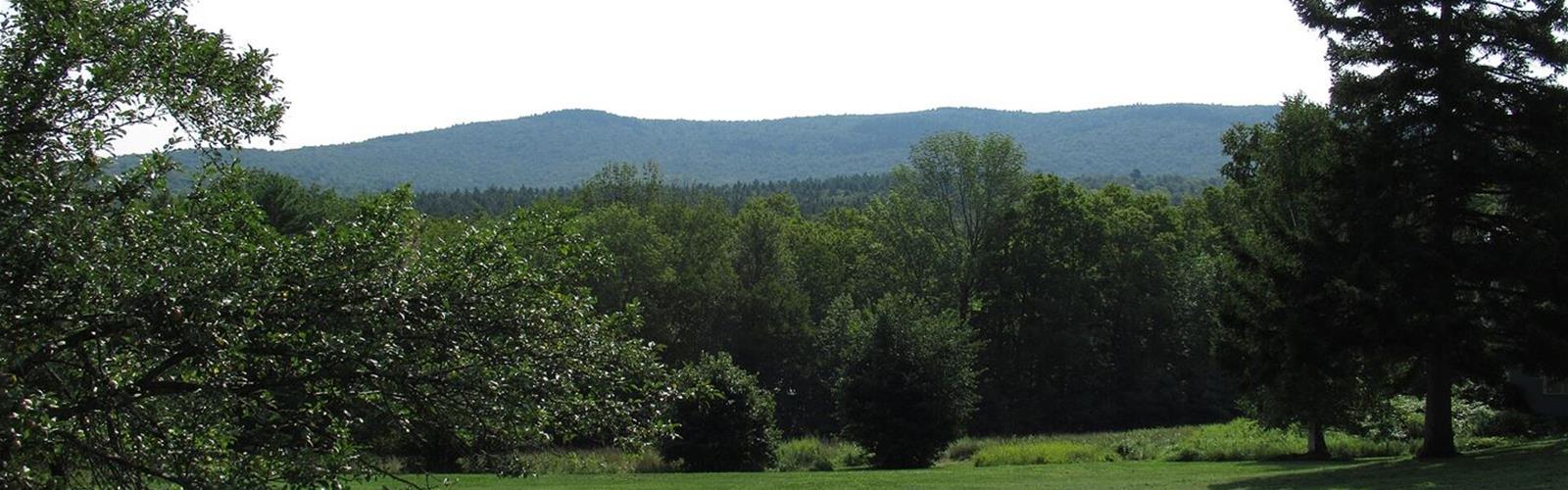
Ready to explore Moose Mountain, New Hampshire? Here's everything you need to know before you go!
Discover the trail
Available trails
| TrailTrails | Dist.Distance | GainElevation | Est. timeEstimated time | Difficulty | GPX |
|---|---|---|---|---|---|
|
Beginner
|
3.7 km | 158 m | ≈ 1h | Beginner | |
|
Beginner
|
2.1 km | 43 m | ≈ 32min | Beginner | |
|
Intermediate
|
6.4 km | 320 m | ≈ 2h | Intermediate |
Trail description
The ridge and its two summits
Moose Mountain stretches 8 miles (13 km) across the east side of the town of Hanover, in Grafton County. It has two summits, slightly over a mile (1.6 km) apart: North Peak, the higher, at 2,303 feet (702 m), and South Peak at 2,293 feet (699 m), according to Wikipedia. The maximum elevation listed for this trail, 702 m, is that of North Peak; the ridge loop described below climbs South Peak. The Hanover Conservancy's guide also gives 2,293 feet for South Peak, but its December 2021 map shows 2,222 feet: the sources disagree on that elevation.
According to the Town of Hanover, the Appalachian Trail climbs the west slope to South Peak, then follows the ridgeline north to North Peak and into the neighbouring town of Lyme. The Hanover Conservancy adds that it was rerouted onto the ridge in the 1980s and is blazed white. The old route, the Harris Trail, is still used in the loops below.
Three loops from Three Mile Road
These three routes are published by the Hanover Conservancy, a local land trust. All start from Three Mile Road. The guides date from 2018 to 2021. The General's Trail guide notes that some trail names were being updated in 2021, so check them against the Conservancy's map on site.
- Moose Mountain Ridge Loop: a 4-mile (6.4 km) loop with 1,050 feet (320 m) of elevation gain, 2 hours 45 minutes to 3 hours. The Conservancy calls it a moderately challenging mountain hike. It starts at the orange Dartmouth Outing Club sign, climbs to South Peak by the Harris Trail, the unblazed Ski Loop and the Nat Thompson Trail, follows the Appalachian Trail north to Wolfeboro Road (shelter visit optional), then comes down that road and the Harris Trail.
- General's Trail: an easy 2.3-mile (3.7 km) loop with 520 feet (158 m) of elevation gain, 1 hour 15 minutes. It is blazed orange, foot travel only, and was built in the early 1990s.
- Mink Brook & Harris Trail: an easy 1.3-mile (2.1 km) loop with 140 feet (43 m) of elevation gain, about 1 hour. It crosses Mink Brook on two bridges, follows the Harris Trail, then returns on the Appalachian Trail.
Moose Mountain Shelter
According to the U.S. Forest Service (White Mountain National Forest), this Adirondack-style shelter sits on the ridge, off a loop trail from the Appalachian Trail. It sleeps 8 and was built entirely by hand, without power tools, by the Dartmouth Outing Club, replacing an earlier shelter on the old Clark Pond Loop Trail. A privy and two overflow tent sites are on separate side paths off the loop trail. No fee is required. Potable water is not available; it only notes marginal water nearby.
From Wolfeboro Road, the Hanover Conservancy counts a 0.2-mile out-and-back (about 15 minutes) to the shelter. The Dartmouth Outing Club replaced the privy in 2021, according to the Appalachian Trail Conservancy.
Good to know before you go
- Dogs: welcome if under their owner's control, according to the Hanover Conservancy. Pick up after them.
- Hunting: allowed on the Appalachian Trail and on the land at the start and end of General's Trail, but not on the private land crossed by the southern half of that loop. The Conservancy recommends blaze orange from September 15 to December 15, dogs included.
- Bikes and permits: Dartmouth Cabin & Trail, which maintains the Appalachian Trail from Hanover, says bicycles are not allowed and no permit is required. It asks for groups of no more than 10 people overnight and 25 for a day trip.
- Winter: the Appalachian Trail parking just south of the dip in the road is not plowed. The Conservancy suggests poles and microspikes or snowshoes for the brook crossings.
- Wolfeboro Road: according to the Conservancy, jeep ruts and wet footing mark the start of the descent; according to the Town of Hanover, a section of this old Class VI road attracts all-terrain vehicles.
- Thunderstorms: the Conservancy's guide recommends the Appalachian Trail southbound, which leads straight back to Three Mile Road.
- Land: the ridge loop crosses federal land, Dartmouth College land and Shumway Forest, protected by a Hanover Conservancy easement since 2017.
Services and amenities
8-person shelter (Moose Mountain Shelter), a privy and two overflow tent sites on separate side paths off the access loop. No potable water.
Everything you need for your next hike. Bilingual, printable, 1 page.
Get your free hiking checklistRecommended gear for this trail
As an Amazon Associate I earn from qualifying purchases.


Ready to go?
Everything you need to know before you goStarting Point
From Etna village, turn right onto Ruddsboro Road and follow Mink Brook for 1.5 miles (2.4 km). Turn left onto Three Mile Road. After 1.4 miles (2.3 km), a big dip in the road has parking on both sides. The ridge loop starts at the orange Dartmouth Outing Club sign reading “Parking/No Camping.” General's Trail starts from the Appalachian Trail parking area, 1.2 miles (1.9 km) along Three Mile Road. From the north, the Appalachian Trail is reached by Goose Pond Road in Lyme.
When?
As an Amazon Associate I earn from qualifying purchases.
Affiliate links — LGPO may earn a commission at no extra cost to you.
- Hiking shoes Essential
- → Salomon Elixir Tour Mid WP · 203.38 $
- Layered clothing Essential
- Rain jacket Essential
- Trekking poles
- → Black Diamond Trail Ergo Cork · 69.99 $
- Headlamp
- → Petzl Actik Core 625 · 103.95 $
FAQ - Frequently asked questions
Everything you need to knowAlternatives and suggestions
Short on time or energy: the Mink Brook & Harris Trail loop (2.1 km, 140 feet of gain) or General's Trail (3.7 km, 520 feet of gain).
Outings near Moose Mountain, New Hampshire
Discover other trails you might enjoy

Moose Mountain Shelter
Dartmouth-Lake Sunapee · 1.1 km away

Appalachian National Scenic Trail
Dartmouth-Lake Sunapee · 2.8 km away

Boston Lot
Dartmouth-Lake Sunapee · 15.0 km away
Gile Mountain Trailhead
Connecticut River Valley · 17.4 km away
Cardigan Mountain State Park
Dartmouth-Lake Sunapee · 20.6 km away

Camp Moosilauke
Dartmouth-Lake Sunapee · 22.6 km away
Hiking near Montpelier
220 trails to explore ~68 km away
We work hard to provide the most up-to-date and error-free data possible. If something seems incorrect, let us know! Your contribution helps the whole community.
Hikers' opinions
Be the first to review!
No hiker has shared their experience yet. Share your impressions and help other hikers!