

Ready to explore Sentier Pédestre Grande Chute? Here's everything you need to know before you go!
Discover the trail
Trail description
Description
The Sentier Pédestre Grande Chute is a 9.5-kilometer trail in Abitibi-Témiscamingue that earns its name — the whole hike builds toward the Grande Chute waterfall, and it delivers. With only 100 meters of elevation gain spread across the route, this is a trail that just about anyone can tackle, whether you're introducing kids to longer hikes or simply looking for a rewarding half-day out in the boreal forest.
The Trail Itself
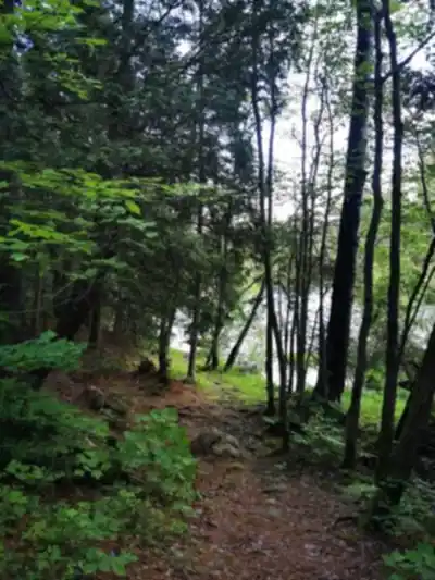
The path moves through dense mixed forest that's classic Abitibi-Témiscamingue — spruce, fir, and pine overhead, a soft forest floor underfoot, and that particular quiet you only get this far north. Trail markers are consistent throughout, so navigation is never a concern. The terrain shifts as you go: packed earth gives way to exposed Canadian Shield bedrock in places, and wooden boardwalks carry you over the wetter, low-lying sections without turning your boots into a mud project.
The 100 meters of elevation gain is gradual enough that you won't feel it as a climb so much as a gentle, steady progression through the landscape. Small clearings break up the forest canopy at intervals, giving you a chance to look out over the surrounding hills and take in just how much unbroken forest stretches in every direction. These spots are also where wildflowers tend to concentrate during the warmer months.
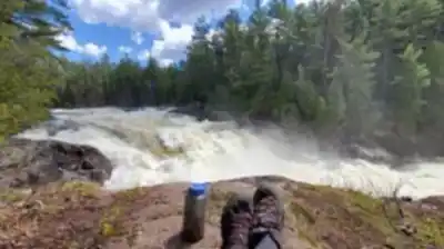
The Grande Chute Waterfall
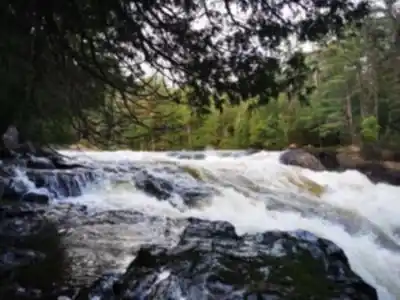
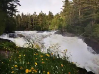
You'll hear it before you see it. The sound of the falls builds gradually as you approach, which does a good job of building anticipation. When the Grande Chute finally comes into view, it's a powerful cascade dropping over rugged Canadian Shield rock — the kind of geological feature that makes it clear you're standing on some of the oldest exposed rock on the planet.
The falls create a natural bowl where the sound bounces off the surrounding rock and forest. There are multiple spots to take it in from different angles, which makes it worth slowing down and exploring rather than just snapping a photo and turning back. The mist coming off the water keeps things noticeably cooler right at the falls, a welcome feature on a warm summer day.
Wildlife Along the Way
The mixed boreal forest along this trail supports a solid range of wildlife. Deer are common in the area, and their tracks show up regularly in the muddy sections after rain. Red foxes live in the surrounding forest, though they tend to stay out of sight unless you're moving quietly. Birdwatchers will find the habitat productive — the layered forest structure, with mature trees above and younger growth filling the understory, attracts both resident species and seasonal migrants throughout the hiking season.
Fallen logs and decomposing wood along the trail are worth a closer look if you're interested in forest ecology. They support insects, fungi, and small mammals while slowly returning nutrients to the soil — a small but visible part of how this forest sustains itself.
Facilities on the Trail
Several designated picnic areas are spaced along the route, positioned to take advantage of clearings and natural viewpoints. They're basic but functional — enough to sit down, eat, and appreciate where you are before continuing. The spacing works well for different paces, so whether you're moving steadily or stopping often, there's always a rest spot within reasonable reach.
Practical Information
At an estimated 2 hours and 45 minutes, the Sentier Pédestre Grande Chute fits comfortably into a half-day outing, with enough time at the waterfall to actually enjoy it rather than just pass through. Standard hiking footwear handles the trail well under normal conditions, though waterproof boots are a smart call during spring or after heavy rain, particularly on the boardwalk sections and anywhere the bedrock stays damp.
Bring more water than you think you need — the trail length combined with time spent at the falls tends to stretch outings longer than planned. The trail is well-suited to hikers of varying experience levels, including families with older children who are comfortable on natural terrain for a few hours.
Recommended gear for this trail


Ready to go?
Everything you need to know before you goStarting Point
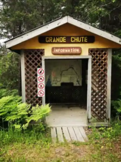
To access the hiking trails, head to the main trailhead located at 100 Chemin de la Grande Chute, Rouyn-Noranda, QC. There is a parking lot available at this address for visitors.
When?
How much?
- Hiking shoes Essential
- → Salomon Elixir Tour Mid WP · 203.38 $
- Layered clothing Essential
- Rain jacket Essential
- Trekking poles
- → Black Diamond Trail Ergo Cork · 69.99 $
- Headlamp
- → Petzl Actik Core 625 · 103.95 $
FAQ - Frequently asked questions
Everything you need to knowThe Essential Hiking Checklist
Everything you need for your next hike. Bilingual, printable, 1 page.
Download the free checklistSimilar hikes nearby
Discover other trails you might enjoy

Pointe-aux-roches
Abitibi-Témiscamingue

Parc national d'Aiguebelle
Abitibi-Témiscamingue

La Bannik
Abitibi-Témiscamingue

Sentiers pédestres Opasatica
Abitibi-Témiscamingue

Récré-eau des quinze
Abitibi-Témiscamingue

Camp Dudemaine
Abitibi-Témiscamingue
Hiking near Barrie
146 trails to explore ~297 km away
We work hard to provide the most up-to-date and error-free data possible. If something seems incorrect, let us know! Your contribution helps the whole community.
Hikers' opinions