Hiking Forêt D'enseignement Et De Recherche Du Lac Duparquet - panoramic view
--°C
Loading...
See forecast →

Hiking in Forêt D'enseignement Et De Recherche Du Lac Duparquet: trails, map and practical info

Abitibi-Témiscamingue • Quebec

4.3 Appreciated by 9 hikers
François Dumaine
By François DumaineContributor since 2016Updated 23/06/2026
Difficulty
Easy
Distance
27 km
Elevation
100 ft
Duration
7h30
Max altitude
100 ft

This easy 26.5 km trail through Abitibi-Témiscamingue's research forest doubles as a living laboratory for sustainable forestry practices. Explore diverse ecosystems near Lac Duparquet while learning about biodiversity conservation through educational signage.

Recommended for :
Beginners

Ready to explore Forêt D'enseignement Et De Recherche Du Lac Duparquet? Here's everything you need to know before you go!

Discover the trail

5 community photos

Trail description

{
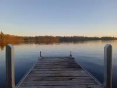
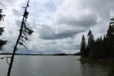
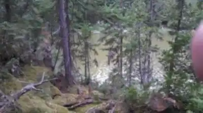
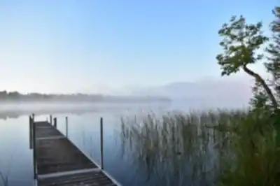
"section_trail_network": "The trail network in Forêt D'enseignement Et De Recherche Du Lac Duparquet comprises multiple interconnected trails totaling 26.5 km, with about 100 m of elevation gain and an easy rating. Rather than a single 26.5 km route, visitors can choose from various trail combinations to customize their visit. Some may complete a shorter 3-5 km section in 1-2 hours, while others might link multiple segments together for a full-day outing of 5-7 hours. That combination suggests routes where the challenge is more about how far you choose to walk rather than steep climbing or technical terrain.",
"planning_section": "With an easy rating and a flexible trail network totaling 26.5 km, it helps to decide ahead of time what kind of outing you want and how much distance you're comfortable covering. Some visitors come specifically to reconnect with nature in a calm setting, keeping individual walks shorter and unhurried (1-3 hours). Others treat it as a longer exploration—walking for hours across multiple trail segments, reading signage, and making the most of the maintained paths. Check with the facility for specific trail maps showing individual route distances and estimated times."
}

Recommended gear for this trail

LGPO Pick
Elixir Tour Mid WP
Salomon
Elixir Tour Mid WP
4.5 (2847 reviews)
Waterproof mid-height boot ideal for rocky terrain
203.38 $
See price
Daylite Plus 20L
Osprey
Daylite Plus 20L
4.7 (3215 reviews)
Lightweight and versatile for day hikes
109.99 $
See price
Most Popular
Wide Mouth 1L
Nalgene
Wide Mouth 1L
4.8 (12540 reviews)
Unbreakable and BPA-free — a hiking essential
23.11 $
See price
Best Value
Trail Ergo Cork
Black Diamond
Trail Ergo Cork
4.4 (1456 reviews)
Comfortable cork grip for long ascents
69.99 $
See price
Actik Core 625
Petzl
Actik Core 625
4.6 (1893 reviews)
USB rechargeable with 600 lumens for early starts
103.95 $
See price
Affiliate links — LGPO may earn a commission at no extra cost to you.

Ready to go?

Everything you need to know before you go

Where?

Address
488, ch du Balbuzard, Rapide-Danseur, QC J0Z 3G0, Canada
GPS coordinates
48.5126213, -79.36880959999999
Phone
(819) 948-2055

Starting Point

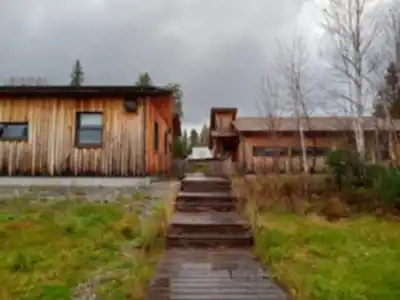
To access the hiking trails, head to the main trailhead located at 635 Chemin du Lac Duparquet, Duparquet, QC J0Z 1W0. This is the primary entry point for visitors. There are no additional trailheads for this location.

When?

Opening hours
No information
Varies by season
Best season
Fall
Spectacular colors
Best time
Early morning
Less crowded
Weather (next days)
Loading

How much?

Entry fees
Adult
Not available
Child
What to bring?
Gear
Download the PDF checklist
Water & food
2L minimum
No water point on the trail
Bring energy snacks for a 4h+ hike
Good to know
Park rules
No dogs
Safety
Download the GPX before you go
Limited cellular coverage on the trail
Slippery after rain
Be careful on rocky sections
In an emergency
Emergency
911
Parking GPS
48.5126213, -79.36880959999999
Center
(819) 948-2055

Hikers' opinions

4.3
3 Reviews
R3
Review 3
Mar 12, 2024
The old forest is very beautiful. The lake is also very beautiful. The trail is pretty rustic, good for a good hike. Visitors are welcome, however, as it is a university research center, apart from good informative signs along the route there is no facility for visitors. The markup is sketchy and almost absent at the end of the trail. We have to retrace our steps rather than make the last loop. With 100m elevation gain over 26.5 km, it's manageable but plan extra time for navigation challenges.
R2
Review 2
Feb 8, 2024
The trail is not always well marked, I had to tack because I couldn't find it anymore. Given the 26.5 km distance through research forest areas, proper navigation skills are essential. The minimal trail maintenance and sparse markings make this challenging even for an 'easy' rated trail. Bring a GPS device or detailed map, especially for the outer sections of the trail system.
R1
Review 1
Jan 15, 2024
Research station hosting the International Cold Forest Research Laboratory. Venue for dendrochronology and paleoecology conferences and laboratories. The 26.5 km trail system offers unique access to ongoing scientific research areas. While primarily designed for academic purposes, the educational signage provides fascinating insights into forest ecology and climate research for curious hikers.

FAQ - Frequently asked questions

Everything you need to know
Easy
100.00 m
100.00 m
7h30
No
No
The Forêt D'enseignement Et De Recherche Du Lac Duparquet trail is rated as Easy difficulty. This makes it suitable for hikers of various skill levels, including beginners and families.
The Forêt D'enseignement Et De Recherche Du Lac Duparquet trail covers a distance of 26.5 km. This is a substantial distance that requires proper planning and preparation for your hiking adventure.
The Forêt D'enseignement Et De Recherche Du Lac Duparquet trail has an elevation gain of 100 meters. Combined with the Easy difficulty rating, this moderate elevation change makes for a pleasant hiking experience.
No, dogs are not permitted on the Forêt D'enseignement Et De Recherche Du Lac Duparquet trail. Please plan accordingly and make alternative arrangements for your pets before visiting.
Yes, there is an entrance fee to access the Forêt D'enseignement Et De Recherche Du Lac Duparquet trail. Check with the facility at 635 Chemin du Lac Duparquet, Duparquet for current pricing and payment options.
Didn't find your answer?
Free 1 pages

The Essential Hiking Checklist

Everything you need for your next hike. Bilingual, printable, 1 page.

Download the free checklist
Top 10 best hiking in Abitibi-Témiscamingue
Our ranking based on hiker reviews

Hiking near Gatineau

48 trails to explore ~438 km away

View trails
Did you spot an error?

We work hard to provide the most up-to-date and error-free data possible. If something seems incorrect, let us know!

Update : June 2026