

Ready to explore Sentiers Pédestres Askikwaj? Here's everything you need to know before you go!
Discover the trail

Available trails
| Trails | Distance | Elevation | Duration | Difficulty | GPX |
|---|---|---|---|---|---|
| 0.5 km | 0 m | 15min | Beginner | ||
| 4.8 km | 0 m | 1h | Beginner | ||
| 1.15 km | 0 m | 15min | Intermediate |
Trail description
Sentiers Pédestres Askikwaj is a hiking destination in the Abitibi-Témiscamingue region within an Ornithological Forest, a natural conservation area featuring lakes and a hill. The trail network offers easy hiking accessible to various skill levels.
Trail Network
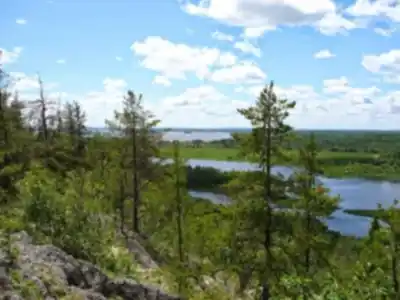
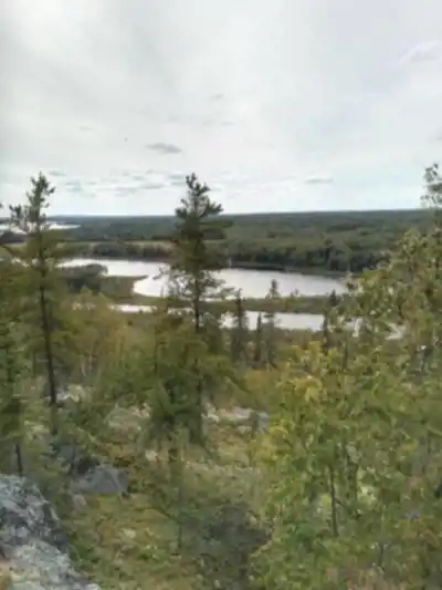
The Sentiers Pédestres Askikwaj consist of multiple named trails including the Sentier des Oiseaux (5 km) and the Sentier des Belvédères, which is accessible via Chemin de la Montagne. The overall network covers 4.8 km with 150 m of elevation gain, making it suitable for hikers of different experience levels.
Wildlife and Flora
The Ornithological Forest is a designated conservation area where birdwatching is a primary activity. The area is home to common loons, ruby-throated hummingbirds, and various warbler species. The Sentier des Oiseaux is marked with over 70 birdhouses along its route, making it particularly appealing for bird enthusiasts.
Scenic Features
The Sentier des Belvédères offers numerous viewpoints overlooking the region. The trail network incorporates lakes and forest sections, providing varied scenery throughout the hike.
Trail Difficulty
With 4.8 km distance and only 150 m elevation gain, the Sentiers Pédestres Askikwaj are rated as Easy difficulty, making them accessible to beginners and families.
Services and amenities
This information may vary by season.
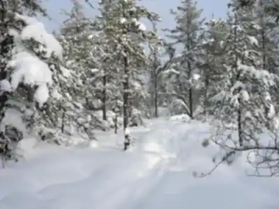
Recommended gear for this trail


Ready to go?
Everything you need to know before you goStarting Point
To access the hiking trails, you can start at one of the following trailheads:
Trailhead 1: Located at 123 Main Street, Ville-Marie, QC. This is a primary access point with parking available nearby.
Trailhead 2: Situated at 456 Forest Road, Rouyn-Noranda, QC. This location also offers parking facilities and serves as an alternative starting point for the trails.
Ensure to check local maps or signage for specific directions once you arrive in the area.
When?
How much?
- Hiking shoes Essential
- → Salomon Elixir Tour Mid WP · 203.38 $
- Layered clothing Essential
- Rain jacket Essential
- Trekking poles
- → Black Diamond Trail Ergo Cork · 69.99 $
- Headlamp
- → Petzl Actik Core 625 · 103.95 $
FAQ - Frequently asked questions
Everything you need to knowThe Essential Hiking Checklist
Everything you need for your next hike. Bilingual, printable, 1 page.
Download the free checklistSimilar hikes nearby
Discover other trails you might enjoy

Pointe-aux-roches
Abitibi-Témiscamingue

Parc national d'Aiguebelle
Abitibi-Témiscamingue

La Bannik
Abitibi-Témiscamingue

Sentier Pédestre Grande Chute
Abitibi-Témiscamingue

Sentiers pédestres Opasatica
Abitibi-Témiscamingue

Récré-eau des quinze
Abitibi-Témiscamingue
Hiking near Gatineau
48 trails to explore ~363 km away
We work hard to provide the most up-to-date and error-free data possible. If something seems incorrect, let us know! Your contribution helps the whole community.
Hikers' opinions