

Ready to explore Sentiers De Baie-sainte-catherine? Here's everything you need to know before you go!
Discover the trail


Trail description
Description
Sentiers De Baie-Sainte-Catherine sits quietly in the Charlevoix region, right at the gateway to the Saguenay–St. Lawrence Marine Park. It’s the kind of place that works for a lot of different outdoor moods: a straightforward hike for people who just want time on a trail, a scenery-heavy outing for photographers, or a nature-focused day for anyone looking to spot wildlife and watch the river change as you move through the landscape.
Where you are and what makes it different
Because the trails are set near the meeting point of the Saguenay and St. Lawrence systems (through the nearby marine park), the setting feels distinctly coastal and big—wide water, open horizons, and that unmistakable “edge of the continent” feeling you get when the river starts to look more like an inland sea. The St. Lawrence River is a constant presence here, showing up again and again as panoramic views along the way and giving the hike a strong sense of place within Charlevoix’s dramatic scenery.
This location also stands out for its biodiversity. You’re hiking in a zone where forest, field, and shoreline influences blend together, which tends to mean variety—different textures underfoot, different light, and plenty of reasons to keep your eyes up and moving as you go.
Trail network and overall hike feel
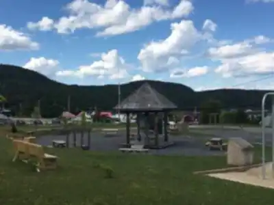
The Sentiers De Baie-Sainte-Catherine network offers a range of trail difficulties, which makes it friendly both for experienced hikers and for people who are newer to hiking. Even without treating it like a major expedition, you can plan a real half-day or full-day visit here depending on how much time you spend at viewpoints and how often you stop for photos and wildlife watching.
The paths are described as well-marked, which helps with confidence on a first visit and makes it easier to focus on the surroundings rather than navigation. Expect the route to feel like a mix of environments rather than one continuous type of terrain: the trails meander through lush forests and open fields, shifting the experience from enclosed, shaded walking to brighter stretches where the landscape opens up and sightlines expand.
Scenery: St. Lawrence River viewpoints
If you’re coming for views, the big draw is the set of panoramic views of the St. Lawrence River and the “majestic surroundings” that come with it. On the ground, that translates to moments where the trees thin out or the trail crests into an opening and the river becomes the focus—broad, reflective, and often framed by the rolling Charlevoix terrain.
For photographers, these transitions are part of what makes the hike rewarding: forest sections can give you deep greens and textured light, while the open areas and viewpoints add scale and contrast. If you’re trying to capture the character of Charlevoix in a few frames, this is the type of trail system that naturally serves it up—varied scenes without needing to drive from spot to spot.
Nature and wildlife
The mix of forest and open field also means you’re in good territory for watching animals at the edges of habitats. Hikers may catch glimpses of local wildlife such as deer, and the area is also home to various bird species. The best approach is to keep your pace relaxed in quieter sections, scan ahead on the trail, and watch field margins and treelines where movement is easier to spot.
Because this is a place people visit to reconnect with nature, it’s worth treating wildlife viewing as part of the plan rather than a lucky bonus. Bring patience, keep voices low when the trail narrows through thicker forest, and pause occasionally in open sections to listen—birds are often easier to locate by sound before you see them.
Terrain and what you’ll experience on the trail
Without overcomplicating it, the best way to picture Sentiers De Baie-Sainte-Catherine is as a changing walk through distinct “rooms” of landscape. In the forest stretches, you’ll get that enclosed feeling of hiking under a canopy—cooler air, softer light, and a more intimate sense of distance. Then the trails spill out into open fields where the sky becomes part of the experience, and the river views feel bigger and closer.
That variety is what keeps the hike engaging for different skill levels. Newer hikers can take their time and enjoy frequent visual payoffs, while seasoned hikers tend to appreciate that it’s not just a single repetitive corridor. Every shift in terrain brings a slightly different mood, and it’s easy to build stops into your day without feeling like you’re interrupting the flow.
Whale watching and the coastal add-on
One of the unique extras in this area is the opportunity for whale watching along the coast. While the trails themselves are the core of the visit, the proximity to the Saguenay–St. Lawrence Marine Park puts you in a region known for marine life viewing, and it’s entirely realistic to pair a hike with time spent near the water looking for activity offshore.
If whale watching is part of your plan, think of it as a flexible add-on rather than something that needs to happen at a specific moment on the trail. Build in extra time before or after your hike so you can linger along the coast and take advantage of good visibility and calm conditions when they happen.
Nearby villages and what to do after
After time on the trails, the area makes it easy to keep your day going at a slower pace. The existing appeal here isn’t about big attractions—it’s about the chance to explore nearby quaint villages and enjoy local cuisine and hospitality. If you’ve spent the day outdoors, this kind of low-effort, high-reward finish fits well: a meal, a warm drink, and a bit of wandering before heading home.
How to plan your day here
Sentiers De Baie-Sainte-Catherine works best when you treat it as an experience with layers: hiking first, viewpoints throughout, wildlife if you’re attentive, and coastal time if you want to extend the outing. Pack the basics you’d bring for any hike—water, snacks, and layers—then add what fits your personal goals. If photography is your priority, give yourself extra time for stopping frequently as the scenery shifts between forest, field, and river panorama. If your main goal is simply to reconnect with nature, keep your schedule light so you can move slowly and take in the details without feeling rushed.
Whether you’re looking for solitude or something a bit more adventurous, this trail network is built around the simple pleasures that make Charlevoix memorable: varied landscapes, big water views, and the feeling of being close to wild places without needing a complicated plan.
Recommended gear for this trail


Ready to go?
Everything you need to know before you goStarting Point
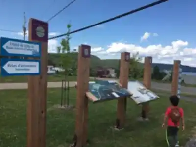
To get to the Baie-Sainte-Catherine trails, go to Baie-Saint-Paul. From there, take route 138 East towards La Malbaie. After passing through the village of Saint-Irénée, turn left onto Route du Fleuve. The Baie-Sainte-Catherine trails are a few kilometers further on, on the right.
When?
How much?
- Hiking shoes Essential
- → Salomon Elixir Tour Mid WP · 203.38 $
- Layered clothing Essential
- Rain jacket Essential
- Trekking poles
- → Black Diamond Trail Ergo Cork · 69.99 $
- Headlamp
- → Petzl Actik Core 625 · 103.95 $
FAQ - Frequently asked questions
Everything you need to knowThe Essential Hiking Checklist
Everything you need for your next hike. Bilingual, printable, 1 page.
Download the free checklistSimilar hikes nearby
Discover other trails you might enjoy

Mont Du Lac Des Cygnes
Charlevoix

Parc National Des Hautes-gorges-de-la-rivière-malbaie
Charlevoix

Parc National Des Grands-jardins
Charlevoix

Mount Morrios
Charlevoix

Sentiers Pédestres Les Éboulements
Charlevoix

Sentier Des Caps De Charlevoix
Charlevoix
Hiking near Quebec City
40 trails to explore ~182 km away
We work hard to provide the most up-to-date and error-free data possible. If something seems incorrect, let us know! Your contribution helps the whole community.
Hikers' opinions